
We’re talking about one ‘extremely’ intense Super Typhoon Vongfong that’s spinning over the West Pacific. Winds now sustained at around 180 mph with gusts topping 220. This system is set to make a recurve as it makes a close approach to Japan in the coming days. This will likely have significant influence some 3,500 miles to the east over the US in the 7-10 day period.

Credit: CNN
It’s turned downright hot over Texas with a record tying 98 in Dallas today. As for Fort Worth, today’s 100 made it the hottest October day since 1979.
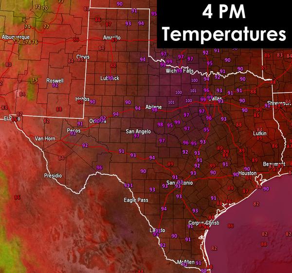
Credit: Texas Storm Chasers
A typhoon has just recurved in the past few days and response from that comes EARLY next week but the response to Vongfong comes later next week with the ECMWF dropping a 3rd major trough into the Lower 48, this times the Pacific Northwest.
By this time next week, we may be talking record cold over the very areas sweating just now (Texas) and it’s all thanks to the recurve of the the last typhoon which just struck Tokyo.
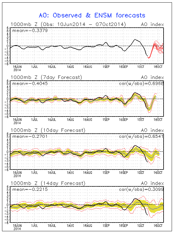
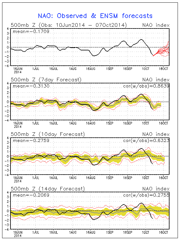
Given that both NAO and AO is firmly negative, I fear that the trough set to dive down the Plains could bring surprising depth of cold with ARCTIC influence and widespread freeze conditions, perhaps accompanied by some mountain snow.
[s2If current_user_can(access_s2member_level1)]
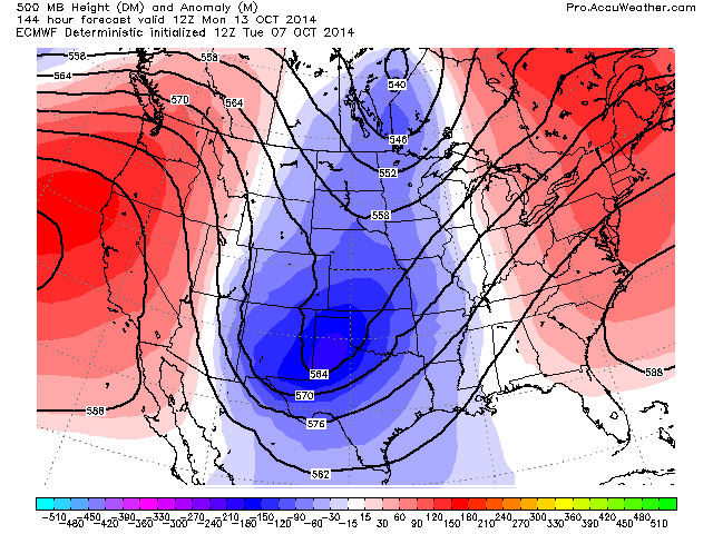
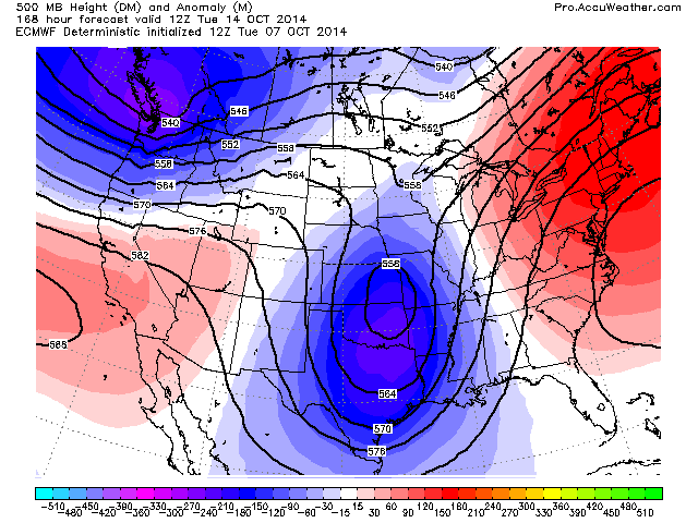
Here’s the latest 500mb height anomalies through the next 240 hours off the ECMWF. Notice the first deep trough which drills down the Plains but check out the trough which the model has dropping into the Pacific Northwest.
120 hrs
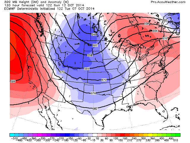
Credit: AccuWeather Pro
144 hrs
Credit: AccuWeather Pro
168 hrs
Credit: AccuWeather Pro
216 hrs

Credit: AccuWeather Pro
240 hrs

Credit: AccuWeather Pro
Dallas and North Texas could be talking 10-20 below normal early next week while they talk 10-20 above today.
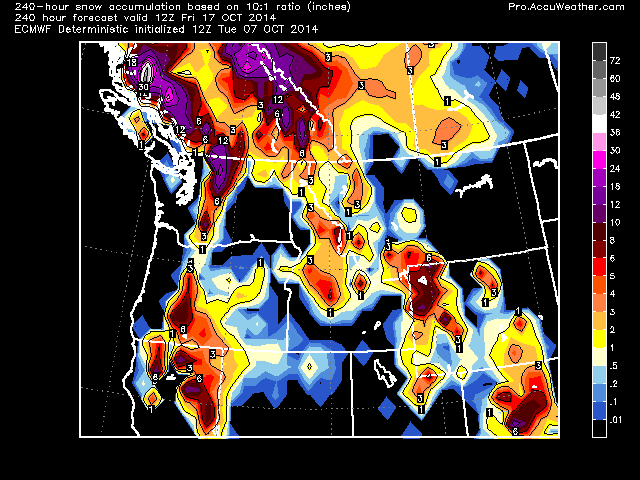
Check out the projected PNW snow in association with the second trough.

Note the ridging and warmth holds on the East Coast.
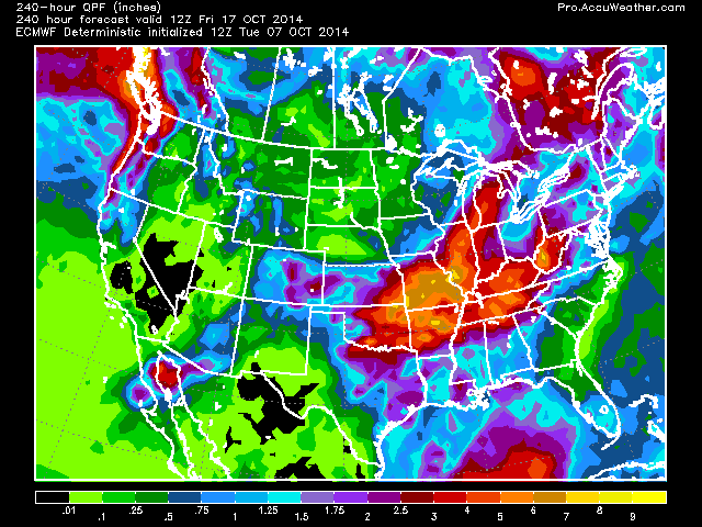
Meanwhile expect significant Tennessee Valley rain amounts through the next 10 days thanks to Simon’s remamnts merging with cold air and fronts coming down from the north.

Credit: AccuWeather
Impressive 10 day rain totals according to QPF.
More tomorrow!
[/s2If][s2If current_user_cannot(access_s2member_level1)][magicactionbox id=”18716″][/s2If]


")


Recent Comments