
I’m currently in Northern Ireland visiting my grand parents and I’ve only just managed to get a Wi-Fi connection this afternoon.
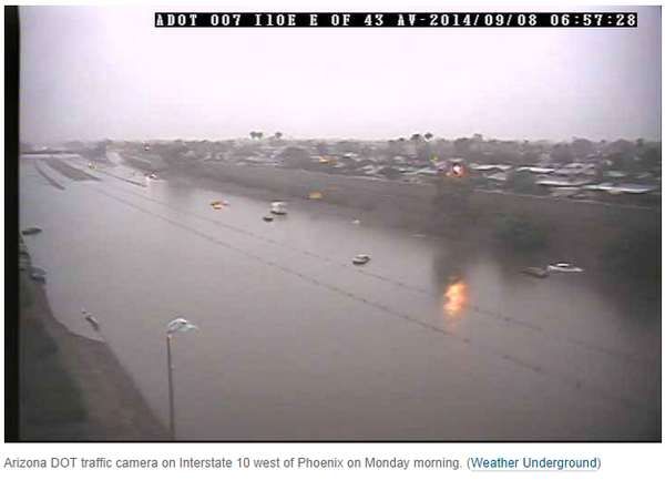
Boy what a wild September weather pattern across North America starting with Norbert along Mexico’s west coast to the massive and historic flooding in Arizona and the Southwest Desert. Next up, snow?

Credit/Source: NWS Phoenix

Credit/Source: NWS Phoenix
As the door opens to probably the coldest air mass in 3 months over the next 36 to 48 hours, we expect to see a significant early snowstorm for the high elevation (possibly low too) over Montana, Wyoming and Colorado in the coming days.
We saw a pretty amazing but not unprecedented temperature drop followed by snowfall in Calgary, Alberta. They hit 26C or 79F just on Sunday while the following day (Monday), residents had to shovel as the first snow of the season brought some trees down and created slippery roadways.

Source/Credit: @WatchCTVNews
The snow hit over a month earlier than the past 2 years (both were late October) but it’s snowed earlier than this and heavier on this date in Calgary before. MORE, potentially heavier snow is on the way as the remnant low of Norbert tracks northeast both drawing moisture north as well as pulling cold air south.

Credit/Source: The Weather Network
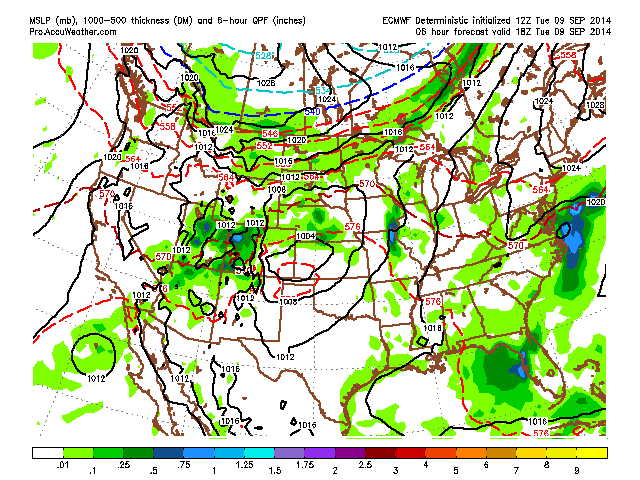
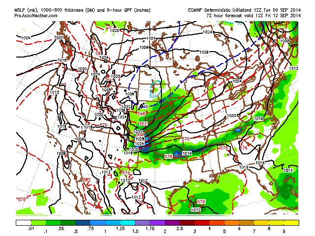
Both GFS and ECMWF show significant snow through the upcoming 96 hours but they have differing output.
While the ECMWF has the more plausible Rockies snowstorm, the GFS shows snow further east.

[s2If current_user_can(access_s2member_level1)]
As you can see, the GFS has a rather different solution.

ECMWF surface solution through 96 hours.


Notice the big cold high dives into the Rockies and Plains once the system leaves and pushes into Canada. Can’t figure out whether the initial system is the snow producer or whether it’s from secondary system which develops and runs the leading edge of the cold front?
Here’s the 500mb height anomaly at 72 hours.

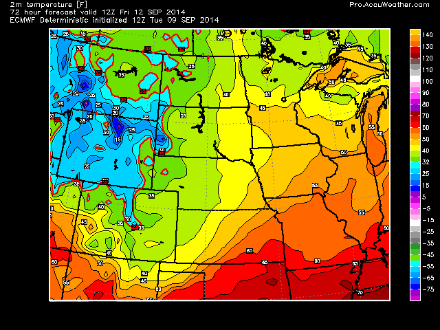
Now take a look at projected lows vs anomalies (C) Friday morning!


So the model suggests 3-6 inches of snow followed by near 0F lows Friday AM over northern Wyoming?
[s2If current_user_can(access_s2member_level1)]
[/s2If][s2If current_user_cannot(access_s2member_level1)][magicactionbox id=”18716″][/s2If]


")


Recent Comments