>FOLLOW THE BLOG ON FACEBOOK & TWITTER
TODAY’S TOP WEATHER STORIES
On Weather & Climate Through the Eyes of Mark Vogan
ICING ON THE CAKE OF THE 2011 SOUTHERN PLAINS & HEARTLAND COLDWAVE
STATE OF OKLAHOMA STRIKES NEW DEPTHS OF COLD WITH -31F AT NOWATA (MESONET) AND -28F AT BARTLESVILLE

The following are preliminary record low temperatures set or tied this morning across the southern Plains and Southwest, with the previous record in parenthesis:
Courtesy of AccuWeather.com
–Medicine Lodge, Kan.: -17° F (-15° F, 1899)
–Dodge City, Kan.: -10° F (-5° F, 1885, 1981)
–Ashland, Kan.: -20° F (-3° F, 1982)
–Ness City, Kan.: -18° F (-7° F, 2003)
–Liberal, Kan.: -8° F (-4° F, 1933)
–Bartlesville Airport, Okla.: -28° F (-13° F, 1929)*
–Oklahoma City, Okla.: -5° F (4° F, 1899, 1929)
–McAlester, Okla.: -4° F (10° F, 1981)
–Tulsa, Okla.: -12° F (-3° F, 1929)
–Fayetteville, Ark.: -18° F (3° F, 1981)
–Midland, Texas: 5° F (13° F, 1933)
–Austin – Camp Mabry, Texas: 19° F (21° F, 1929)
–Austin – Bergstrom, Texas: 19° F (23° F, 1973)
–Del Rio, Texas: 23° F (23° F, 1973)
–Alamosa, Colo.: -24° F (-19° F, 2004)
–Cottonwood, Ariz.: 17° F (23° F, 2001)
–Victoria, Texas: 24° F (24° F, 1973)
–Topeka, Kan.: -9° F (-8° F, 1982)
–Abilene, Texas: 11° F (11° F, 1933)
–San Angelo, Texas: 12° F (12° F, 1929)
–Corpus Christi, Texas: 26° F (27° F, 1929)
Today’s Special National Weather Service Press Releases On Recent Snowfall and This Morning’s Cold Temperatures
Record Low Temperatures This Morning Over Oklahoma and Western North Texas
NWS NORMAN, OK
Oklahoma City (Records back to 1892-1893 winter)
NWS NORMAN, OK
Major Winter Storm & New Tulsa Records February 8-9, 2011
NWS TULSA, OK
New Record Low Temperature Set at Wichita Mid-Continent Airport
NWS WICHITA, KS
Winter Storm Brings Snow and Bitterly Cold Temperatures
NWS LUBBOCK, TX
Record Low Temperature at Rockford This Morning
NWS CHICAGO, IL
Cold Temps This Morning
NWS MILWAUKEE, WI
Weather service records coldest Feb. 10
AMARILLO GLOBE-NEWS
Sundogs: A winter treat
AMARILLO GLOBE-NEWS

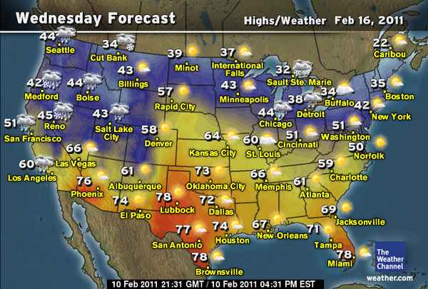
February Thaw: Pattern Change Ahead
by Jonathan Erdman, Sr. Meteorologist, The Weather Channel


TODAY’S WEATHER ACROSS SCOTLAND & UK
By Mark Vogan
UK enjoys sunny, settled day Thursday with mild temps by day and chilly at night under clear skies, light winds but it’s back to cloud, rain and windier weather Friday as next Atlantic system rolls in
European Russia Turning Colder as US Warms Up Substantially
TODAY’S WEATHER ACROSS AMERICA
From AccuWeather

100-Degree Warmup Ahead For Some States Next Week
By Heather Buchman, Meteorologist
Snowstorm Breaks Records From Oklahoma To Mississippi
By Kristina Pydynowski, Senior Meteorologist
Return of Wet Weather Coming Soon To The Northwest
By Kristina Pydynowski, Senior Meteorologist
Northeast Cold, Nusance Snow To Continue This Weekend
By Alex Sosnowski, Expert Senior Meteorologist

WEATHER TALK
By Mark Vogan
PERSISTENCY OF EXTREME COLD IS ONE THING BUT TO BEAT HISTORIC COLDWAVES OF THE LAST 100 TO 150 YEARS IS ANOTHER!
Outstanding Cold Floats Across Outstanding Snowpack from North Texas to Northern Wisconsin, focusing on northeast Oklahoma, southeast Kansas with -20s, even -30s!
ICEBOX OF THE SOUTH?
NOWATA, OK -31
In order to see the shear scale of this morning’s cold, keep in mind that according to AccuWeather, the ‘average high and low’ for Bartlesville for the coldest period of the year is 46/23 and their low of -28, if holds, would also beat the old state record for Oklahoma by 1 degree never mind the Nowata reading which was colder that at Bartlesville by 3 degrees. I don’t know the averages for Nowata but I’m guessing it’s similar to Bartlesville.
Places That Have Been Less Cold Than Nowata, OK This Winter But Average Much Lower Temps!
Lowest reading of Winter 2010-11
Moscow, Russia -10 (average hi/lo 15/3)
Minneapolis, Minnesota -16 (average hi/lo 21/4)
Fargo, North Dakota -27 (average hi/lo 15/-3)
Ulan-Bator, Mongolia -27
Would you believe that typically frigid Winnipeg, Manitoba saw their lowest reading only 1-degree colder than Nowata at -32 and this winter hasn’t exactly been warm, in fact it’s been a pretty long, cold and snowy winter with only a measly 3 days reaching above freezing since November 16th and those have been in the past 5-days. Actually the warmth Winnipeg has seen is because the core of coldest air swung southwards into the Southern Plains.
Whilst some areas didn’t get as cold as Last week, some areas obliterated their’s
It seemed that last week’s cold was impressive, well at the time it was, then came this week’s cold and blew last week’s chilly numbers out of the ‘frozen’ water. Of course, somes spots saw lower readings last week, particularly daytime highs which in locales across the Texas Panhandle it didn’t get out of single numbers. Whilst Dalhart, Texas fell to 13 below zero last week, they didn’t get even close yesyterday or today whereas nearby Amarillo saw readings a degree cooler this morning than last week with a 6 below zero low and ferocious wind chills yesterday morning falling into the 30s below zero with heavy, windblown snow. AccuWeather’s Realfeel registered a stunning 41 below zero late Tuesday night with gusts blowing at around 40mph and accompanied by heavy snow which created a dangerously frigid whiteout.
Dallas, Texas saw a low of 15 degrees this morning which is slightly warmer than last week’s minimum of 13 degrees, though both last’s week and this morning’s low set or tied a records and also experienced subzero windchills.
Oklahoma City on the southern edge of cold-core, registers first subzero low in 15 years!
Does the power of a snowstorm over a given area and and/or where the deepest snow is laid down, effect the level of cold which follows?
As for Oklahoma City, well with a fresh snowcover of 8+ inches, this city sat at the south side of a core of cold which settled into northern and central Oklahoma, directly over the deepest snowpack which went from near around 8″ inches in downtown, 12″ in the north burbs and up to around 22-25″ near to the Kansas border. If you look at morning low’s, the readings literally drop to greater depths, the deeper the snowpack is. deepened overnight and into this morning to the north and northeast of town. Whilst it hit 3 degrees last week, it fell to 5 below zero in the city this morning, not only breaking a record for the date but making this the first 0-degree or lower reading since 1996.
NE Oklahoma: 25″ of freshly laid snow = 25 below zero or colder!
Of course, the setup for such a cold morning was laid out with atmospheric perfection. A powerful storm with a bunch of energy and fuelled (like last week’s system) with powerful Arctic high to it’s north dumped over 2 feet of snow over north-central and northeast Oklahoma. With upper-air flowing eastwards, this pulled the system eastwards and opened the door for the core of cold to then pull southwards, both by the pulling effects of the departing low as well as the open space in the atmosphere opened up by the storm’s eastward movment. Interestingly, winds went calm by early evening last night over this deep snow and with brilliantly clear, stary skies, so the temperature plunged and plunged and plunged, falling to new depths!
My question is, does depth of snow, never mind the power of the Arctic high, play a role in how cold it can get? I even wonder, does the core of cold, also run along a channel of where the core of snowfall is laid down, for eg, it hit -5 at OK City, there was around 8″ in their area, then it was -12 at Tulsa, they recieved over a foot, then once into the 20+ depths, lows went into the -20s. Where there was roughly 25″, lows were around -25 to -31, see what I’m getting at here?
I do understand that the core of cold was centered over northern Oklahoma and Southern Kansas but I find it very interesting that the coldest numbers lay down over the areas which saw most snow from the storm.
WHAT’S REACHING TODAY’S BLOGS?
Extreme Cold Stats: Canada, Oklahoma Breaks Record
Jesse Ferrell, AccuWeather
Multiple Record Cold/Snow Stats For Oklahoma
Oklahoma Weather Blog
A Quiet Meltdown
Joe Lundburg, AccuWeather
THE EXTREMES OF THE DAY
TODAY’S US EXTREMES
COURTESY OF ACCUWEATHER
HIGH:
LOW: -37 degrees at Embarrass, MN
TODAY’S EXTREMES HERE AT MY HOUSE
HIGH: 48 degrees
LOW: 28 degrees
TODAY’S CONDITIONS (LOCALLY)
AFTER A RAINY NIGHT, SKIES CLEARED OUT AS A BUBBLE OF SETTLED WEATHER ROLLED IN BETWEEN WEATHER SYSTEMS. THE SOAKED SURFACE AND CLEAR SKIES WHICH ALLOWED READINGS TO FALL BELOW FREEZING MEANT ICING FORMED. THE DAY OVERALL WAS SUNNY AND WITH LIGHT WINDS IT FELT PLEASANT WITH THE FEB 10TH SUN STARTING TO BRING HEAT BACK TO THE SURFACE AS IT’S ANGLE CLIMBS EVER HIGHER IN THE SKY!
Thanks for reading.
-Mark


")


>swat