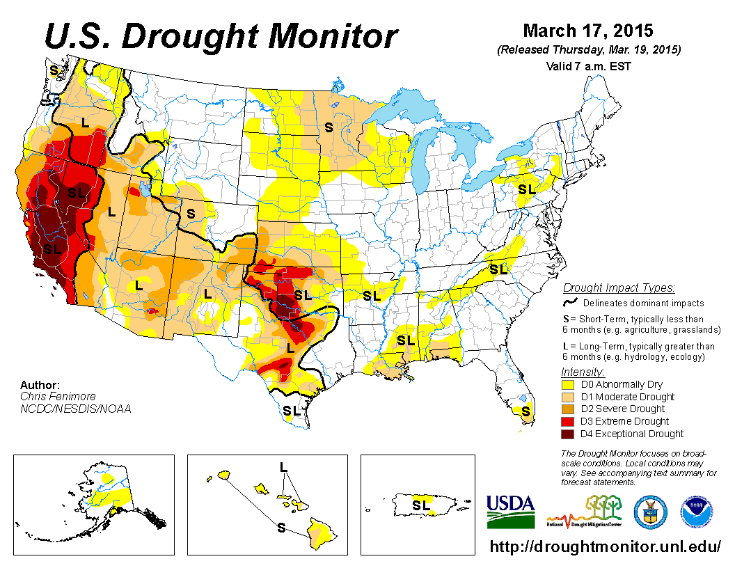
While the remainder of spring 2015 is looking wet across much of the country, we’re beginning to see hints of drought now into the Northern Tier. This follows a drier than normal winter.
In today’s video I showed the CFSv2 precip and temps for April through July and it looks like the model is going for warmer than normal right where the the dryness is appearing.
[s2If current_user_can(access_s2member_level1)]
This makes for 3 areas of concern 1) California/Southwest 2) Mid-South and 3) N Plains for increased dry and increasingly hot conditions as a result.


Will be interesting to see whether the Alaska ridge/eastern trough, colder than normal Great Lakes and wet expected over the Heartland will counteract this potential drought and therefore heat situation over the Dakotas and Minnesota.
CFSv2 has wettest conditions further south.


Before we get to the heat and humidity of summer, we’ve plenty more chill to get through.
MJO is progressing into phases 1, 2 and 3.

All cold phases.

It’s snowing and accumulating in Chicago as of this writing.

WeatherBug

AccuWeather
See video for today’s discussion.
[/s2If][s2If current_user_cannot(access_s2member_level1)][magicactionbox id=”18716″][/s2If]


")


Recent Comments