
The current stormy pattern wanes as we end this week and commence the weekend as a huge Scandinavian ridge builds west. This powerful blocking high will ultimately push back the Atlantic influence.
[s2If current_user_can(access_s2member_level1)]
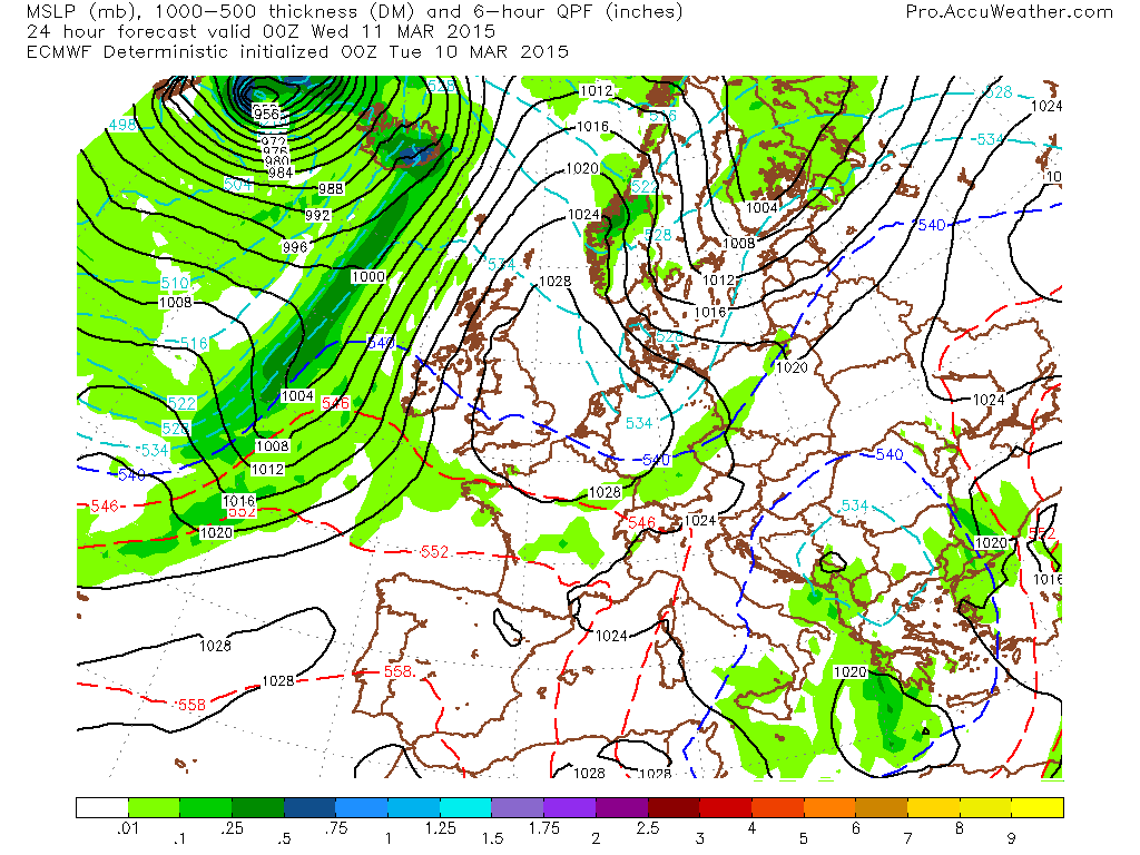
Our air flow reverses and this setup may look cold but I’m afraid there’s one key feature lacking, cold air! Notice where the 540 line is and lack of ‘low thicknesses’. Without a major cold pool, this setup won’t deliver what many of us want, a true ‘beast from the east’. Europe is void of arctic or siberian air. It will be chilly but not cold.
Credit: AccuWeather Pro

Credit: AccuWeather Pro

Credit: AccuWeather Pro

Credit: AccuWeather Pro

Credit: AccuWeather Pro

Credit: AccuWeather Pro

Credit: AccuWeather Pro
The 850mb or 5,000ft level temp profile shows that what little cold air there is available get’s forced west underneath the west-east oriented high.

Credit: AccuWeather Pro

Credit: AccuWeather Pro

Credit: AccuWeather Pro
Notice that this cold is moderate and limited with the high draining the continent as it all get’s pushed west towards and over the UK out into the Atlantic. Like I say it will be chilly, especially the further east you are but this isn’t winter where sun angle is low and the air mass is continental cold!
This setup could support some rather cold nights though. Clear skies and light winds with modestly cold, dry air means good potential of some pretty hard frosts.
This Scand blocking high joins forces with another over Arctic Canada and thus we appear to receive a -NAO.
GFS ensemble.

Credit: AccuWeather Pro

Credit: AccuWeather Pro

Credit: AccuWeather Pro
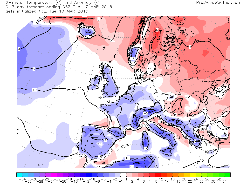
2m temp anomalies.


See video for the discussion.
[/s2If][s2If current_user_cannot(access_s2member_level1)][magicactionbox id=”18716″][/s2If]


")


Recent Comments