
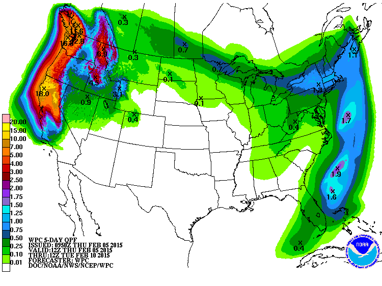
First and foremost, I’ve already admitted that winter or should I say January was far drier than I thought it would be for California. After all it was the driest January on record for San Francisco but let’s just watch as the rains pound the West Coast over the next 7-10 days!
Looks a lot like a pineapple express is coming given the huge print out of precip on the QPF next 5 DAYS!
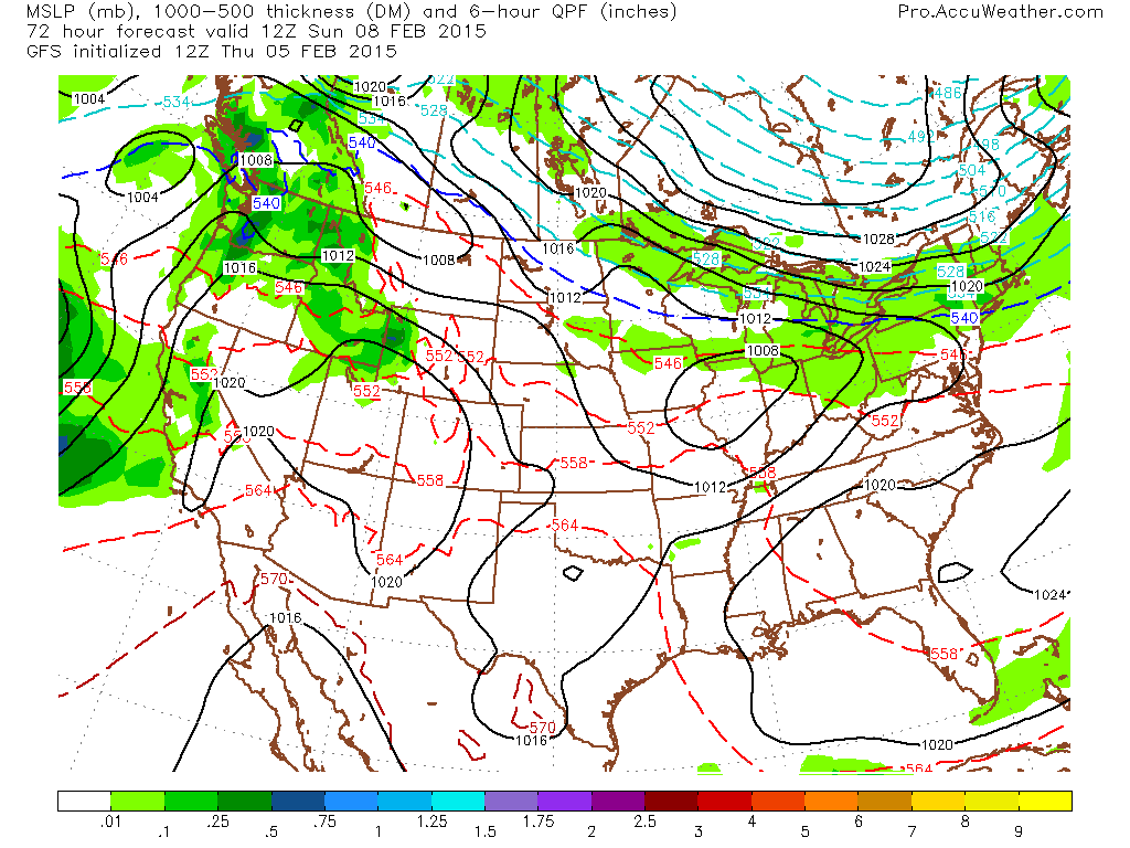
These storms slamming the West Coast will add insult to injury for the snowbound Northeast because a SERIES of BRUTAL air masses will continue to dive south out of Canada, meeting the southern branch energy over the Heartland and so expect a lot more snow in this pattern.
Speaking of snow, 42.2% of the Lower 48 is now covered with 99.2% of the Northeast covered.


The pattern now setting in could be historic for the Northeast. Modelling is remarkably consistent at driving one wave after the next of really cold, arctic origin air into the region and based on the fact that much of New England is buried beneath 2ft or more of snow, well this may be one of the coldest, if not thee coldest February on record.

Credit: Colleen Glenney
[s2If current_user_can(access_s2member_level1)]
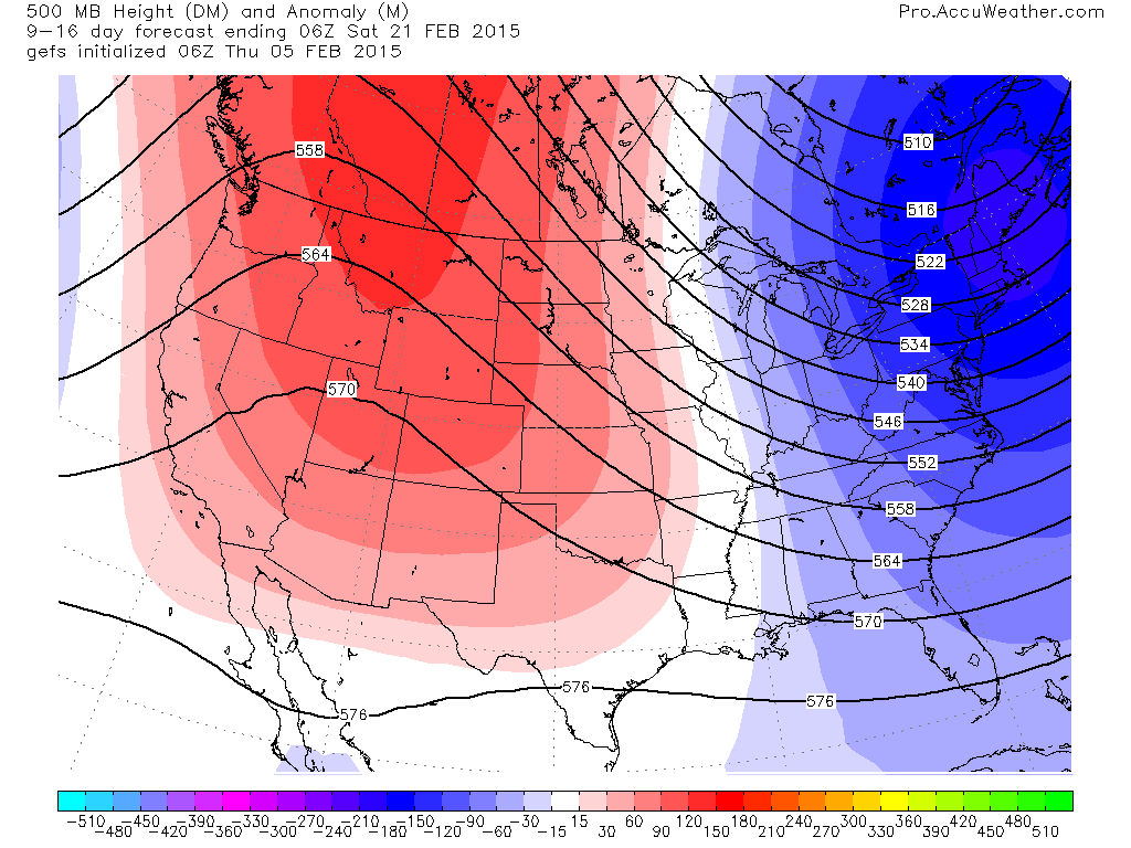
Check out the GFS ensemble 7-day mean 500mb height anomalies through the next 16 days. That trough just get’s stronger.

Credit: AccuWeather Pro

Credit: AccuWeather Pro
Credit: AccuWeather Pro
Remember what the CFSv2 is showing.

Joe Bastardi of Weatherbell has been on the game earlier about the prospects of a challenge to the infamous February of 1934 which was the Northeast’s coldest. That’s a big call but based on the current pattern, what we’ve seen and are seeing and model projections, well it may well be true.
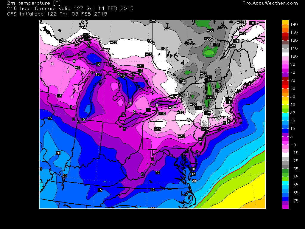
Following the very latest system, tonight is a night highlighted for brutal cold and here’s projected GFS temps Friday AM.

Credit: AccuWeather Pro
Then we’ve got a prolonged, potentially MULTI-DAY snow event across the Great Lakes and Northeast this weekend into early next week followed by yet more VERY cold air.

Credit: AccuWeather Pro
Credit: AccuWeather Pro

Credit: AccuWeather Pro
Credit: AccuWeather Pro
Then is comes the next, followed by more major cold!

Credit: AccuWeather Pro

Credit: AccuWeather Pro

Credit: AccuWeather Pro

With the upcoming Sat through Mon or Tue snow followed by another late week, here’s the ECMWF snow projections through…
Next 7 days.

Next 10 days.

See video for the discussion.
More tomorrow.
[/s2If][s2If current_user_cannot(access_s2member_level1)][magicactionbox id=”18716″][/s2If]


")


Recent Comments