
From the worst Balkans flooding in history to the hottest May weather on record for northwest Russia and eastern Scandinavia, this week looks set to bring a major flood threat.
[s2If current_user_can(access_s2member_level1)]
It looks as though a large north-south region stretching from the boot of Italy into Greece all the way north to the Baltic states look set for multiple inches of rainfall over the next 3-5 days. This is likely to cause flood or flash flooding which will grab headlines.
Here’s the QPF rain chart through 72 hrs
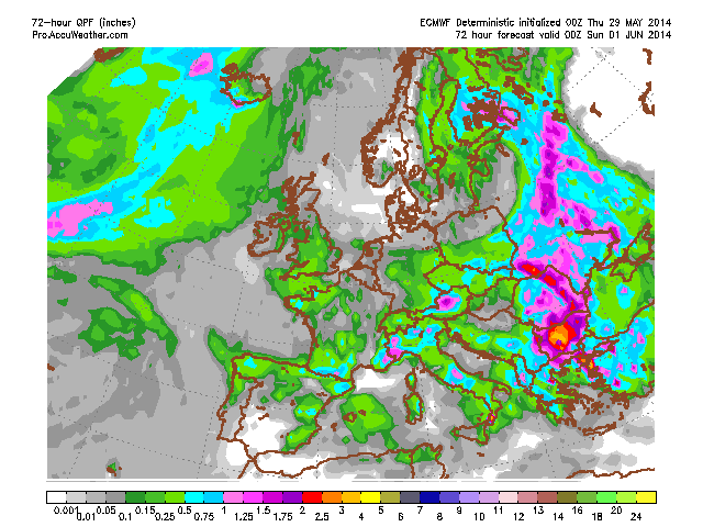
Courtesy/Owned by AccuWeather Pro
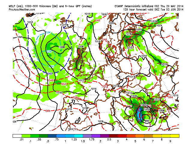
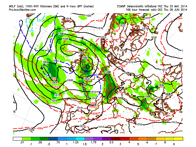
7 days
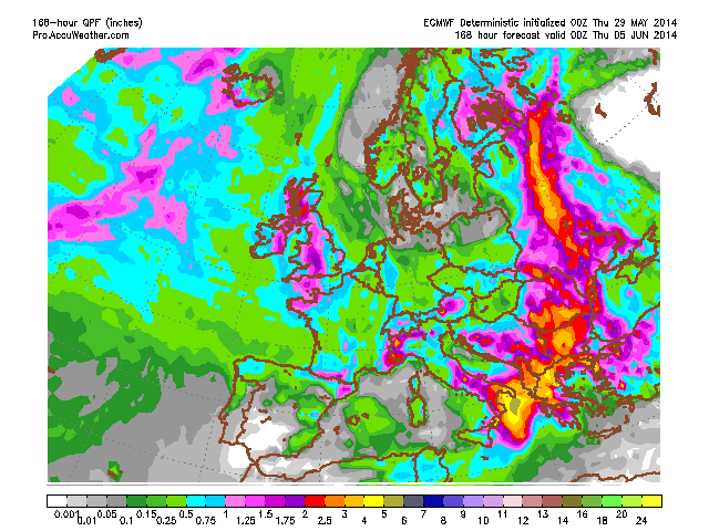
Courtesy/Owned by AccuWeather Pro
The UK and western flank of the continent shall enjoy high pressure and warmer temps but rest assured, it turns rather unsettled early to mid next week as low pressure slides in from the Atlantic.
ECMWF surface chart through the next 7 days shows high pressure this weekend eventually giving way to a large area of low pressure and quite wet, windy and cool weather throughout the West next week.
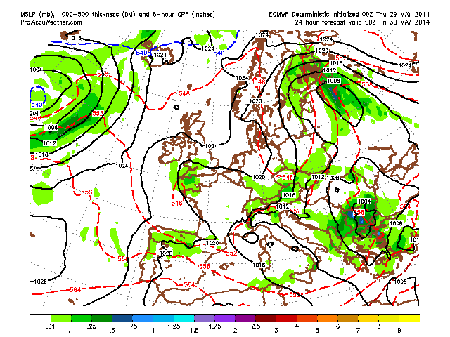
Courtesy/Owned by AccuWeather Pro
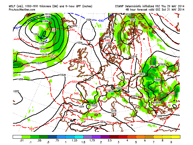
Courtesy/Owned by AccuWeather Pro
Courtesy/Owned by AccuWeather Pro
Courtesy/Owned by AccuWeather Pro
Be sure to check out today’s video for discussion.
[/s2If][s2If current_user_cannot(access_s2member_level1)][magicactionbox id=”18716″][/s2If]


")


Recent Comments