>
Join The Conversation!
Today’s Weather Headlines
Europe & Long Range Latest
Although it has been a winter of frustration when it comes to forecasting with a very up and down nature, it does however appear to look more promising from next week onwards with regards to a more noteworthy NEGATIVE AO/NAO which would suggest not only plenty of winter for the mid-latitudes of North America, Asia and Europe but WESTERN Europe could well get in on some of the action if we get a negative NAO. Multiple models show a blocking high developing over Greenland and a turn to colder from Jan 26th onwards.
Here’s hoping!
US Latest
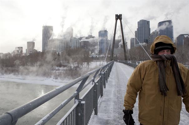
Brutal Cold Across Northern Rockies and Plains
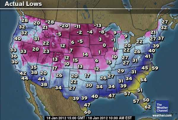
As expected way back at this time last week. The frigid arctic air has arrived stronger than what the models anticipated, unable to see just how cold that low level arctic air would be.
Through today, we’re seeing little warming over the N. Rockies and Plains with temps in Billings actually still falling, now at -10 amazingly! Some locales today won’t reach -15 degrees with wind chills stuck in the 30s and 40s below zero. Exposed flesh can freeze in minutes at these levels so use real caution outdoors through today.
Tonight will see the brutal chill move eastwards and that means, Minneapolis will drop below zero for the first time this season. We may see a low by morning near -10 degrees there and highs tomorrow may struggle to reach 0.

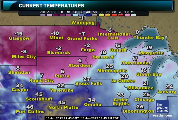
As you can see from the above map, there is little warming going on across Montana and the Dakotas this afternoon.
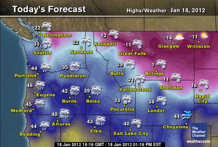
Today’s forecast high’s across the N. Rockies.
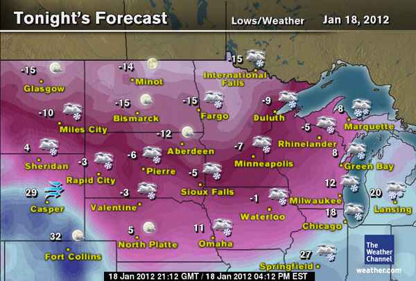
Tonight’s forecast lows across the N. Plains
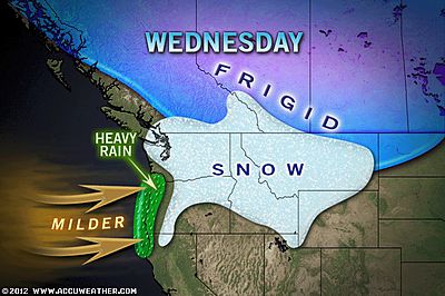
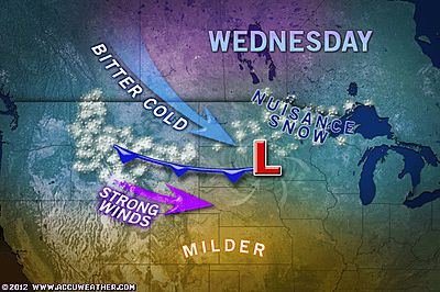
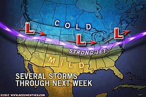
High Impact & Major Winter Storm To Cover Wide Areas Of The Pacific Northwest Shortly!
FIRSTHANDWEATHER

Seattle: Winter’s Worth of Snow in One Day
ACCUWEATHER.COM

Seattle Snow
City Streets Deserted as NW Storm Peaks
THE WEATHER CHANNEL
ACCUWEATHER.COM
Northwest Snowstorms to Reach Midwest, East, California
ACCUWEATHER.COM
Cold Winds, Snow Showers Return to the Northeast
ACCUWEATHER.COM
High Winds Target Eastern Lakes, Central Appalachians
ACCUWEATHER.COM
Canada Latest
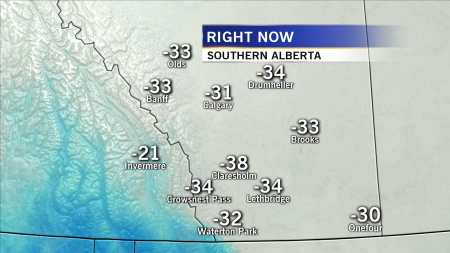
Western, central Canada shivers in widespread -30s C!
For letter carriers, bylaw officers, baby it’s cold outside
EDMONTON JOURNAL
Five schools close in Airdrie, Cochrane as wind chill warnings hit Alberta
CALGARY HERALD

Deep freeze engulfs Saskatoon
THE STAR PHOENIX
THE EXTREMES OF THE DAY
TODAY’S US EXTREMES
COURTESY OF ACCUWEATHER
HIGH: 82° at Fort Lauderdale, FL
LOW: -33° at Gold Butte, MT
TODAY’S UK EXTREMES
COURTESY OF THE MET OFFICE
HIGH: 57° (13.9°C) at Exeter Airport (Devon)
LOW: 24° (-4.2°C) at Santon Downham (Suffolk)
TODAY’S EXTREMES HERE AT MY HOUSE
HIGH: 50°
LOW: 39°
Thanks for reading.
-Mark


")


>Hi Mark. Old high school friend here (Jamie). I suspected that the cold period you forecast for mid december to Xmas/new year and Jan wouldnt happen. Don't be frustrated. The cold is coming for the end of Jan and Feb. I know you are correct in forecasting this. Even the MO are open to this as a scenario. Traffic Scotland had "low forecast for thursday" warnings up on their motorway displays. And if it doesn't happen, then don't get upset. We all know that weather surprises us more often that not. The MO get it wrong more often that not more so than anyone. Three colder winters on the trot have occurred and that is unusual, another consecutive cold winter would might make modern history.
Your video blogs and site are very interesting. I commend your work. I enjoy your blogs.
Keep up the good work.
Best wishes
Jamie