>IMPORTANT NOTICE: From March 9-21, 2011, I shall be on holiday in New Jersey, USA and therefore won’t be blogging, I hope to post some during my holiday, updating on what I’m doing, where I’m visiting and what’s the weather like but the usual posts will resume on March 21, 2011.
TODAY’S TOP WEATHER STORIES
On Weather & Climate Through the Eyes of Mark Vogan
Southern Ontario, the St Lawrence Valley & Maritimes of Canada Slammed by Crippling late season Snowstorm
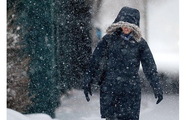
A women walks along Saint-Jacques St during a storm storm on Monday morning March, 07, 2011 in Montreal. Photograph by: (Bryanna Bradley / THE GAZETTE)

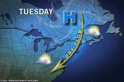
Snow surprise for Montreal, Eastern Townships and Southern Quebec
CTV MONTREAL
Quebec Slammed with heavy snow
THE WEATHER NETWORK
Major storm continues
VALLEY WEATHER BLOG (MONTREAL, QUEBEC)

AccuWeather.com Spring 2011 Forecast for Canada
ACCUWEATHER NEWS
IN OTHER NEWS TODAY
Severe gales warning for Greece
BBC WEATHER
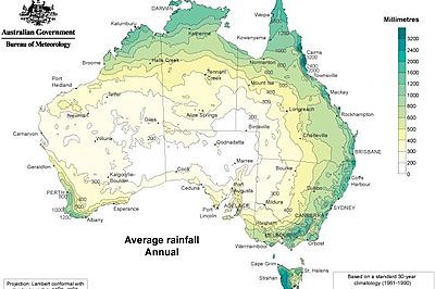
Australian Rainfall Record Shattered
ACCUWEATHER NEWS
Christchurch quake mapped from space
BBC SCIENCE & ENVIRONMENT
TODAY’S WEATHER ACROSS SCOTLAND
From AccuWeather
Possible Florida Fire Relief Coming Thursday
By Gina Cherundolo, AccuWeather.com Staff Writer
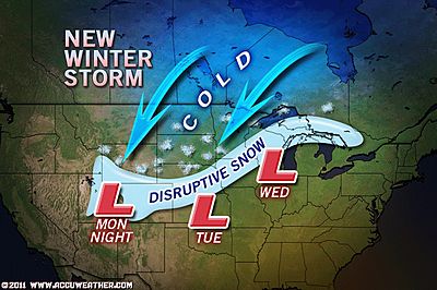
Midweek Snowstorm For Plains I-80 Zone
By Alex Sosnowski, Expert Senior Meteorologist
Midweek Tornado Threat Includes 15 States
By Alex Sosnowski, Expert Senior Meteorologist
Thunderstorms Threaten Mardi Gras Celebration
By Gina Cherundolo, AccuWeather.com Staff Writer
WEATHER TALK
By Mark Vogan
The Atmosphere is reacting to the advancement of Spring but not everywhere!
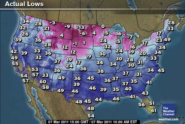
ANOTHER MORNING AND ANOTHER FRIGID START ACROSS N. ROCKIES AND PLAINS AND ANOTHER SNOWSTORM LOOMS!
Out of the first 7 days of March, the northeast Montana city of Glasgow is running an impressive 24 degrees below normal with 6 out of 7 nights dropping below zero and this morning saw yet another frigid morning where the low hit 9 below zero with wind chills between 25 and 35 below zero.
This area of Montana appears to be one of the heardest hit for this winter’s extremes as lows have dipped to 37 below zero and highs have been as cold as 21 below zero, however it’s the persistency of the cold as compared to normal is one thing here, but with close to 100″ of snow when around 30″ is considered normal, well that is quite another. Combine the two it’s this has been one of the harshest winter’s in many years!
Unfortunately, despite it now being March 7th, tonight appears to be another subzero night and there not over yet, the good news is, it can’t last forever right?


THE EXTREMES OF THE DAY
TODAY’S US EXTREMES
COURTESY OF ACCUWEATHER
HIGH: 89 degrees at Pecos, TX
LOW: -22 degrees at Williston, ND


")


Recent Comments