>FOLLOW THE BLOG ON FACEBOOK
TODAY’S TOP WEATHER STORIES
On Weather & Climate Through the Eyes of Mark Vogan
HELSINKI, FINLAND ENDURES IT’S COLDEST READING IN 8 YEARS AND COLDEST FEBRUARY READING IN 12 YEARS, SEE WEATHER TALK BELOW FOR THE STORY!
Death toll rises from New Zealand quake as searches continue
CNN
New Zealand PM: “Grave fears” for quake missing
CBS NEWS
IN OTHER NEWS TODAY
Record Breaking Heat Coming To Perth
ACCUWEATHER NEWS
Libya Weather Unsettled Through at Least Friday
ACCUWEATHER NEWS
Snowstorm Targets Southern Ontario, Quebec
THE WEATHER NETWORK
US Wx Latest
USA ONCE AGAIN FIND’S ITSELF UNDER THE FIGHTZONE OF HUGE TEMPERATURE CONTRASTS, LARGE STORMS AND RECORD-CHALLENGING WEATHER!
By Mark Vogan
Yet another oush of extremely cold air is driving south from frozen west-central Canada into the Northern Rockies and Plains with lows tonight possibly falling to between 35 and 40 below zero. This push of severe cold, for the late stage in the season will fuel a stong Pacific storm which will ride the underside of the deepening western trough and swing through the Desert Southwest, as the cold drive all the way through San Francisco Bay and towards the Beaches of Southern California, not only will we see extremely cold weather in typically mild or even warm locales, espeiclally now that it’s late season with low 30s possible in Downtown LA and San Franciso but precipitation may well fall in the frozen-type for the first time in many many years for both downtown areas of these city’s. Stay right here for more in tomorrow post!
San Francisco May See It’s First Snow Since 1976, Even LA Area to see Snow-levels fall to 500 FEET or lower…
Tornado, Severe Weather Threat Increases Into Early Tonight
ACCUWEATHER NEWS
EXTREME LATE WINTER COLD FUNELLING INTO MONTANA, ROCKIES AND N. PLAINS TONIGHT!


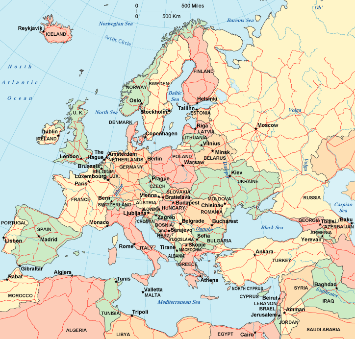
TODAY’S WEATHER ACROSS SCOTLAND, UK & EUROPE
By Mark Vogan
Continent of Europe Split between Unseasonably Mild Air to the West, Unseasonably Cold Air to the East
Tain, Moray, Scotland reaches 15C this afternoon…
There is very much a battle of air masses currently fighting over our continent at the present time as a strong oush of very mild, even bordering ‘warm’ air over the UK, France, Low Countries and into the Iberia whilst the air cools as one heads eastwards and becomes downright bitter once over eastern Germany and Poland where highs are near or at freezing and lows easily below. Further east and Arctic air remains in control as highs are barely making it to -10C or 14F across the Ukraine and struggle to get out of the single digits (F) over Belarus, Lithuania, Latvia, Estonia and east into the Russian heartland. Eastern Scandinavia, i.e. Helsinki is struggling to reach 0 degrees or -18C as lows by night in both Helsinki and across the Baltic Sea and into Tallinn, Estonia lows are approaching -28 to -30C each and every night. That by the way is -18 to -22F. Well, well below seasonal norms and the air tonight once again is falling back through the -20sC.
Whilst it’s bitter across eastern Europe, it’s positively balmy and certainly springlike over Britain and much of western, particularly southwest Europe with highs well into the 15-20C range from Portugal and Spain all the way to northern Scotland where Tain in Moray (north of Inverness) reached a warm 15C, that can certainly be considered warm for late February and there were a few 15s over England also. This was all thanks to a front pushing through and behind it very warm air flowed out of the southwest and from a sub-tropical source region and thus allowing the warmest air of the year to flow freely across the British landmass.
TODAY’S WEATHER ACROSS AMERICA
From AccuWeather

Record Cold In The Northwest, Northern Plains Tonight
By Bo Zhang, AccuWeather.com Staff Writer
Flooding Another Risk From Arkansas to New England
By Heather Buchman, Meteorologist
Another Big Storm for the Plains, East Next Week
By Gina Cherundolo, AccuWeather.com Staff Writer
Storm to Slam Northeast US, Much of Atlantic Canada
By Alex Sosnowski, Expert Senior Meteorologist
WEATHER TALK
By Mark Vogan
Helsinki, Finland: Running 10.3 degrees Below Normal and 13 Consecutive Nights Below Zero and Counting!
The -20F low on Feb 20th was lowest since Jan 2003 and lowest February reading in 12 Years!

The lowest reading in Helsinki over the past few days was a bone-chilling -20F/-28.8C which is the coldest seasonal low in over 8 years. You have to go back to January 7, 2003 when the low fell to -24F.
For Helsinki to have seen a low this low during the month of February, you have to go back further than 2003 and to Feb 8th, 1999 to be exact when a low of -22F or -30C was recorded. That’s 12 years ago.
This month’s cold in Helsinki means so much more when looking at what’s the ‘average’ high and low. The normal for mid-February in this typically cold Northern European city is 25/15 or -4C/-9C. So to put the past two-weeks of frigid cold in perspective, the warmest high in the last 13 days is 14 degrees or -10C, that’s COLDER than the average low of 15 degrees F.
When reflecting back through this winter, January, though still below normal overall saw a low only down to -9F or -23C and amazingly during the frigid first month of this overall harsh winter in Helsinki where the departure from normal for the month was a large as 12.4 below normal, the lowest reading was only -12F. This puts the past 2 weeks into perspective and I’ll tell ya what, had it not been for a warmer than normal start to February, this month would likely be nearer 15 to 20 below normal. It’s likely that this month will end nearer 12 below normal since it’s likely that the last few days of February will continue with below normal highs and subzero nights.
As for last winter, the lowest reading was -18F or -28C in January, 2011.
As for stark contrast, during winter 2008-2009, the lowest reading in Helsinki during December was a warm 21 degrees or -6C and the lowest reading all of that winter was a mere -1F or -18.5C.
As for the warm winter of 2007-08 which saw January 9 degrees ABOVE NORMAL the lowest reading that month only dipped to 19 degrees or -7C with the lowest of that season falling to only 10 degrees or -12C.
As for the last time Helsinki has seen temperatures as cold as this month, one has to go back to January 2003 when high’s where as cold as -9F/-22.6C and a low of -24F or -31.3C.
VAGARIES OF THE WEATHER
INDIA & SUB-CONTINENTAL ASIA WEATHER
BY RAJESH KAPADIA
F4 active in Northern India on Thursday, as the hill states experienced snowfall at many places with heavy sleet forcing closure of Jammu-Srinagar National Highway, and snowfall on the higher reaches of Pir Panjal mountain range since Wednesday night.
Qazigund received 3 cm of snow, while Gulmarg recorded around 2 cm of snow.
Higher reaches of Himachal Pradesh witnessed snowfall at many places, including Manali and Shimla. Manali received 2 cm of fresh snow, while Shimla experienced 5 cm of snowfall on Wednesday night and the lower hills received intermittent showers, with Saloni and Kumarsain receiving 10 mm of rains.
High altitude Kinnaur and Lahaul and Spiti districts also were covered by thick white blanket.
Rain and snow also occurred at isolated places in Uttaranchal.
In Delhi, it was a pleasant day with the mercury just below the normal level at 24c in the day.
Pakistan too had its share from F4 today, with the NWFP and Northern regions of Punjab getting rains and snow in the extreme North. Dir recorded the highest of 44 mms of rain. Islamabad had 6 mms of rain with the temperature in the 20 – 6 range.
Kathmandu has again warmed up to 27.5c, very high for this time of the month. Prompts me to forecast some effect of F4 in the city on Friday/Saturday.
UAC-2 smittered some rains in S.Maharashtra with Sangli recording 3 cms and Ahmadnagar getting 1 cms. Aurangabad and Marathwada cities received light rains.
It now seems that the UAC has moved Northwards, into N. Mah region. The image put up (above) shows this development.
But, actual clouding associated with it is in the East of the system,and apparently less than yesterday.
The only obvious reason I see for the clouding, avoiding the system centre, is lack of sufficient moisture inflow, due to poor attraction by the system. And, also the wind discontinuity line shifting east.In fact, the clouding associated with this line, is
seen stretching from M.P. thru interior Mah. thru interior Karnataka into Kerala. very prominently seen in this sat. image from Dundee @ 11.30 pmIST.on Wednesday.
Forecast :
Friday: Light to medium rains all along the line of wind discontinuity right upto Kerala, as seen today. And fairly active F4, though, while moving away from Pakistan, restricted to Northern Indian regions and Western Nepal.
Saturday: Line of rainfall across India moves a bit Eastwards, and weakens. F4 weakening and concentrating on Utteranchal and western Nepal.
Sunday: Awaiting F5 !
Not Much effects on Mumbai. 25% clouding (2 OKTA) on Friday/Saturday with 31c as the high and 21c the other extreme. Cooling to some extent expected from Saturday (F4 effect).
San Francisco could see first snowfall in 35 years:
it’s really possible that downtown San Francisco might see its first snowfall in more than 30 years later this week.
“If we do experience snow, you may see it in the air, but it will likely be gone before it hits the ground,” Benjamin, a weather service forecaster in Monterey, said.
However, the snow could likely stick to metal surfaces up in San Francisco’s Twin Peaks, as well as the Hills in neighboring Oakland, he added.
FOR THE VERY BEST INDIA, SUB-CONTINENT AND INTERNATIONAL WEATHER INFO, CHECK OUT OUR PARTNER’S BLOG IN-FULL BY CLICKING HERE!
WHAT’S REACHING TODAY’S BLOGS?
A Wild Finish to February, But Maybe March Will Come in Tame
Joe Lundburg, AccuWeather
Snow and Severe Weather Maps. Discussion on Severe Weather
Henry Margusity, AccuWeather
Warnings Book Photo Contest
Jesse Ferrell, AccuWeather
THE EXTREMES OF THE DAY
TODAY’S US EXTREMES
COURTESY OF ACCUWEATHER
HIGH: 97 degrees at McAllen, TX
LOW: -25 degrees at Baker, MT
TODAY’S EXTREMES HERE AT MY HOUSE
HIGH: 54 degrees
LOW: 41 degrees
TODAY’S CONDITIONS (LOCALLY)
After a damp, drear, cloudy but mild overnight, the day warmed to the mildest levels of 2011 with a southwest breeze (stronger aloft) transporting warm Atlantic air across the country. There were decent spells of sunshine in the afternoon.
Thanks for reading.
-Mark


")


Recent Comments