>Today’s Top Weather Stories
On Weather & Climate Through the Eyes of Mark Vogan
BREAKING WEATHER NEWS
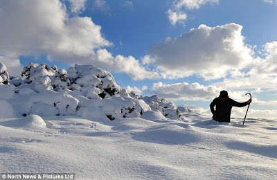
GREAT BRITAIN UNDER WINTER’S SIEGE AS SNOW AND COLD ALL BUT CRIPPLES MOST AREAS, TEMPS DROP TO -18C AND 1-2 FEET OF SNOW FALLS!!!
live news feed…
“I’ve cleared my garden path three times already and the snow continues falling” (Mark Vogan)
BREAKING NEWS: HEAVY SNOW ONCE AGAIN LIKELY OVER CENTRAL SCOTLAND EARLY TOMORROW MORNING!
Several UK locations have reported their coldest November temps on record.
WALES: Llysdinam, Powys reported -18C (0F)
SCOTLAND: Loch Glascarnoch, Highlands reported -15.3C (4F)
ENGLAND: Shrewsbury, Shropshire reported -12.5C (10F)
NORTHERN IRELAND: Lough Fea, Co Tyrone reported -9.5 (15F)
Info courtesy of the BBC
latest news articles
NEW: Snow shuts Edinburgh airport as big freeze grips Britain
The Daily Telegraph
Coldest November night on record in parts of UK
BBC Weather
Sunday’s SPL matches postponed due to weather
STV Weather
Heavy snow causes major road closures across Scotland as winter arrives
The Daily Record
Doing the 3rd shovel of today!
This was the view late at 12.15pm today looking out my bedroom window!
Today’s Weather across America
From AccuWeather
Snow, Brutal Cold for Salt Lake City, Flagstaff, Denver
By Meghan Evans, Meteorologist
High Winds in Plains to Disrupt Travel, Elevate Fire Threat
By Meghan Evans, Meteorologist
Early Week Windblown Snow to Hit from Omaha to Duluth
By Meghan Evans, Meteorologist
Snow Measured in Feet For Some to the Lee of the Great Lakes
By Meghan Evans, Meteorologist
Weather Talk
By Mark Vogan
BREAKING NEWS: HEAVY SNOW ONCE AGAIN LIKELY OVER CENTRAL SCOTLAND EARLY TOMORROW MORNING!
TODAY’S SNOWSTORM TOTALS 4-5 INCHES HERE WHILST OTHER AREAS SEE UPWARDS OF A FOOT! NOT ONLY IS IT VERY SNOWY BUT IT’S BEEN RECORD COLD ALSO…
LAST YEAR’S -22C LOW FOR BRITAIN’S COLDEST MAY BE BEATENB THIS WEEK AS DEEPER COLD MOVES IN ON THE BACKSIDE OF THE SNOWSTORM.
After temperatures dropping off to 20 degrees last night under clear skies and helped by the previous night’s 3 inch snows, today has seen snow falling pretty much all day and accummulated to around 5 inches here at my house in Lennoxtown. However that is a far cry to other areas of Scotland and many portions of northern England where very heavy, windblown snow has created havoc.
This is turning out to be quite the cold wave now and after lows fell to impressive record levels late last night and early this morning, colder air still appears to be on the way. The push of air crossing the North Sea which has been the “snow maker” for pretty much the whole of Scotland and much of northern and central England and Wales, that flow is going to transport even colder air over all of Britain this week.
IF IT WAS THAT COLD LAST NIGHT, HOW DARN COILD IS IT GOING TO GET THIS WEEK?
What amazes me is that those numbers last night which brought a temperature of -18C/0.4F to Llysdinam, Powys (new all-time cold low for Wales), a -9C/15F at Lough Fea, Co Tyrone (may be a new national cold record for Northern Ireland) and a -15C/4F at Loch Glascarnoch in the Scottish Highlands (record November for for that site), this may show that with even colder air and further coverage of snow across the country that even colder temperatures may be on the cards through this week. As I’ve kept saying, the coldest air still remains over Scandinavia but is starting to push out over the North Sea towards us as this snowstorm is now departs and the air rides in on the backside of the snowstorm. An even stronger push of arctic air may bring highs of -2C/28F or lower to much of the UK away from the coast and lows to -10C/14F over a very broad area with some spots seeing -15C or lower. It’s very plausible to now look at the potential that the -22C/-8F reading that was last winter’s coldest in all of the UK may even be beaten this week as the air now about to push over us will be less moderated and only will be moderated in a minimal fashion as all cold air masses from the Arctic do be due to a more southerly latitude, by higher sunlight and the mild waters surrounding Britain. Now that we’ve seen the crucial “widespread snowcover” that was needed in order to put the final and key ingredient in for “maximum radiational cooling” we are likely to see firstly “icy east winds” then more relaxing of the air and cold that will challenege the magnitude of the numbers seen during last year’s harsh and long winter here.
FOR DETAILS ON HOW MUCH SNOW FELL AND WHERE CLICK ON THE MEDIA LINKS I’VE PUT UP ABOVE!
What’s Reaching Today’s Blogs?
The Extremes of the Day
Today’s US Extremes
Courtesy of AccuWeather
High: 86 degrees at Naples, FL
Low: -5 degrees at Burns, OR
Today’s UK Extremes
Courtesy of the Met Office
High: 40 degrees (4.6C) at Boulmer (Northumberland)
Cold High: 24 degrees (-4.5C) at Sennybridge (Powys)
Low: 4 degrees (-15.6C) at Sennybridge (Powys)
Today’s Extremes here at my house
High: 34 degrees
Low: 20 degrees
TODAY’S CONDITIONS
SNOWCOVER: 5″
AFTER THE COLDEST START TO THE SEASON, A PERSISTENT BAND OF SNOW MOVED IN FROM THE EAST DURING THE OVERNIGHT AND PERSISTENT WITH PERIODS OF HEAVY SNOWFALL.. THAT SNOW HAS ACCUMMULATED TO AROUND 5″, TONIGHT WILL BE COLD THE LOWS IN THE 20S.
TOMORROW’S FORECAST: HIGH: 32 LOW 28
Thanks for reading.
-Mark


Recent Comments