>See Weather & Climate Through the Eyes of Mark Vogan on Facebook and Twitter. What are you missing? Videos, Weather Info and promotional items which are NOT seen here on the blog! During your visit, click “like” and be a part of the blog.. thanks for reading and your support.
COMING THIS HALLOWEEN ( SUNDAY, OCT 31st)
MARK VOGAN’S OFFICIAL 2010-2011 UNITED KINGDOM AND EUROPE WINTER FORECAST
Today’s Top Weather Stories
On Weather & Climate Through the Eyes of Mark Vogan
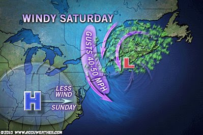
Damage and Debris Left Behind by Nor’easter
AccuWeather News
Cleanup Weather for Deadly Russian Flooding
AccuWeather News
Cold, Snow To Hit Europe Next Week
AccuWeather News
Today’s Weather across America
From AccuWeather
Northwest Storm Train to Soon Ramp Up
AccuWeather
Seemingly Endless Rounds of Southwest Thunderstorms
AccuWeather
Snow Could Visit Great Lakes Next Week
AccuWeather
Weather Talk
By Mark Vogan
UK Weather
FIRST “COLD” NIGHTS OF WINTER ARRIVE ACROSS THE COUNTRY EARLY NEXT WEEK, BRAEMAR FORECASTED TO DROP TO 25 (-4C), GLASGOW 30 (-1C)
Cloud stopped the drop last night!
Despite expectations of a freezing morning across many inland areas, cloud cover kept temperatures mostly above freezing and this was certainly the case even in Highlands locales such as Dalwhinnie and Aviemore as my truck temperature remained at 4, 5 and 6C even at the classic cold spots thanks to even a light drizzle under heavy cloudcover and even a breeze. It appeared that certainly on my route north on the A9, the coolest places were between Pitlochry and Dunkeld (Perth & Kinross) with temps dropping to around 3C (37F), also, when I returned home, my house thermometer read 3C and this was the coolest temperature of the night here as skies clouded over late last night stopping the cooling process but then broke allowing the air temperature to drop from around 40 to the 38 degrees for the morning low around 7.30am. Due to the fact daylight was returning, this limited the amount of drop in temperature, had it been earlier and when it was still dark, it’s likely we’d have seen the 32 degree low I anticipated.
NEXT WEEK, LOOKS TO BRING THE FIRST ACTUAL WINTER-LIKE COLD ACROSS MANY AREAS
Though we’ve seen lows drop to 30 degrees here at my house and a chilly 24 degrees up at Tyndrum (Stirlingshire) which was in fact considered one of the lowest ever recorded reading for September in the UK, it appears next week we are seeing the first real widespread frost and freeze across many areas of the UK. Scottish Central Belt expected by Tuesday and Wednesday nights to drop to around 30 for Glasgow (That’s City Centre), Edinburgh 30 and for areas such as Livingston (west of Edinburgh and higher in elevation are expected to fall to 28 (-2C).
Across England, lows are expected to tumble to around 30 in Manchester (City Centre) and at the known cold spot of Benson, Oxfordshire it will drop to around 34. These numbers according to the latest forecast from the BBC.
Highland areas are expected to drop to the coolest levels as expected with Aviemore dropping to 28, Dalwhinnie 27 and Braemar 25 (-4C). Remember, some spots that have the same conditions of light winds and clear skies will drop to LOWER levels than surrounding areas and what I mean is, that when Aviemore falls to perhaps 28 or slightly lower, areas just north of this known cold spot may see a few degrees COLDER as the terrain and other factors regularly allow even colder lows in the Carrbridge, Boat of Garten and Dulnain Bridge areas and there are more than likely, other spits within the Highlands or even across the Southern Uplands that see colder temperatures than the well advertised, well recorded locales where “official Met Office recording stations are located”, I only wish there were spots that had thermometers for “official” recording as I’m sure even last winter’s -22C reading wasn’t thee coldest of last winter.
I shall keep a close eye on these temperatures next week as I drive north each night to Inverness.
What’s Reaching Today’s Blogs?
Signs of Winter
Brett Anderson, Canada Expert, AccuWeather
The Google Mid-Atlantic Wind Farm Vs. Hurricanes
Jesse Ferrell, AccuWeather
The Extremes of the Day
Today’s US Extremes
Courtesy of AccuWeather
High: 97 degrees at Needles, CA
Low: 16 degrees at Libby, MT
Today’s UK Extremes
Courtesy of the Met Office
High: 60 degrees at Plymouth
Low: 29 degrees at Tyndrum
Today’s Extremes here at my house
High: 53 degrees
Low: 38 degrees
Thanks for reading.
-Mark


Recent Comments