
United States of America

Hurricane Patricia has went from Category 1, 85 mph system to Category 5, 200 mph tempest within a mere 30 hours! It threatens Mexico central Pacific coast with catastrophic destruction tonight! Here’s some imagery and analysis. Eye of Patricia is within 50 miles of the coast. Patricia exploded over unusually warm, El Nino induced […]

Because of the wild variation and swings month-by-month across the Lower 48, November has been a tough call as to what we can expect. While the heart of summer was cool and wet for a large swathe of the country, both spring and fall has seen wild swings with a hot West, cool East then […]

We have a highly volatile situation unfolding over the Southern Plains through the next 5 days as an upper low swings out of the Southwest into Texas. As it moves out over the plains, it shall plug very moisture rich air from the Gulf. The connection between the two systems will present a potential major flash flood problem with a […]

While a major Texas/Southern Plains flood event is ready to unfold with rich tropical moisture lifting north and merging with a strong cut off low sliding east out of the Four Corners, it’s the West Pacific that’s catching my eye. [s2If current_user_can(access_s2member_level1)] TWO typhoons look destined recurve. The ECMWF already has the monster trough diving into the […]

As expected, old man winter has made an early appearance over eastern Canada and the US following a very warm September. This was Sep. Check out the flip through the first half of Oct. Yesterday’s departures were impressive. An unusually cold and strong upper flow drove by far the coldest air of the season south and with […]

The low which is pushing into California for a second time is indeed making it’s presence felt. Major flooding and mudslides have forced the closure of major SoCal roadways including the Grapevine. It’s all thanks to a highly unstable air mass, sparking severe and soaking thunderstorms with incredible and unusual rainfall rates for this region. […]

A potent cut off low which produced heavy rain for California last week is set to slide back onshore in the next 48-72 hours bringing more heavy rain and storms. How can this be? The system has ultimately done a loop the loop sliding initially into California then Arizona before turning south into Mexico and then back out […]
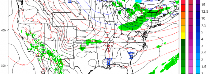
Following a major surge of heat with October records crumbling over the central and northern Plains, here comes the first major cold shot of the season from N Plains to Mid-Atlantic. Month to date. While the East prepares for the first cold of the season, it remains record hot in the Southwest. Death Valley received […]

A wild, dynamic and highly amplified pattern has led to wild and extreme weather across the US. The wind was one thing but the heat? Well it was incredible by October standards. Highs soared to 99 degrees at Mooreton, North Dakota yesterday as a trough pushing onto the West Coast, has expanded north and east, an unusually hot […]

We have a very interesting pattern across the US these days with an unusual and erratic upper cut low which crossed California into the Four Corners then backed west back out over the Pacific and is now set to return onshore. The heat is on across the West and Plains as that upper low swings back out […]
Recent Comments