>
Mark Vogan’s forecast annalysis
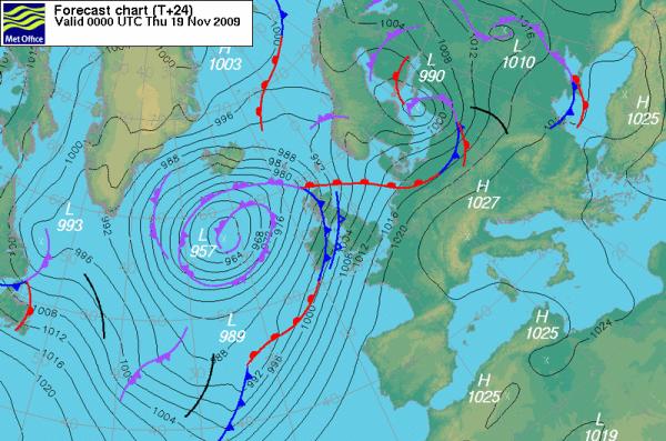
As you can see from this Met Office pressure map, there are two cold fronts running side by side and as of midnight their expected to be in the position outlined in this graphic. Winds blowing along these fronts out of the southwest will funnel mild, maritime air in ahead of theses front creating the instability for heavy rains and strong winds to push up from the southwest. These fronts both are associated with a deepening 957mb low, west, northwest of the British and Irish coast.
You can see why the forecast calls for strong winds and torrential rains through tonight and tomorrow as these two fronts and the low itself moves slowly east with the center of low pressure moving well north of mainland Britain. Despite the fact we will see strong winds likely from these, we here in southwest Scotland and across northwest England with the Lake District likely the bullseye for heaviest precipitation, it’s going to be the heavy rains and flooding that will be the headline maker here, whereas again by looking at the map above, just below the southerly cold front, the isobars are tighter and therefore south Wales, south and central England is likely to see the strongest winds, perhaps reacjing 70 mph in exposed spots along the English Channel coast and western Wales as well as the high ground. Exposed coasts of Scotland, Ireland and the high elevations may also see gusts towards 70 or even 80 mph from this system.
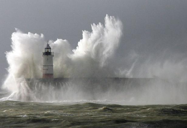
 Last weekend’s windstorm that raked the South of England, Photo here of Newhaven, East Sussex
At this very moment it’s raining. It seems like each and every day we see rain! That’s basically because that is the case. It’s November and it can be often a poor weather month but even for us here in Scotland, the amount of rainy days is exceptional.
We once again have heavy, persistent rain on the way as yet another major weather system is lurking out over the Atlantic and ready to barrel more misery our way. A tightening pressure gradient is going to progress throughout the overnight, just in time for me driving southbound on the M74 around 3.30am tomorrow and heading into the worst of where the “heaviest” or “worst of the weather” will be funneling in from the Atlantic.
According to this afternoon’s BBC forecast, we could see or at least some areas of northern England or southwest Scotland could see a MONTH’S worth of rain within 36 hours!!
Whilst driving northbound yesterday on the A76 between Dumfries and Sanquhar in the hilly terrain of southwest Scotland’s Dumfries and Galloway region, it was amazing at how many fields surrounding me had significant flooding in them, a result of the persistency in the wet weather which really had continued since the start of July after the warm, dry and settled period ended.
The highest rains will occur over the highest, windward terrain, so therefore the English Lake District and the southern Uplands of Scotland may see that months worth of rain from this as the vast canopy of rain pushes out of the southwest into this region of the country. The highest peaks over the Lake District may also see strong gale-force winds as well as southwest Scotland as southwest winds blow straight up the Solway Firth!
Unfortunately, another low will be knocking on our southwest door by Saturday! The storm train will continue and likely will see out a near record or record wet November in somes areas when all is said and done. Afterall areas of Dumfries and Galloway, witnessed a record wet August, so the trend continues!
Stay tuned.
Thanks for reading.
-Mark
 Last weekend’s windstorm that raked the South of England, Photo here of Newhaven, East Sussex


Recent Comments