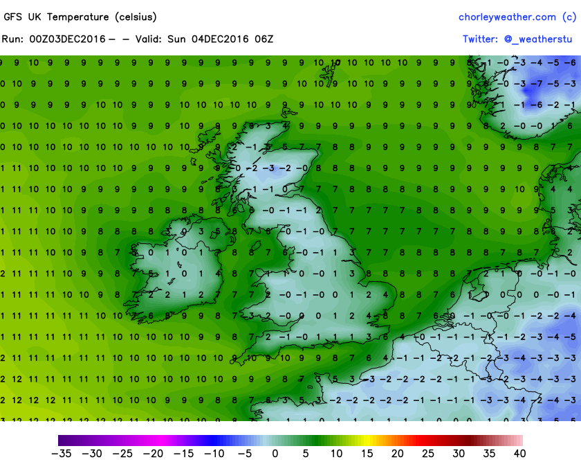
Cooler, drier air returns to the UK over the next few days as our flow comes in from a cold continent. This will result in brighter cooler days along with frosty nights.

Credit: chorleyweather.com
Credit: chorleyweather.com
While we may start the week fine, dry and cool, significant change arrives mid week as warm oceanic air floods the west but forces further arctic/siberia air into the east.

Credit: chorleyweather.com
The dull, wet, windy and mild returns as the jet stream wakens and Atlantic storms gather.
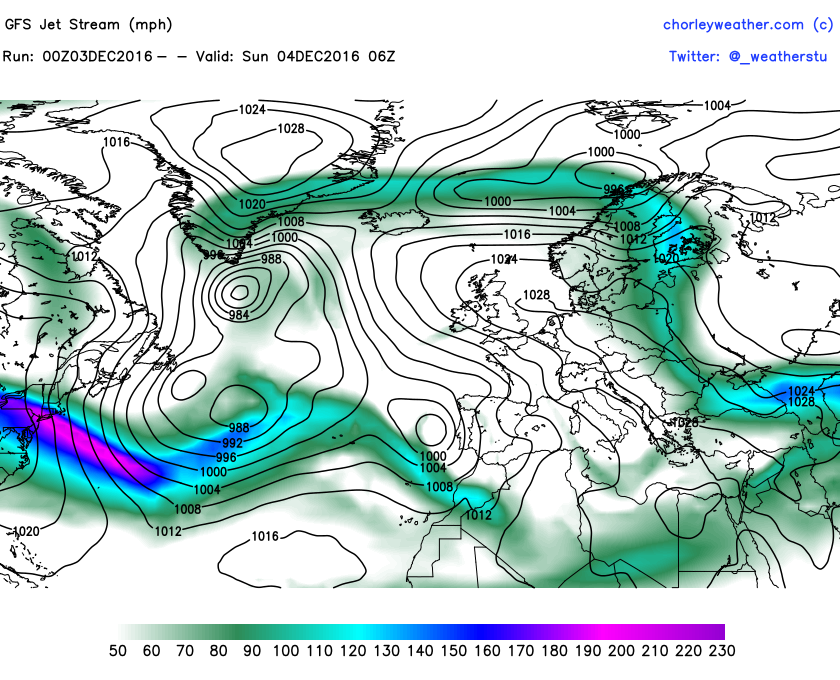
Note in the GFS jet stream chart for tomorrow how a strong jet sweeps off the Northeastern US, this is the sign of change already underway despite high pressure still parked over the UK at this time.
Credit: chorleyweather.com
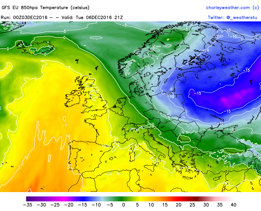
By Tuesday, lows shall deepen between the jet and Greenland all the while southerly winds increase over the UK in advance of the first frontal system. This forces a lobe of Asian cold into eastern Europe.

Credit: chorleyweather.com
By Wednesday we’re back under the cloud, wind and rain with temps in double figures pretty much UK-wide.

Credit: chorleyweather.com
As we progress through the week, a series of cold shots dive into eastern Europe in response to the return of Atlantic winds over the UK and Low Countries. SW flow over the Western continent translates to NNE flow in the east.
Credit: chorleyweather.com
Credit: chorleyweather.com
Eventually that westerly flow crosses Europe but the cold appears to cling onto far eastern Europe.

Credit: chorleyweather.com

Credit: chorleyweather.com


Recent Comments