I think it’s safe to say that the trough coming down over the Northeast to end this month is nowhere near as strong or cold as I had it. A lot of the reason is the negative hanging back over the Southwest.
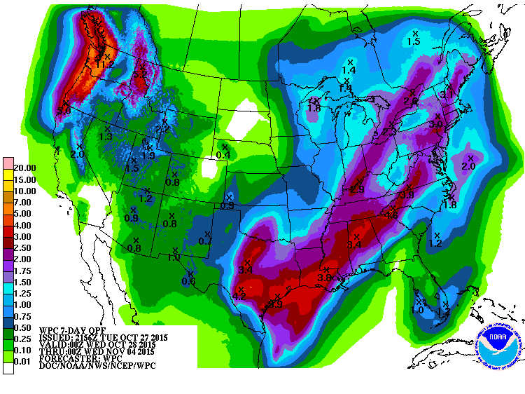
The big weather story through the rest of this week will be the heavy rains spreading north, the strong winds around the Great Lakes and possibly the first snowstorm for some in the Upper Midwest. Let’s not forget the big rains pushing into the drought stricken Pacific Northwest too.

Credit: AccuWeather Pro

Credit: AccuWeather Pro
[s2If current_user_can(access_s2member_level1)]
Wind gusts over Great Lakes (kts) at 2pm Thursday

Wave heights over Great Lakes at 2pm Thursday

Big difference in GFS and ECMWF at 72 hours for snowfall over Upper Midwest.

Credit: AccuWeather Pro

Credit: AccuWeather Pro
With the continuation od this highly amplified pattern, the trough which drops is quickly replaced by a major ridge day 5-10 over the Northeast as heights collapse over the Southwest.

Credit: AccuWeather Pro
See video for the discussion.
[/s2If][s2If current_user_cannot(access_s2member_level1)][magicactionbox id=”18716″][/s2If]


Recent Comments