
As summer 2014 is about to draw to a close, the upper air pattern is finally shifting! It looks like the Midwest and East will finally see summer, outwith summer! By that I mean we’ll see summer warmth when ‘meteorological summer’ is over. Keep in mind that fall officially begins Sep 1.
Like winter, the summer has been cool from the Plains t0 East Coast but it looks likely that September (at least through the first half) will be quite different.
Outwith the West, warmth has never been able to come in and hold. Notice that the summer has been dominated by a positive PNA which supported the Western ridge, eastern trough. A mere continuation of winter. It’s finally heading negative for the first time since late July.

The CFSv2 has the first real ‘sustained’ warmth in the East. Didn’t see this ANYTIME during the June through August period.

[s2If current_user_can(access_s2member_level1)]
ECMWF 500mb height anomalies
Day 3-10

2-metre temp anomalies

While September looks to be a warmer than normal month for much of the US, I believe the fall season overall will be warmer and wetter compared to normal given the type of pattern we’re seeing with warm waters off both coasts and the El Nino coming on.
The Jamstec sees a warm/wet fall.

Spike In PDO Likely To Be Saving Grace For California.. Just Another Phase In The Cycle!
As stated in yesterday’s post, the spike in the PDO coupled with the oncoming El Nino looks good for California. I agree with the wet solution through the winter months.
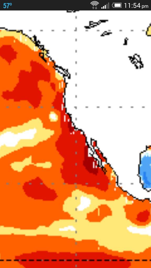
Below are projected CFSv2 sea surface temp anomalies off Western North America.. Remember the last 3 years have seen significantly BELOW NORMAL water temps which have supported above normal upper heights = below norm rainfall.
Oct-Dec
Dec-Feb

CFSv2 precip forecast for Dec-Feb period!

See yesterday’s post for more on ‘why the severe CA drought’!
[/s2If][s2If current_user_cannot(access_s2member_level1)][magicactionbox id=”18716″][/s2If]


Recent Comments