>
Join The Conversation!
In Today’s Blog
Latest US Discussion @ #USA
Detailed Pattern Discussion For Next 7 Days Across The USA (Includes Video)
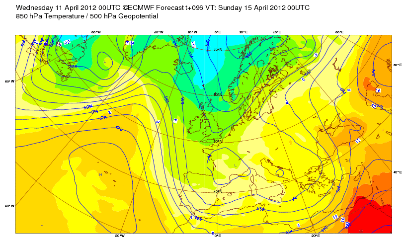
Latest UK-Europe Discussion @ #UK-EUROPE
Thunderstorms Are Roaming Parts Of The UK Today With Torrential Rain & Hail (Includes Video)
Latest Weather from India-Sub-Continent @ #INDIA-SUB CONT
Latest India, Sub-Continental Weather By Rajesh Kapadia
ASIA LATEST
Two Massive 8.6 & 8.2 Magnitude Earthquakes Strike West Of Northern Sumatra, Felt Across Vast Area
STARTLING: 5 OF THE 10 MOST POWERFUL EARTHQUAKES SINCE 1900 HAVE OCCURED WITHIN THE LAST 10 YEARS
Highlights
The quake was centered 20 miles beneath the ocean floor about 270 miles from Aceh’s provincial capital.
The tremor was felt in Singapore, Thailand, Bangladesh, India and Malaysia, where tall office buildings shook for more than a minute, according to the Associated Press

QUAKE MOVEMENT WAS KEY TO NO BIG TSUNAMI
Thankfully, both quakes which struck today off west coast of Northern Sumatra they were HORIZONTAL in their movement, not vertical. In a bath, if you slid your hand horizontal across the water, there is little wave action on the surface but if you move your hand up and down (like the movement in the 04′ quake), then there is a lot of movement of sea floor and waves are created outwards in all directions! Also, these quakes as large as they we’re only about half as powerful as the 9.0 on Boxing Day 2004.
Powerful quakes off Indonesia create panic around Indian Ocean
NBC NEWS
Tsunami watch lifted after two big earthquakes
CNN
Two Magnitude 8 Quakes Off Indonesia
ACCUWEATHER

Powerful Indonesia quakes trigger tsunami warnings
FOX NEWS
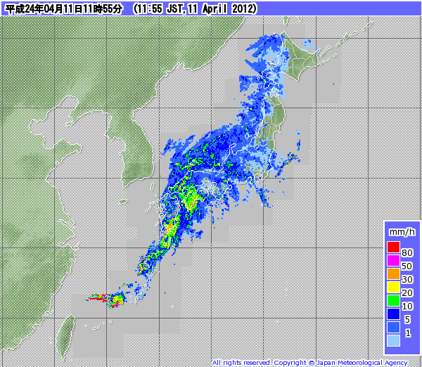
Another Major Storm For Japan
Another Stormy System Races Across Japan / 11 APR 2012
WESTERNPACIFICWEATHER.COM
US LATEST
Severe Weather Threat Conditions For Southern Plains With Tornado Risk Increasing As Calif Storm Comes Ashore
For the latest US weather updates & much more, check out and like my Facebook page!
Detailed Pattern Discussion For Next 7 Days Across The USA

Severe Weather Threat Increasing This Week
THE WEATHER CHANNEL
Another Round of Severe Weather Takes Aim at Plains
ACCUWEATHER
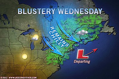
Interior Snow, Blustery Conditions for Northeast
ACCUWEATHER
Wildfires Continue Burning Across New Jersey
Large brush fire burning near MetLife Stadium in Meadowlands
NJ.COM
Brush Fire Burns In New Jersey Meadowlands
CBS NEW YORK
EUROPE LATEST
Thunderstorms Are Roaming Parts Of The UK Today With Torrential Rain & Hail

There was plenty of sunshine to be had and with light wind, it felt pretty warm but as the earth warmed over the UK, so those thermals (rising columns of air) got to work fast, building showers and thunderstorms and these while popped fast and furious over the British and Irish landscape, they all got carried southeastwards aboard a prevailing northwest upper flow. Some of these intense showers and t-storms consolidated into squall lines which brought very gusty winds, torrential rains, thunder, lightning and hail. Blame the abundant sun which warms the air ahead of these cells which provides fuel for them, forcing their already strong upward motion to excellerate. The air in the mid to upper levels is growing colder each day as the trough over us draws down colder air and so the showers and storms are becoming pretty impressive. I’m sure there have been some impressive lightning displays through this afternoon.
Models Persistent In Bringing Down Enough Chill Late This Weekend For A Covering Of Snow To Low Levels Of Scotland
AUSTRALIA LATEST
Large High To Bring Warming Conditions To Chilly Southeastern Australia
THE EXTREMES OF THE DAY
TODAY’S US EXTREMES
COURTESY OF ACCUWEATHER
HIGH: 92° at Harlingen, TX
LOW: 12° at Fosston, MN
TODAY’S UK EXTREMES
COURTESY OF THE MET OFFICE
HIGH: 58° (14.6°C) at Kew Gardens (London)
LOW: 28° (-2.2°C) at Katesbridge (Co Down)
TODAY’S EXTREMES HERE AT MY HOUSE
HIGH: 54°
LOW: 35°
Thanks for reading.
-Mark


Recent Comments