>
Join The Conversation!
Today’s Weather Headlines
Europe Latest
Mild conditions dominate the UK into Wednesday while it turns increasingly colder across Scandinavia and eastern continent
THE EUROPEAN LIKE ALL THE OTHERS ARE FLIPPING BACK AND FORTH BUT THAT PERSISTENT BUILDING, EXPANDING AND INTENSIFYING COLD POOL REMAINS PERSISTENT
SUBSCRIBE TO MY YOUTUBE CHANNEL, CLICK HERE!
This week was well advertised to be mild, even warm, by January standards across the UK, Ireland and much of the western continent with weak impulses of rain pushing along the southwesterly flow.
While the next system sweeps across northern Scotland on Wednesday, you’ll notice by Thursday that winds turn from southwest to northwest and this will make it feel closer to normal. Snow showers will be had across the far north, even at low levels and by Friday, I believe it will feel colder and if there’s any moisture to go with the chilly 3-5C highs across Scotland, we may see some wintry showers down at low levels across inland areas before a return to milder.
So, on Wednesday expect some increasing west or southwesterly winds with rain progressing southwards. While gales may impact the north, the Central Belt will likely see a generally windy day with some modest rain (heavy bursts perhaps) through the afternoon and evening. Further south, cloudy with some sunny intervals will be the rule. Temps range from 8-10C in north to 13C in south tomorrow, by Thursday 5-7C in north and 8-10C in south and by Friday 2-5C in north and 6-8C in south.
As for the upcoming weekend, it appears at this time to be mild with ridging over western Europe but more importantly, despite the chopping and changing of the models. The European stands firm with the deepening of the trough which grows colder, expands and basically re-routes weather around it. So far this season, it’s been a very progressive pattern but yet the models show this feature not only remaining over eastern Europe but it grows stronger and this suggests a more blocked pattern is developing.
I keep urging you to stop paying attention to each and every new model run and start looking at trends. So far, the main trend I’ve seen is that eastern cold pool although we’ve seen changes in the ridge over the UK-Ireland, some colder, some warmer than others.. the fact that the development, deepening and expanding of this trough tells us of a changing pattern with colder now getting into the mix.
So, while we may remain up and down, the warm days are up for Scandinavia south into Poland, Ukraine, Rusia and even south. This trough and large cold circulation will feed increasingly colder air into Europe from Siberia and I believe this expanding cold pool will migrate westwards into the UK and Ireland, covering us by January 20th onwards.
Latest charts off ECMWF


US Latest
As Arctic air builds and drives southwards, storms increase in intensity as the thermal contrast stretches and energy levels rocket
Heavy Rain Coming DC to Philly, NYC, Boston
ACCUWEATHER.COM

Wintry Mix Coming to Part of Interior Northeast
ACCUWEATHER.COM

Torrential Downpours, Severe Storms Hit the Southeast
ACCUWEATHER.COM

Houston hit with flash flood
THE WEATHER NETWORK
No shortage of snow over Alaska
It’s snowed every day in Fairbanks, AK since Dec 18 (22 days), a new record
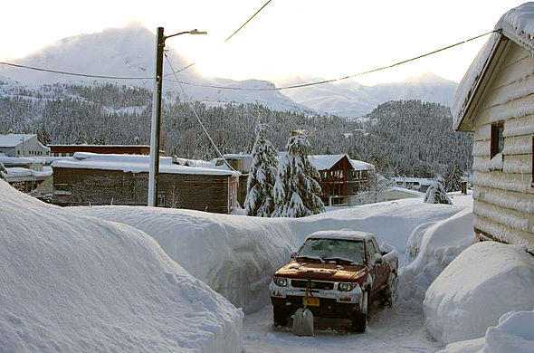
Possible Blizzard for Already Snowed-In Alaskans
ACCUWEATHER.COM
Digging your car out in Cordova, AK
South America Latest
Argentina bakes

Buenos Aires swelters in heat wave
THE WEATHER NETWORK
Brazil Flooding
Australia Latest
Western Australia keeps eye on potential tropical development, brings torrential rains
THE EXTREMES OF THE DAY
TODAY’S US EXTREMES
COURTESY OF ACCUWEATHER
HIGH: 84° at Crystal River, FL
LOW: 0° at Alamosa, CO
TODAY’S UK EXTREMES
COURTESY OF THE MET OFFICE
HIGH: 55° (12.7°C) at Hawarden (Flintshire)
LOW: 29° (-1.5°C) at Topcliffe (N. Yorkshire)
TODAY’S EXTREMES HERE AT MY HOUSE
HIGH: 48°
LOW: 43°
Thanks for reading.
-Mark


Recent Comments