>
Graphic courtesy of AccuWeather.com
Hail and downpour producing thunderstorms now taking the stage for phase two of this powerful Nor’easter across soaked wind-beaten New Jersey and eastern Pennsylavania. Whilst the fiercest winds from the system itself have progressed into New England, now some dynamical lift and will be aided somewhat by a warming March sun, thunderstorms are the biggest factor today in bringing hail, drenching downpours which will exaserbate the flooding issues already across Jersey, eastern PA and across NYC and LI and we may see some intense gusty winds and dangerous lightening as those thunderstorms may get intensified with some enhanced lift through daytime heating and surface convergence as the low departs the Mid-Atlantic and warm and cold air possibly meet.
AccuWeather.com News is reporting pea-sized hail covering the ground this morning in Ocean City, NJ.
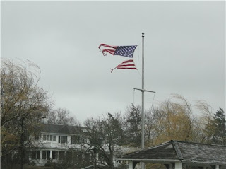
A relentless easterly wind flow, perfectly aligned from the 850mb height down to the surface has pile driven wind and wave onto the Jersey and Long Island shore, packing persistent and relentless, storm to hurricane force gusts which have tore countless trees out of the ground and ripped and snapped powerlines and poles as well as cutting power to hundreds of thousands of people across the tri-state region, a region packed with millions of people. This washing machine of weather is tormenting a weather beaten region of the world…
 Shenandoah County, Virginia
(Image courtesy of AccuWeather Facebook)  Fort Washington, Pennsylvania
(Image courtesy of AccuWeather Facebook)
After record-breaking snowfall, it’s now all about the major flooding and damaging winds that are representing to close of winter 2009-10 to the Mid-Atlantic/Northeast region.


>yeh, that would be great! a fabulous blog youve got sir!! shall be blogging about yours hopefully tomorrow and get you onto my bloglist…
>great post! how'd ya like that first-hand account video on The Northeast Quadrant? I think its great that you blog about our weather too!