>
Join The Conversation!
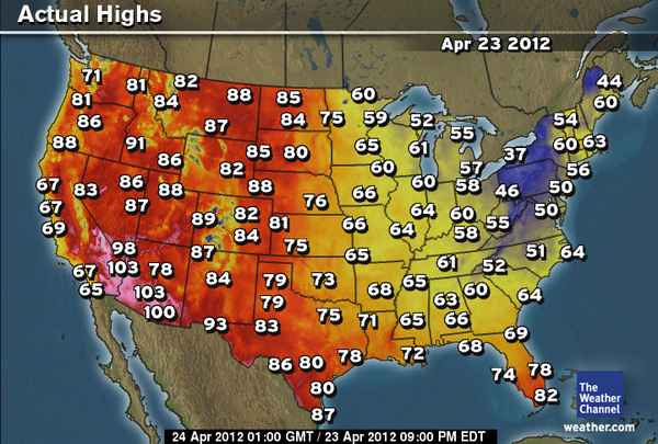
BELOW: California Heat Gets Replaced By Storm, Severe Potential For Late Week Along With Snow Event!
EUROPE LATEST
GFS Brings 972mb Low Into Cornwall Tomorrow, 1 Inch Rains Widely With Some Areas Likely To Top 2 Inches
WIDESPREAD GALES ACCOMPANIED BY POTENTIALLY FLOODING 1-2 INCH RAINS FOR SOUTHERN & MIDLANDS ENGLAND TOMORROW
While one low pushed through southern England/France yesterday bringing close to an inch of rain at Plymouth, that system has gradually worked east, now bringing wet, windy conditions across the Netherlands, Belgium, parts of Germany into southern Scandinavia. A second storm system is hot on it’s heels and deepening as it works it’s way northeastwards towards the southwest of England. The mean trough positioned over the UK and active, Atlantic jet stream means it’s one storm after the other and a potential setup which brings parts of England OUT OF DROUGHT by later in May?

Deeper Low, Larger Windfield Means Bigger Rains, Stronger Winds For Most Across UK/Ireland Compared To Previous System
The GFS has been persistent in bringing a deepening low into SW England during Wednesday with pressure down to 972mb as it pushes up the Bristol channel, it’s track more northeast than east means it’s wind and rain distribution covers more or less all of the UK over the next 36-48 hours, helped by larger windfield than the last system. This depth of centre indicates tightly packed isobars and winds blowing at 25-35 mph throughout the South and Midlands of England as well as Wales. Gusts could widely reach 50 mph with coasts potentially recieving gusts to 60+ which could cause minor damage to trees and roofing.
The storm also looks to be quite a soaker and I expect a healthy inch for most across the the South, Midlands, even up as far as Cumbria. Across the moors of the Southwest, the Chilterns, Downs as well as across parts of the Midlands, we could see upwards of 2 inches of rain. Wednesday sees the bulk of the rains over England and Wales while Thursday this transfers to Scotland where a good inch should fall across the Southern Uplands, perhaps south Highlands.
While winds blow at varying angles out of the south across the Southern UK, the North sees E to NE winds and this direction keeps it feeling cool in the brisk to strong winds blowing off the North Sea. Expect snow above 500 metres over the Grampians and central Highlands.
ELSEWHERE ACROSS EUROPE
Western Trough Deepens Forcing Cool, Unsettled Weather Into Azores, Canaries While Sahara-level Heat Set To Blast Germany, Then Poland, Russia This Weekend

A southwest to northeast oriented trough axis over western Europe broadens in coming days and this supports cooler, unsettled weather all the way into the sub-tropics, as far south as the Azores and Canaries. Rare showers and chilly temps for this time of year here while this orientation of this amplified pattern supports heat originating deep in the Sahel lifting northeastwards aboard a strong southwest jet into central and eastern Europe with a blossoming upper level ridge. Germany should sees highs around 30C by Friday then as the trough changes shape, the core should push east through Poland and into Russia by this weekend with potentially 26C into Moscow. Records will fall from Germany eastwards in the coming days with this pattern setup.
US LATEST
Last Day Of Record Heat In West As Storm Impacts California Wednesday
Yesterday saw highs top 113 degrees at Death Valley, CA, 2nd such high and 2nd day in a row at tying the all-time April record, 91 at Boise, ID, 88 at Salt Lake City, 88 at Glasgow, MT and today will see near 90 at Denver, CO..

The core of this heat shifts eastwards into the W Plains today and tomorrow as another Pacific storm is set to bring a new wave of wind, rain and mountain snow to California. A return to much cooler conditions also.
Texas looks to take centre stage of the heat with highs by tomorrow likely to top 100 across much of western and central parts of the state. Laredo and surrounding desert locales will warm to between 102-106 degrees with records falling.
Late week/weekend Severe Weather & Snowstorm Potential
By late week, while the heat remains over Texas, the warmth spreads into the Ohio Valley as the trough deepens across the West and moves out into the W Plains. One must be concerned about severe weather potential over the Southern Plains/Ohio Valley by Friday, perhaps into the weekend while a cold shot drops into the Northern Plains and Midwest which along with a storm system treking eastwards across the nations heartland, watch for severe weather over the S plains/TN/MS valleys while a lasp gasp snow event kicks up from perhaps Minnesota to New England
Latest Articles
Northeast Wild Weather Wrap Up
ACCUWEATHER
Record Heat Expands Into Plains
THE WEATHER CHANNEL

Plains Record Heat
ACCUWEATHER
Rain, Cooler Air Poised for West
ACCUWEATHER

Strong Storms for Part of Midwest Wednesday
ACCUWEATHER
Canada Latest
Ontario Hit Hard By Snowstorm
Whiteout conditions hit parts of Ontario
THE WEATHER NETWORK
Snowstorm Invades Canada
ACCUWEATHER
AUSTRALIA LATEST
Alice Springs Picks Up 20mm Of Rain
THE EXTREMES OF THE DAY
TODAY’S US EXTREMES
COURTESY OF ACCUWEATHER
HIGH: 98° at Wink, TX
LOW: 19° at Embarrass, MN
TODAY’S UK EXTREMES
COURTESY OF THE MET OFFICE
HIGH: 58° (14.4°C) at Kew Gardens (London)
LOW: 30° (-1°C) at Ravensworth (N Yorkshire)
TODAY’S EXTREMES HERE AT MY HOUSE
HIGH: 53°
LOW: 34°
Thanks for reading.
-Mark


Recent Comments