>
Join The Conversation!
In Today’s Blog
UK-Europe Summer 2012 Forecast @ #SEASONAL FORECASTS
Dry spring could lead to a significantly warm June, July over England which periodically extends up into Scotland and west into Ireland
Your Weather Headlines Today
EUROPE LATEST
UK, Ireland & Western Europe Returns To Winter Following Record Heat!
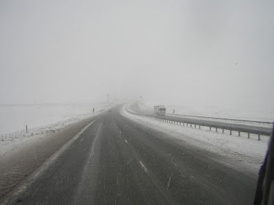
SNOW WARNING MON NIGHT, TUES MORN: SPELL OF SNOW TO SPREAD ON BACKSIDE OF COLD FRONT, HIGHLANDS, SOUTHERN UPLANDS AND N PENINNES LIKELY TO BE AFFECTED, LOW LEVELS MAY SEE BRIEF, LIGHT COVERING
Quick look at today!
It’s a generally fine, dry and pleasant day ahead for most areas with slightly cooler temps than yesterday and much cooler than last week. Cloud and rain will migrate south over Scotland but it’s likely to be just cloudy from the Central Belt on south. The rain should remain over the Highlands and over to Aberdeenshire. In the north and west it should remain milder than last night thanks to the cloud cover but over central and southern England, especially south Wales and southwest England, it will be coolest here with frost under clear skies.
Monday
As the cold front pushes south it will draw rain and then snow down through Scotland and into Northern England during the day. Low levels will remain rainy while snow falls at around 300 metres and above. The rain progresses southwards through the late afternoon and evening bringing much welcome rain to the drought areas.
Monday night into Tuesday
It’s into the evening hours Monday where the snow levels may start to drop as does the temperature. The cold front marks the dividing line between milder air and a colder maritime-polar air and through tomorrow the temnperature will become notably colder down here at the surface as this air mass works it’s way in. The upper levels of the atmosphere is turning very cold compared to what we just saw. This colder atmosphere will eventually cover all of the UK by Tuesday, we must watch out for rain changing over to snow over the Central Belt and roads across Ayrshire, South Lanarkshire and Dumfries and Galloway including the M74 overnight Mon into Tuesday. Roads could turn snowcovered and icy.
During Tuesday rains should clear from north to south and highs will be a chilly 3-6C in Scotland and northern England, 6-9C in the south. Factor in a cold northerly breeze it it will feel like winter once again.
Tuesday night
Tuesday night will see lighter winds, widespread clear skies and with a cold air mass in place, a hard frost and temps widely down to between -2 and -7C will make for a real shock to the system. Watch for icy patches.
NEW VIDEO!
Subscribe To My YouTube Channel
US LATEST
Think Yesterday Was Hot Over Plains? 90s Will Reach South Dakota This PM
First 100 degree high of the year for nation as heat pump pushes 90s all the way to South Dakota this afternoon

Warmest March on Record in Dozens of Cities
THE WEATHER CHANNEL
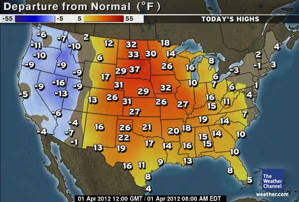
No Foolin’: 90s for Much of the Plains Today
ACCUWEATHER
Watch Out For Strong Storms In Ohio Valley

Powerful Storms with Large Hail Threaten Ohio Valley
ACCUWEATHER
Quick Hitting New England Snow Today, Tonight

Quick Shot of Northeast Snow Sunday Night
ACCUWEATHER
Another Round of Snow for Northeast
THE WEATHER CHANNEL
AUSTRALIA LATEST
THE EXTREMES OF THE DAY
TODAY’S US EXTREMES
COURTESY OF ACCUWEATHER
HIGH: 99° at Vernon, TX
LOW: 13° at Clayton Lake, ME
TODAY’S UK EXTREMES
COURTESY OF THE MET OFFICE
HIGH: 61° (16.2°C) at Strathallan (Perthshire)
LOW: 23° (-5.1°C) at Ravensworth (N. Yorkshire)
TODAY’S EXTREMES HERE AT MY HOUSE
HIGH: 50°
LOW: 27°
Thanks for reading.
-Mark


>Then w should prepare and if we are going to go outside importantly we should have a suit that can protect our skin from the scorching heat.