>
Join The Conversation!
LONG RANGE VIDEO NOW AVAILABLE (SCROLL DOWN)
Today’s Global Weather Headlines
Europe Latest
Eastern Europe Beginning To Get Slammed Hard By Winter
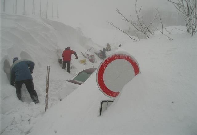
Blizzard Rages on in Southeastern Europe
ACCUWEATHER.COM
Blizzards hit eastern Europe hard
CBS NEWS
Central, Eastern Europe Turning Colder With More Heavy Snow in SE While UK Becomes Battle Ground This Weekend With Cold Drifting West And Warmth Drifting East

This weekend features temps 5 to 10C below normal over the eastern continent with a polar low bringing heavy snow and blizzards to the Balkans, Bulgaria and Romania. UK will see fronts trying to push into western areas but will be halted by the building Scandinavian high, a battle between lower pressure and higher pressure kicks in.
Over the upcoming weekend, while we see the cold air grow colder over the eastern and central continent with Moscow and Kiev, which has already been cold, they both will struggle to reach -12 to -15C this weekend while even Warsaw sees highs of only -6 to -8C, Berlin -2 to -4C, it’s all thanks to a building high pressure system over Scandinavia which is feeding the cold, continental air across Europe, helped by a large, potent polar low centred over the southeast. The clockwise flow around the high, counterclockwise flow around the polar low will result in feeding this cold with even colder Siberian air late this weekend and through next week and so these highs mentioned above may end up relatively mild compared to what may be looming. That is a scary prospect.
UK BECOMES BATTLEGROUND BETWEEN MARITIME AIR AND CONTINENTAL AIR, COULD THIS TRIGGER WEEKEND LOW LEVEL SNOWFALL?
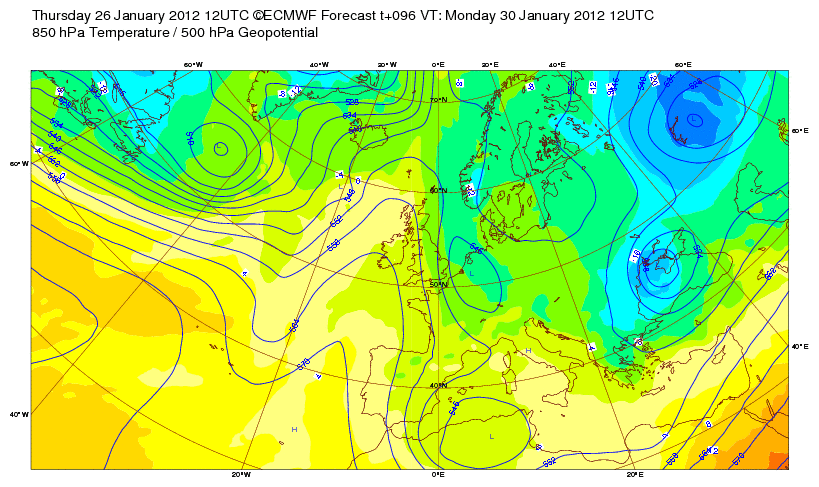
So, while the cold and snowfalls continue out east, the UK will see not a bad next few days and weekend as the pressure is strong enough from off Europe that will hold back frontal systems that want to progress east from off the Atlantic. The weekend looks interesting as it will looks as though the pressure decreases enough in which at least one front will be able to cross Ireland and into the western UK, the thing is, as the air is modestly cold, this moisture brought in by the front may spark some snow, even to low levels.
MODELS SHOW INTENSE SIBERIAN AIR OVER EUROPE NEXT WEEK, BUT ARE THEY COLD ENOUGH?

Models are often too progressive with cold air and with the density of cold, low level air, they often loose sight of it’s intensity. My point is, that although the models show an intense westward push of brutal Siberian air from Asia into Europe through next week, I have a real concern over the fact these models are simply not cold enough and therefore historic temperature records may be challenged next week, especially over the eastern side of the continent.
Asia Latest
Severe Cold Begins Southward Assualt Through China

City hit by extreme -45 degrees Celsius temperature in north China
THE WEATHER NETWORK
Freezing rain causes water shortage in Guizhou, SW China
THE WEATHER NETWORK
US Latest
Concerns Over Severe Weather Return to Alabama Again Today
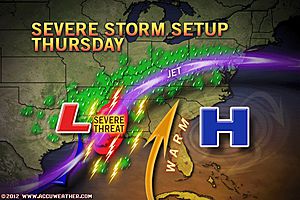
VIDEO: Severe Weather Swipes the Southeast
ACCUWEATHER.COM
Alabama Severe Storms Times Two This Week
ACCUWEATHER.COM
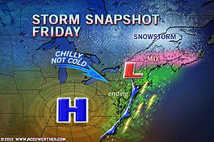
Northeast Rain, Snow, Slush On the Way
ACCUWEATHER.COM
Ice Extends Farthest Into Bering Sea in 20 Years
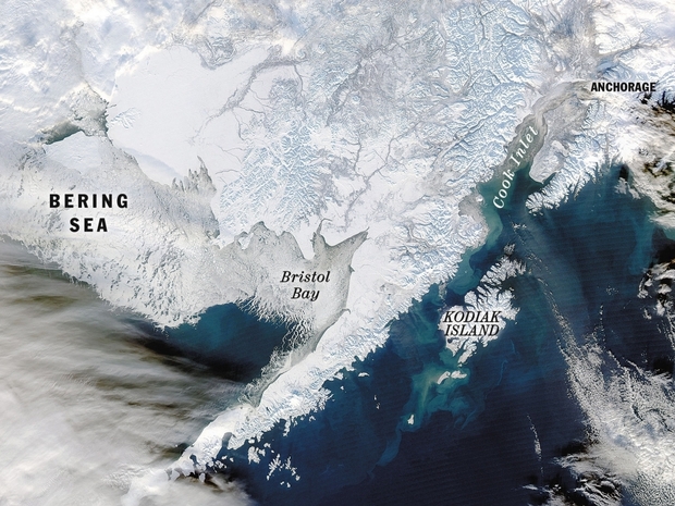
Ice in Bering Sea threatens crab fishery
ANCHORAGE DAILY NEWS
Australia Latest
Major Flooding Continuing To Hammer Top End, Searing Heat Waves Over WA!
THE EXTREMES OF THE DAY
TODAY’S US EXTREMES
COURTESY OF ACCUWEATHER
HIGH: 86° at Chatsworth, CA
LOW: -9° at Farson, WY
TODAY’S UK EXTREMES
COURTESY OF THE MET OFFICE
HIGH: 52° (10.9°C) at Dunkeswell (Devon)
LOW: 26° (-4°C) at Altnaharra (Sutherland)
TODAY’S EXTREMES HERE AT MY HOUSE
HIGH: 42°
LOW: 29°
Thanks for reading.
-Mark


Recent Comments