>
#BRITISH ISLES
UK Locked in a Chilly, Gloomy Pattern with little sunshine and warmth to speak of
#UNITED STATES
Major Cool Shot to take aim at Smoldering Southern Plains, will it last? Pleasant fall-like weather in Northeast
In Today’s News
While Irene’s Clean Up Continues, We Keep A Close Eye On Newly Formed Tropical Storm Katia and Caribbean Disturbance
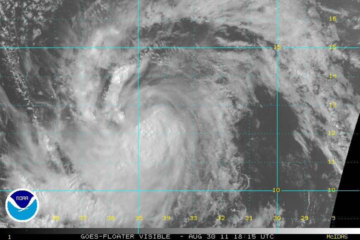
Well it didn’t take long but we have a new kid on the block, Tropical Storm Katia was born earlier today and she is looking healthy and fairly well organised out over the far eastern Atlantic.
Katia is of course the replacement for infamous Katrina, which ironically struck the Gulf Coast six years ago yesterday, her formation was only hours after the anniversary of that brutal strike on Louisiana and Mississippi.
Over the next 4 or 5 days, Katia will continue on a WNW track, crossing low to mid-80 degree waters and with relatively light shear we should see Katia become our next Hurricane and may well by late week or into the weekend become the season’s next Major Hurricane.
Thankfully Katia is a long way off, many miles away and this gives us time to catch our breathe a little from Irene’s impacts. Although some models take Katia into the western basin and then turn ip northwest, then north, then northeast at the longatude of Bermuda, some are already pushing it a little too far west for comfort, so it’s needs to be watched closely, like I’ve said, it’s a long way off and I shall certainly be keeping you posted on Katia’s prgress day in and day out throughout her life.

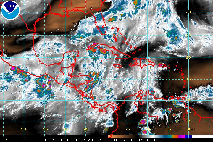
As you can see from the above European for NEXT THURSDAY, this current model which of course will change run by run, currently has the system fairly close to the East Coast, the worry could be that as time wears on this week and into particularly early next week, does the model trend go west or east from the current run? I wouldn’t like to think from this run, it starts trending west. Keep checking back. Starting tomorrow in my #Weather Talk segment I shall start a post ‘Katia Watch’ and I shall upload the graphic of the new model run for next Thursday each day and we can see whether the European keeps in west, east or in a similar longitude at point of it’s northward turn.
Will Katia Be Threat for the East Coast?
ACCUWEATHER.COM
DEATH TOLL NOW STANDING @ 40
MESSEGE TO THE CRITICS OF IRENE’S WRATH
Rescues, places of refuge mark aftermath of Irene in New York town
CNN
Millions Still Face Power Outages, Major Flooding in Irene’s Wake
FOX NEWS
Irene still leaves many cut off, Powerless
CBS NEWS

Hurricane Irene leaves Vt., NY homeowners, towns stranded
NBC
Irene Flooding: Death Toll Rises to 40
ABC NEWS
In Other News
Weather Disasters Busting the Bank for FEMA
ACCUWEATHER.COM
UK Summer Coolest in 13 Years
ACCUWEATHER.COM
Latest on Southern Plains Heatwave/Drought 2011
Houston’s Remarkable Temp Trend of the last few days
109, 107, 107, today?
Rain could arrive in Houston as soon as Thursday
HOUSTON CHRONICLE
Houston forecast: More triple-digit highs Tuesday, but rain relief on the way
K HOU.COM
Showers again blow through Dallas area, but rain won’t put damper on another triple-digit day
DALLAS MORNING NEWS
THE EXTREMES OF THE DAY
TODAY’S US EXTREMES
COURTESY OF ACCUWEATHER
HIGH: 116° at Ocotillo Wells, CA
LOW: 29° at Boca Reservoir, CA
TODAY’S UK EXTREMES
COURTESY OF THE MET OFFICE
HIGH: 65° (18.5°C) at Strathallan (Perthshire)
LOW: 42° (5.7°C) at Topcliffe (Yorkshire)
TODAY’S EXTREMES HERE AT MY HOUSE
HIGH: 62°
LOW: 50°
Thanks for reading.
-Mark


Recent Comments