
Based on past and current pattern and model projection, I believe April is looking mixed with at least one decent spell of warmth but also spells of wet and windy for Western and Central Europe. Warmer and drier than normal further south into Iberia and across the western Med Basin.
I am showing you the CFSv2 perspective because I believe it’s closest to reality just now. Overall it has a similar upper air pattern to what we experienced during the past winter but it’s of a more spring-like state. This late spring/early summer setup looks very typical for Western Europe with a predominant westerly Atlantic influence but I believe there will be a fight between a weak Icelandic low and strong Azores ridge. BOTH will influence but a wetter pattern and therefore wetter ground than the last 2 late spring periods mean warm-ups will be tempered and likely shorter lived as part of the sun’s energy will go into evaporation rather than heating the air.
All in all there’s warm and wet spring some up April 1-30th.
So why do I think this?
Current SST anomalies.
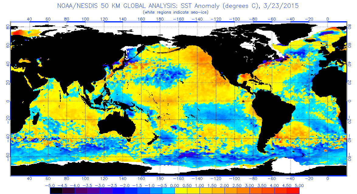
The above SST anomaly profile has driven a certain kind of pattern through the winter and with little change through the upcoming summer (below).
SST projections into summer.

I think we’re heading for a summer version of what we got in winter where westerlies rule but we go back and forth between wet and dry and this should start during April.
There’s a good chance that the first half of April presents our first warm spell with low 20s possible.
This supports the below solution off the CFSv2.
The above actual as well as projected SST profile above supports the below CFSv2 forecast.
700mb anomaly for April

2m temperatures

Precipitation anomaly

See this morning’s video for more details…
Will be releasing my Official Summer 2015 Forecast on April 1. May Outlook will be available around this time next month.


Recent Comments