
I was at Celtic Park last night for the Barcelona game and it was certainly one of the colder nights at the football in several years for me. The previous two November visit to watch Barcelona brought near t-shirt warmth. Even at 8 and more so 9.40pm last night, there was a hard frost outside the ground.

Credit: Mark Vogan
Last night turned out to be Central Scotland’s coldest of the season.

Credit: Sean Batty
Tonight is likely to be equally as cold but tonight is the last of the hard frosts as cloud increases tomorrow onwards.

Credit: BBC Weather
With anticipated wobbling of the high and westward drift out into the Atlantic tomorrow, cloud to increases lifting night temps in Scotland for Fri/Sat nights.

Credit: Tropical Tidbits
The upcoming 5 days sees high pressure remaining dominant across the UK bringing a mix of sun and cloud but largely dry weather coast to coast.

Credit: Tropical Tidbits
Next Week
To end the upcoming weekend and begin next week, the high is positioned north of Scotland introducing drier continental air from Scandinavia which means clearer skies and likely night frosts for more southern parts of the UK as well as north.

Credit: Tropical Tidbits
With HP drifting down the North Sea and LP over Russia, a fresh injection of arctic air dives into the heart of Europe.
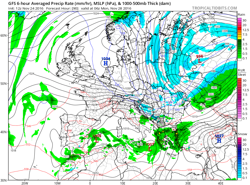
Credit: Tropical Tidbits
Later next week gets interesting according to the GFS with a strong, cold NW wind developing over the UK while LP within a cold air mass in Europe means widespread snowfall.

Credit: Tropical Tidbits

Credit: Tropical Tidbits
Gfs sees significant snow on the way.
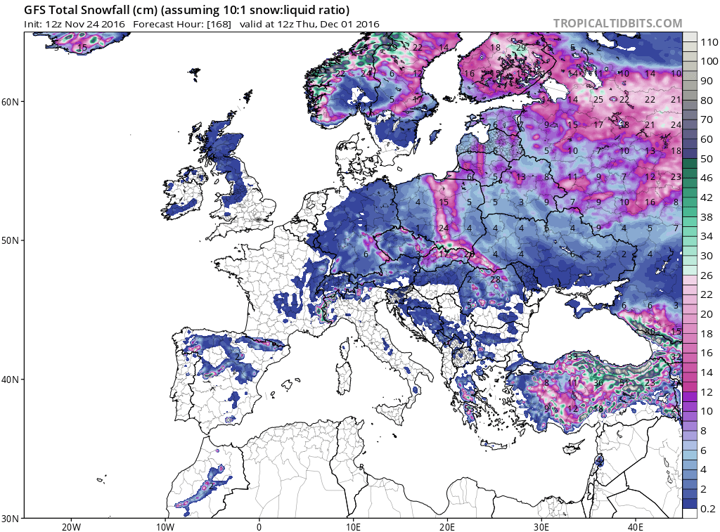
Credit: Tropical Tidbits
By next weekend, we enter a stormier period with Atlantic weather returning.
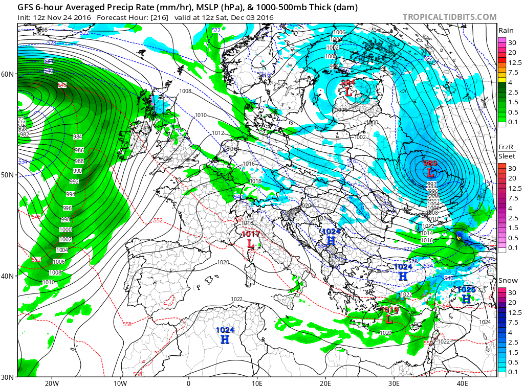
Credit: Tropical Tidbits

Credit: Tropical Tidbits
So, the settled weather is set to continue on into next week for the UK while Europe returns to a colder, snowier pattern. Later next week on into the weekend shall see the return of Atlantic weather with a spell of stormy conditions for all. Beyond this period, the models are up and down given the changes going on within the arctic. When there’s strat warming, models have a hard time seeing the atmospheric setup down in the mid latitudes but it’s looking likely that cold trend continues with snow chances increasing!
Feeling under the weather today, hence why there’s no video and this post is rather late in the day! Hope to have one for you tomorrow.
[s2If current_user_can(access_s2member_level1)]
[/s2If][s2If current_user_cannot(access_s2member_level1)][magicactionbox id=”18716″][/s2If]


")


Recent Comments