
Snowing now!
A9 Drumochter
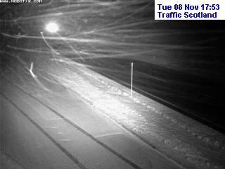
Credit: Traffic Scotland
A82 Glen Coe
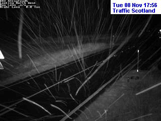
Credit: Traffic Scotland
ORIGINAL POST
There’s plenty of cold dense air in place over the UK ahead of an approaching Atlantic front. The stage is set for the first significant hill snow event of the 2016-17 winter.
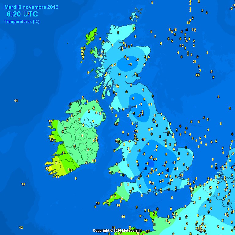
Credit: Meteoceil
Expect rain to change over to snow, especially above 800-1,000ft through today with significant accumulation (3-6 inches) expected. High road routes such as the A9, A96, M8, M74, M6 and A66 are all expected to see snowfall. Low elevations across the north including Glasgow-Edinburgh corridor could see slight accumulation in places for a time but it’s tricky pinpointing exactly the places that will see snow cover.
Credit: BBC Weather

Credit: Met Office
GFS snow totals through 12pm Wed.
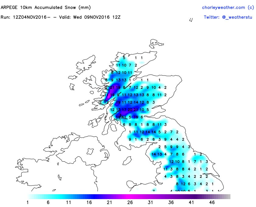
Credit: chorleyweather.com

Credit: chorleyweather.com
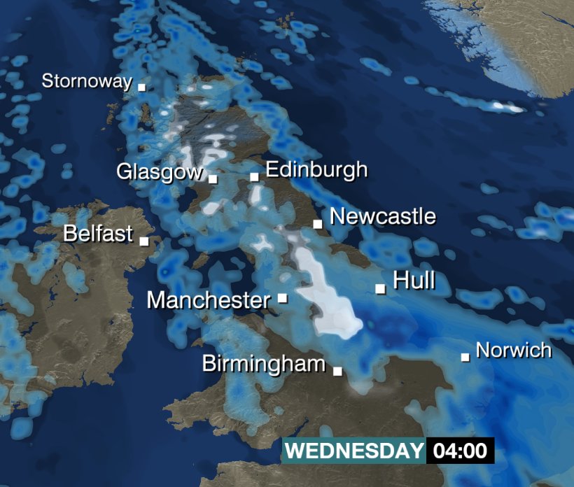
Away from the coast, air temps should hold 2-4C widely and moisture is expected to move into far western areas by midday/early afternoon spreading slowly east through this afternoon and evening. After dark, low levels of Scotland, Northern Central England have the best chance at snow and a covering.

Credit: BBC Weather

Credit: BBC Weather

Credit: BBC Weather
We’re closely watching even lower levels of the Midlands for accumulating snow overnight tonight.
Credit: BBC Weather
See this morning’s video.
FOR TO BE ADDED!


")


Recent Comments