
The rest of this week and through the weekend will be dominated by a brisk, cool westerly air flow crossing Ireland and the UK with frequent showers piling in accompanied with longer spells of rain. There will be some sun but it’s limited.
Plenty of rain to pile into particularly Scotland over the next 5 days.
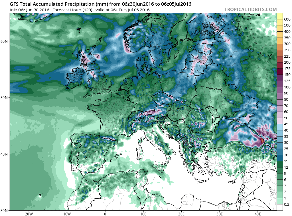
Credit: Tropical Tidbits
GFS surface
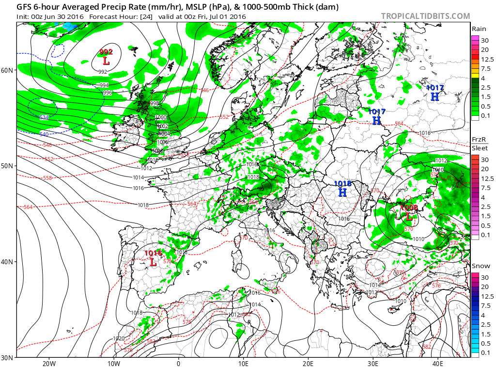
Credit: Tropical Tidbits
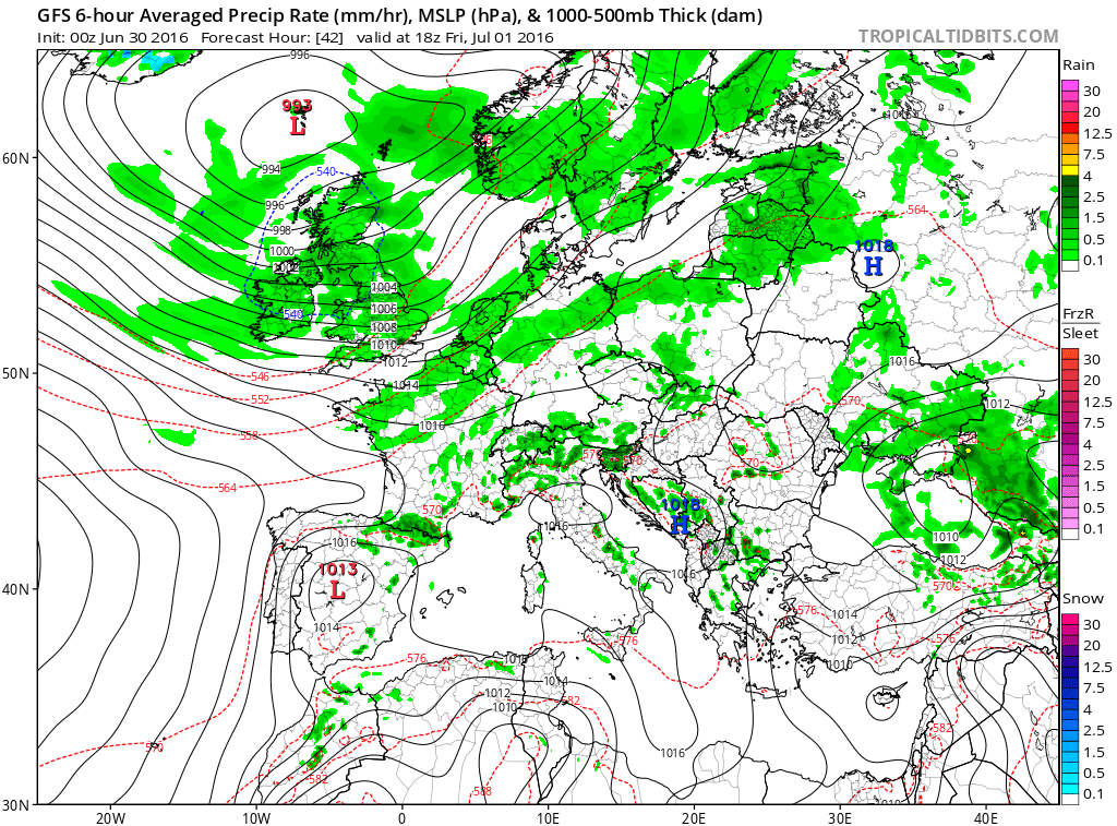
Credit: Tropical Tidbits
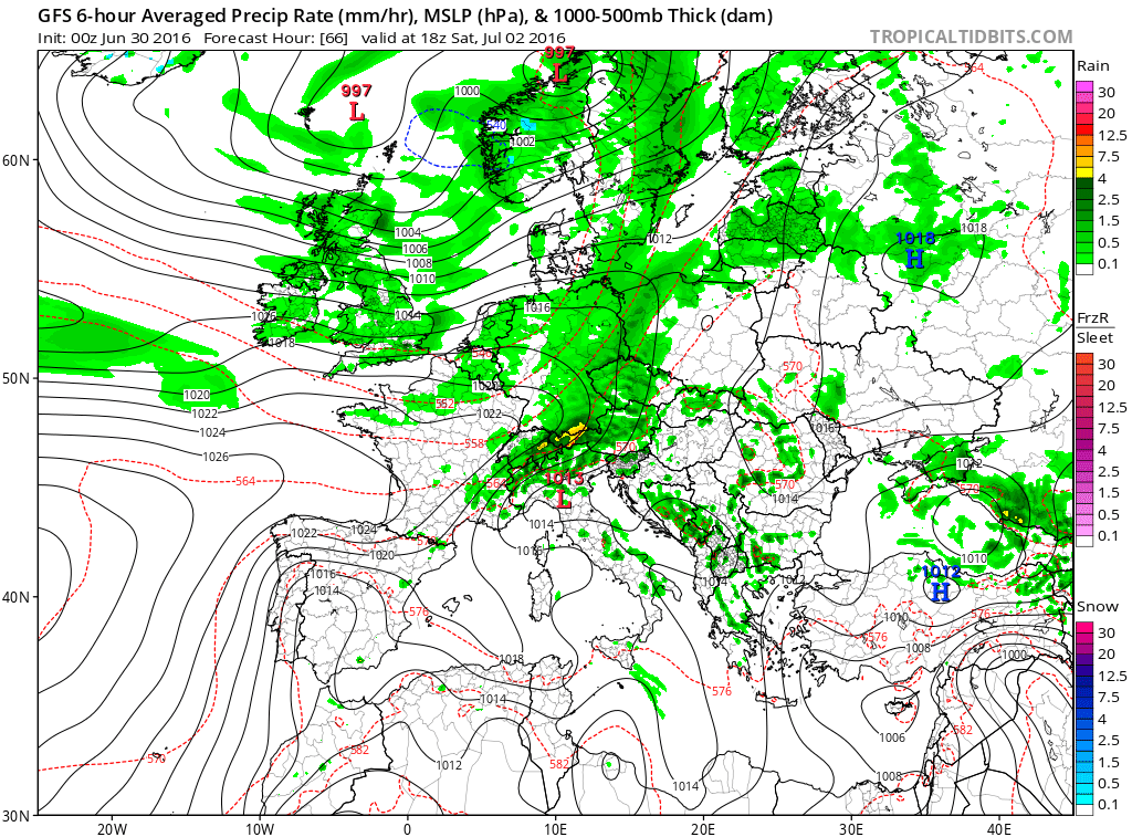
Credit: Tropical Tidbits

Credit: Tropical Tidbits
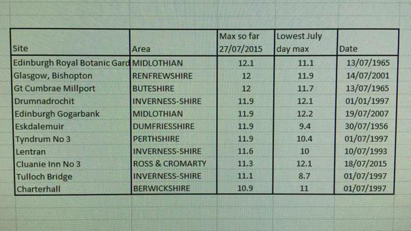
The combination of gusty west winds, cloud and frequent showers will supress daytime temps significantly. Following the record warm open to July 2015, mid and late month hosted some of the coldest July days on record here over Scotland and the next few days may not be too far off the values we shivered in last July.
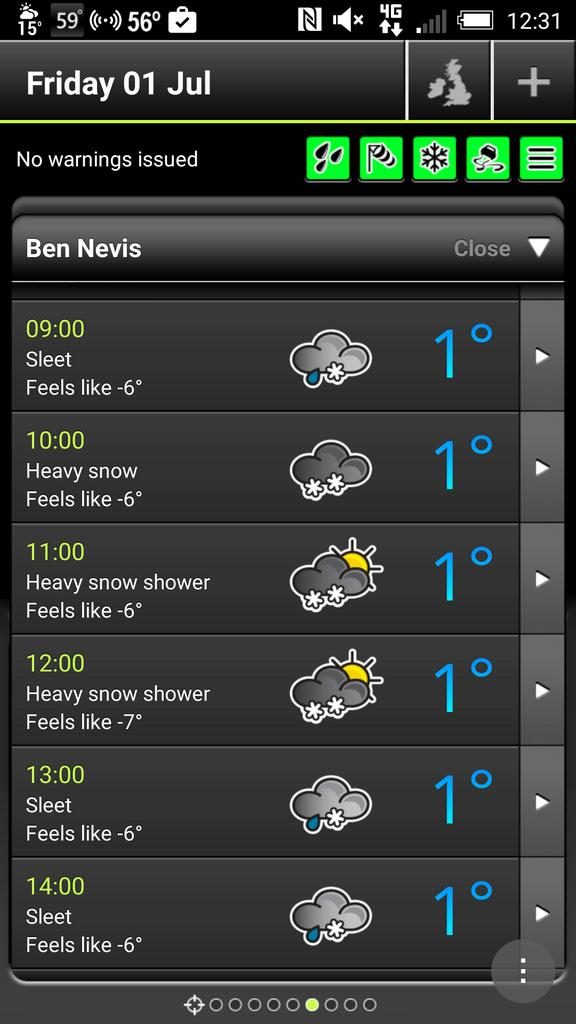
GFS forecasted highs for tomorrow (Jul 1st)

Credit: Tropical Tidbits
Don’t be surprised to hear reports of snow over the tops of the Scottish Mountains in the next few days.
The point of today’s post is all about whether this pattern holds or will it break to bring us at least some summer through July? While you’ll not want to hear this, I’m liking what the CFSv2 monthly and weeklies are showing for July and that’s because it nicely coincides with my the forecast I’ve had since April. Cool and frequently unsettled looks most likely with just short lived settled, warm spells.
FEATURE IMAGE CREDIT: Simon Cardy
[s2If current_user_can(access_s2member_level1)]
CFSv2 July 500mb height anomaly
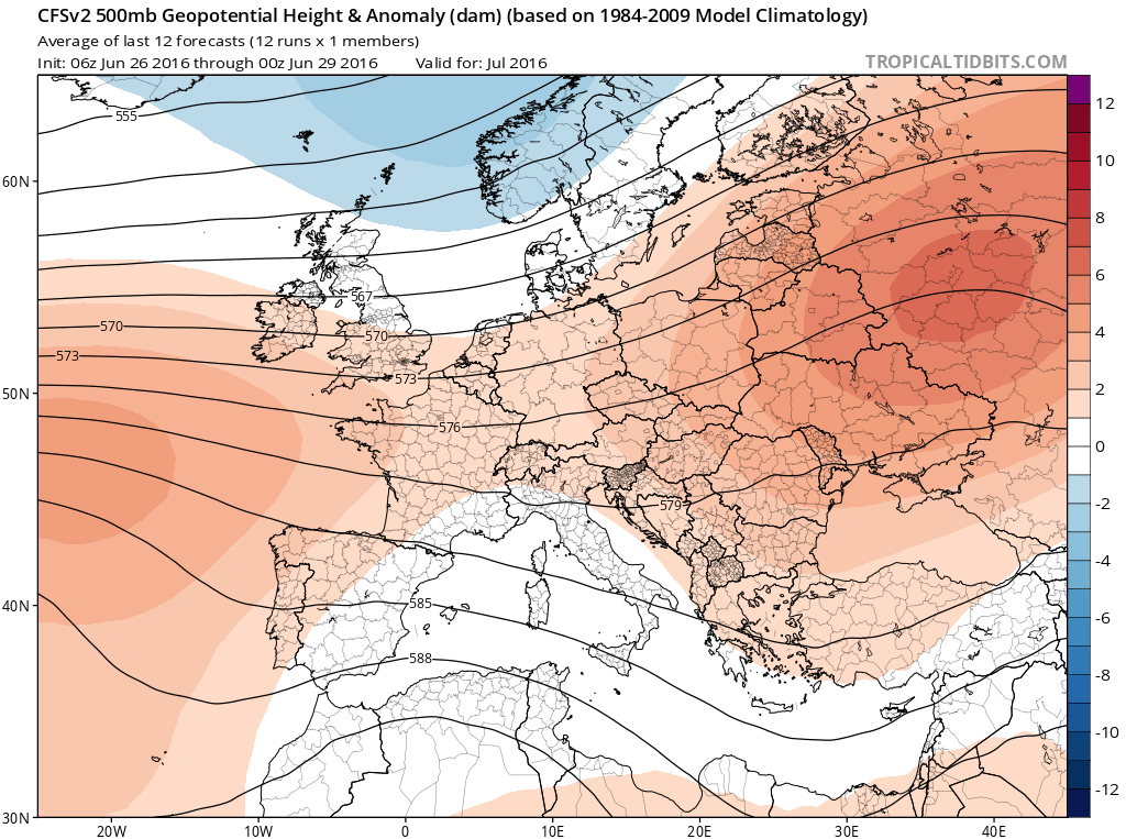
Credit: Tropical Tidbits
July 2m temp anomaly
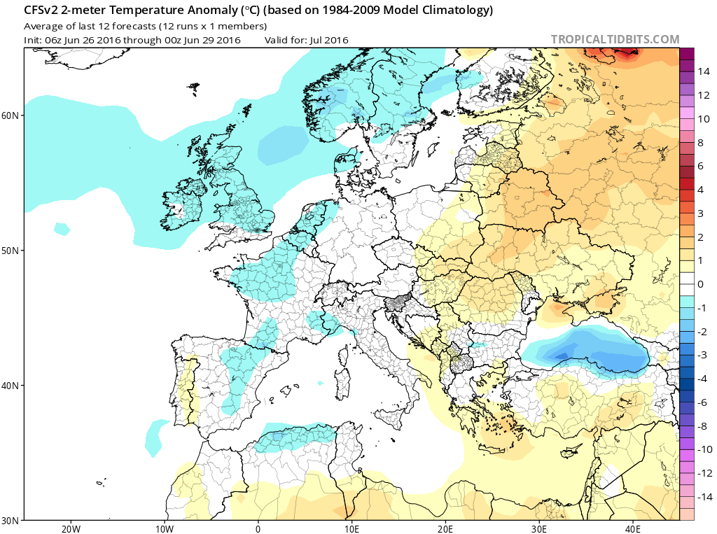
Credit: Tropical Tidbits
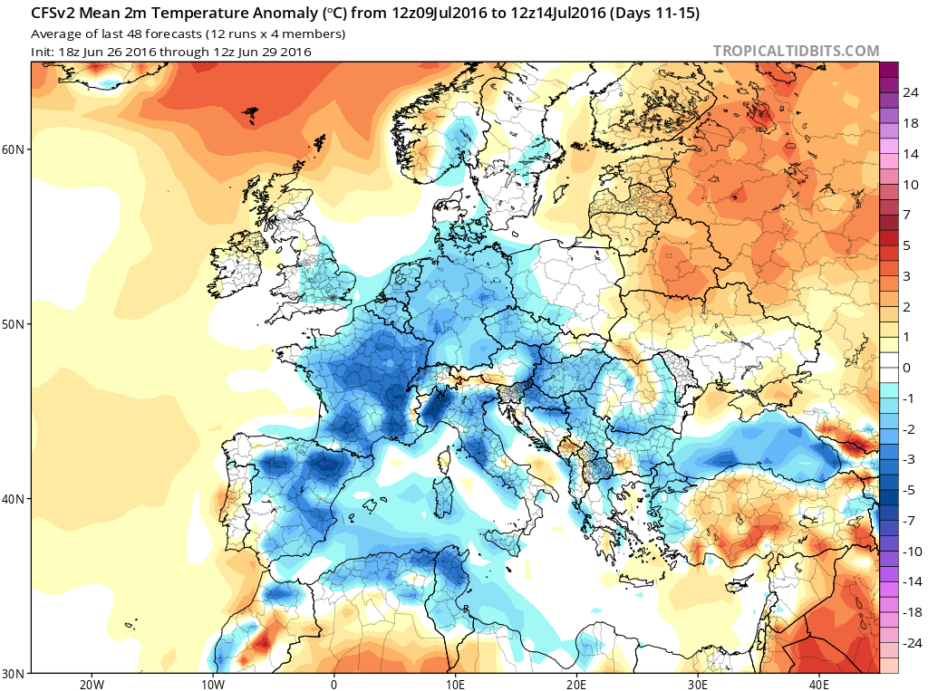
CFSv2 weekly 2m temp anomalies.
Day 1-5

Credit: Tropical Tidbits
6-10

Credit: Tropical Tidbits
11-15
Credit: Tropical Tidbits
16-20

Credit: Tropical Tidbits
21-25

Credit: Tropical Tidbits
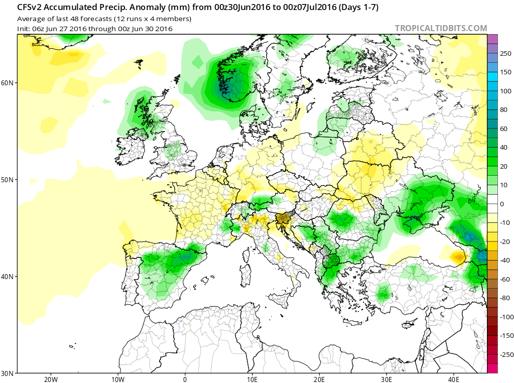
Precip anomaly shows wet focused on NW but eventually southern Europe through the 2nd half of July.
Credit: Tropical Tidbits

Credit: Tropical Tidbits

Credit: Tropical Tidbits

Credit: Tropical Tidbits
See this morning’s video.
[/s2If][s2If current_user_cannot(access_s2member_level1)][magicactionbox id=”18716″][/s2If]


")


Recent Comments