
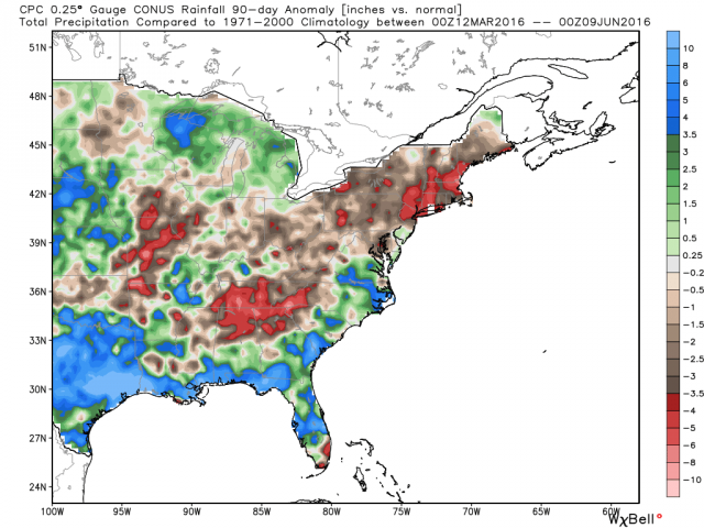
It’s been a dry spring for the interior Southeast and Northeast and with evaporation rates high at this time of year, drought conditions can quickly worsen. With dry ground, strong incoming solar energy goes into heating but wet ground, evaporation hence why Texas is finding it hard to get to normal or above.

[s2If current_user_can(access_s2member_level1)]
4-8 inches of rain on top of the normal amounts is now needed to eliminate this growing dry deficit.

Of course heat loves to go to where it’s dry and it’s getting hot over the interior Southeast as the Plains hot dome continues to push east. The saving grace for the Northeast not getting all that hot, for now, is a stubborn mean trough. As we press into the heart of the warm season, the upper air pattern will eventually change.
Credit: Weatherbell
The year overall has been wet but last 90 days has been dry in both Nashville and Atlanta.

Credit: Weatherbell

Credit: WeatherBell

Credit: Weatherbell

Credit: Weatherbell
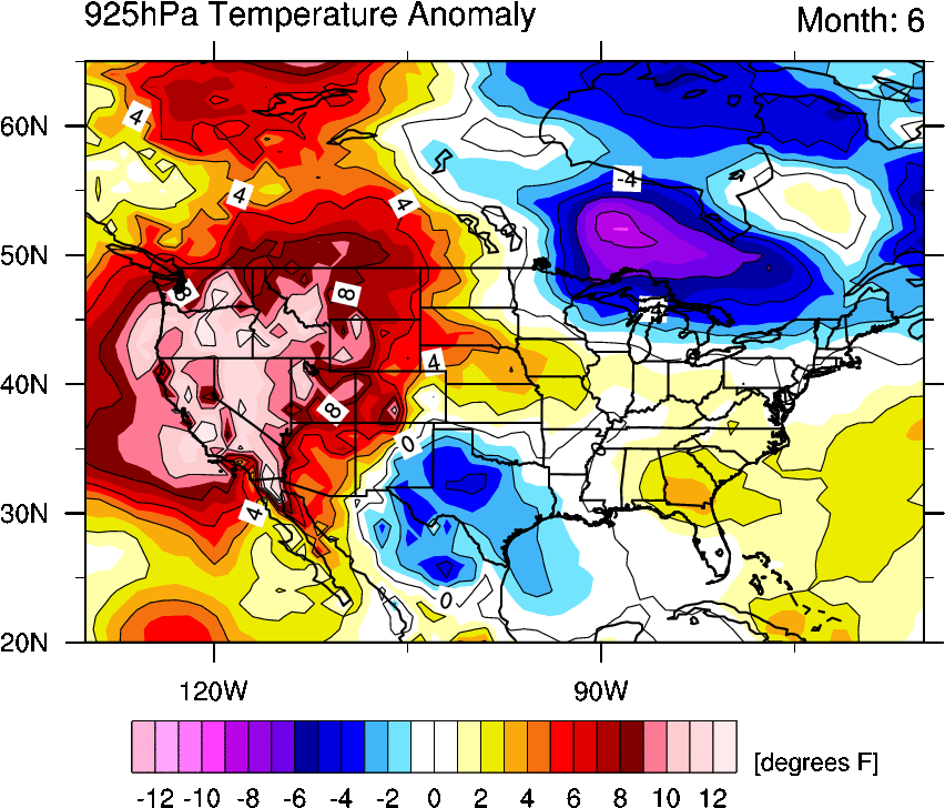
The temperature for the first 10 days of June nicely reflect the soil moisture over Texas and Southeast.
Credit: Michael Ventrice
GFS ensemble 5-day mean 2m temp anomalies continue this cool where wet, warm where dry reflection next 5 days with likely record breaking heat for the Mississippi/Tennessee Valleys, aided by the drier than normal.

Credit: Tropical Tidbits
The 6-10 shows an upper trough with stormier and therefore cooler spell.

Credit: Tropical Tidbits
Then it dry’s and heats back up in 11-15 day. Watch for a hot end to June in the Northeast.

Credit: Tropical Tidbits
See today’s video.
[/s2If][s2If current_user_cannot(access_s2member_level1)][magicactionbox id=”18716″][/s2If]


")


Recent Comments