
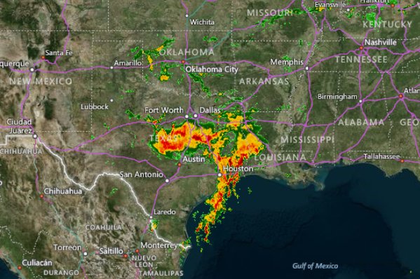
We know there’s been a ton of rain over the Southern Plains, primarily Texas in the past 30 days but how much? 800% of normal!

Notice the above normal precip over the N Plains and Wisconsin but considerably drier from Alabama, Georgia up the spine of the Appalachians. The Southwest and Northwest has been driest and over the next 15 days, that’s where the heat will be centred.
Here’s a quite look at the GFS 500mb anomaly snap shots. Note the building ridge up the West Coast, cut off No 1 over Texas and No 2 over the Upper Midwest. This building heights and warmth Out West will help push the TX upper low ENE and the Minnesota low ESE which the models try to phase in the East.

Credit: Tropical Tidbits

Credit: Tropical Tidbits

Credit: Tropical Tidbits

Credit: Tropical Tidbits

Credit: Tropical Tidbits
[s2If current_user_can(access_s2member_level1)]
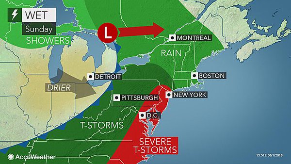
This finally allows Texas to dry out and warm up but as a consequence the Eastern Seaboard turns rather soggy!
Credit: AccuWeather
Until that low finally moves out with the pumping West Coast ridge, further major flooding occurs with torrential rains falling on saturated ground.
Credit: AccuWeather
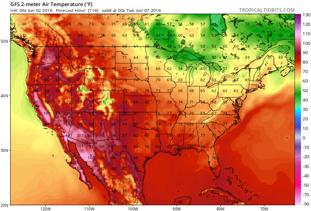
This weekend into early next week is likely to host the first 110s in Phoenix and 120s in Death Valley but note highs only in the 50s and 60s in the Upper Midwest and Great Lakes.

Credit: AccuWeather


GFS 2m temp forecast through late week and weekend.

Credit: Tropical Tidbits

Credit: Tropical Tidbits
Credit: Tropical Tidbits

Credit: Tropical Tidbits
See tonight’s video.
[/s2If][s2If current_user_cannot(access_s2member_level1)][magicactionbox id=”18716″][/s2If]


")


Recent Comments