
Following a warm winter, it turned colder and wetter during the spring but it looks like May will end warm to hot through the Midwest, Great Lakes and Northeast for Memorial Day weekend. However, May has been a cold month throughout the Lower 48 with the exception of the Pacific Northwest and where it’s been very dry over Alberta and Saskatchewan, there’s been mid summer level heat.
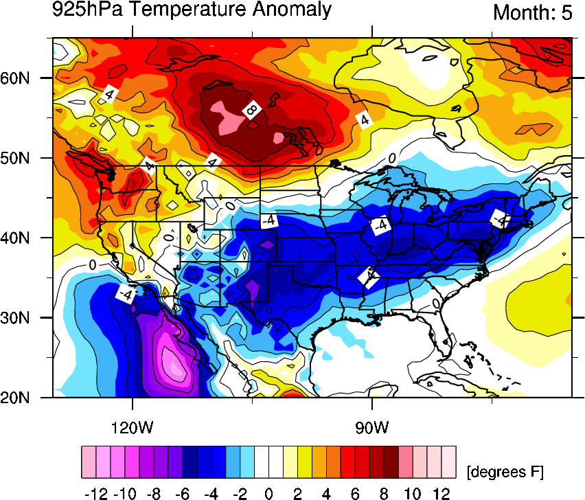
CREDIT: MICHAEL VENTRICE
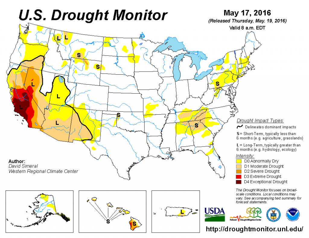
The El Nino enhanced southern branch jet stream has greatly helped the national drought.
Latest US drought conditions.
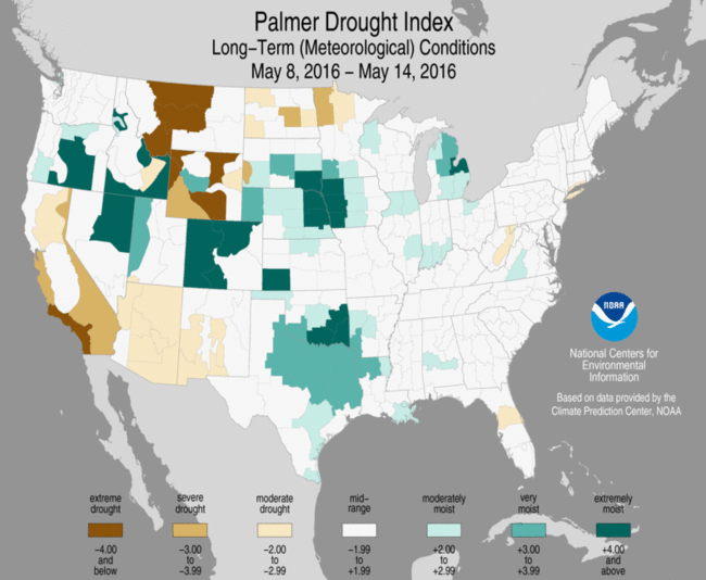
Latest Palmer drought index shows where the ground is driest and wettest.
So What About Summer’s Opening Month?
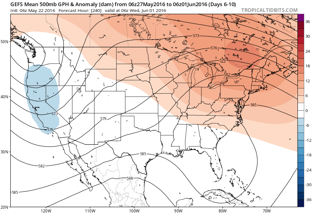
For June, I expect the see strongest upper heights across the Northern Tier where it’s driest, primarily over southern Canada with extension into the Northern Tier from Washington to Maine, always cooler with the continued rainy pattern as well as saturated soils.
With the core of ridge likely to bounce between Alberta and Quebec, one must watch for below normal heights and further flooding rains from Four Corners to Louisiana and potential early season tropical cyclone formation within Caribbean or Gulf where waters are already above normal. Below normal atmospheric pressure and above normal waters is excellent for early season development.
Looks like we have a hot end to May in the Great Lakes and Northeast while cool and unsettled in the West, stormy in between.

CREDIT: TROPICAL TIDBITS
CREDIT: TROPICAL TIDBITS
Model sees the building warmth into the Great Lakes and Northeast for Memorial Day weekend.

CREDIT: TROPICAL TIDBITS

CREDIT: TROPICAL TIDBITS
GFS 2m temperature chart shows 90s for Mid-Atlantic and Northeast Memorial Day weekend.

CREDIT: TROPICAL TIDBITS

CREDIT: TROPICAL TIDBITS
With the strong ridge core positioned over Quebec, heights lower below normal off South Florida and one must watch for early tropical development.

CREDIT: TROPICAL TIDBITS

CREDIT: TROPICAL TIDBITS
GFS sniffing something already?

CREDIT: TROPICAL TIDBITS
CFSv2 monthly for June shows the core of positive extending from NW Canada to Northeast US, neutral heights within the Rockies.
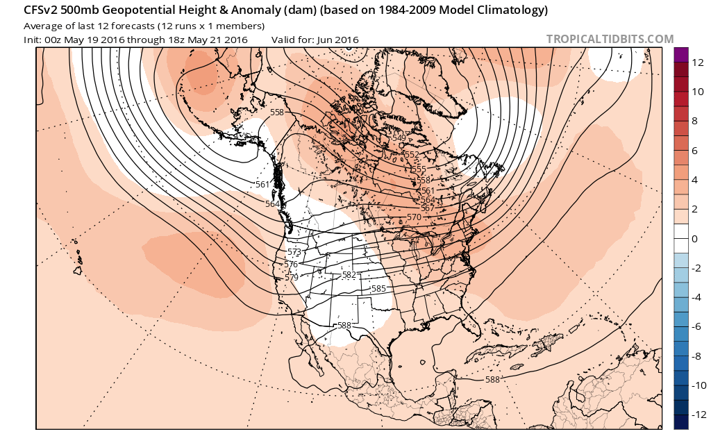
CREDIT: TROPICAL TIDBITS
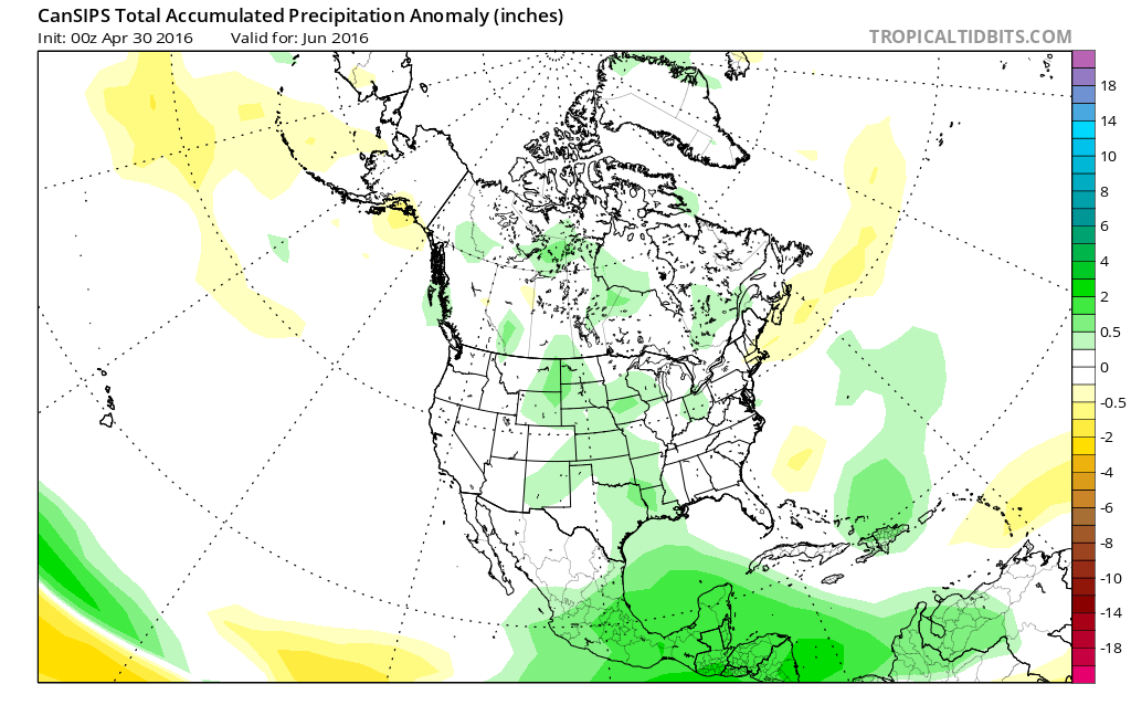
CFSv2 indicates a widespread wet June.

CREDIT: TROPICAL TIDBITS
Cool N Rockies to Texas, warmer to the north and east.

CREDIT: TROPICAL TIDBITS
Canadian shows core of ridge over Eastern Canada.

CREDIT: TROPICAL TIDBITS
Like CFSv2, it’s widespread wetter than normal.
CREDIT: TROPICAL TIDBITS
Warm California and Nevada, Northern Plains, Great Lakes and Northeast north into Canada but cold pool centred over Oklahoma and Kansas.

CREDIT: TROPICAL TIDBITS
FEATURED IMAGE (TOP) CREDIT: kelly @kelly_keifer


")


Recent Comments