
High pressure continues to promote beautiful clear skies for much of the British Isles. Great weather if you happen to be off this week.
Satellite picture from yesterday.
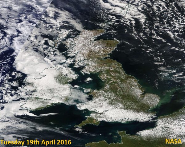
Credit: NASA
Last night’s sky was just beautiful here.

Credit: Mark Vogan
This morning’s satellite view is even better. Barely a whisp of cloud from southern Highlands to South Coast.

Credit: Met Office
Here’s the evidence down below!

Credit: Mark Vogan
Those clear skies made for another cool start with light frost on my car for a second straight morning.

Credit: Met Office
Despite the morning chill, the air is quick to warm since the sun is as strong as late August. By 2-3pm we should widely see 13-16, locally 18C.

Credit: BBC Weather
Ready for the big temperature drop coming this weekend?

Credit: BBC Weather
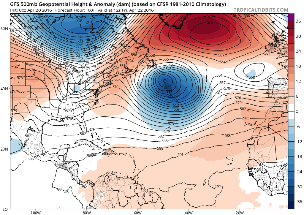
If you like warmth which the majority of us do at this time of year then the high pressure that’s our friend just now will be our enemy this weekend as it retrogrades WNW.

Credit: Tropical Tidbits

Credit: Tropical Tidbits
Credit: Tropical Tidbits

Credit: Tropical Tidbits
TOP IMAGE CREDIT: Monica McNally @MonicaMcNally
[s2If current_user_can(access_s2member_level1)]
At the moment, the high is providing us with sinking air which warms nicely in a sunny and light wind regime. We’ll happily trade the chilly nights for cloudless, pleasantly mild feeling spring days but as this high departs to our west and with winds blowing clockwise around the centre, are you ready to be introduced to northerly winds again this weekend?
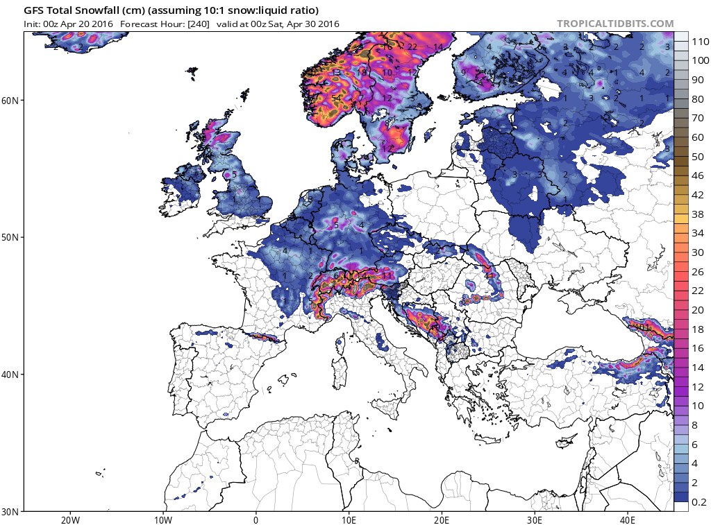
Once this pattern establishes late weekend, systems will ride the northerly flow over the UK bringing wind, rain, sleet and snow. I suspect each system could push in reinforced late season cold air. Nights that may be chilly now will be a lot chillier next week as we bring in a much colder air mass that lowers the bar of potential cooling overnight.
This is not the prettiest end to April. In fact this may be one of the colder since the memorable cold and snow to end April 1981.

Credit: Tropical Tidbits

Credit: Tropical Tidbits

Credit: Tropical Tidbits

Credit: Tropical Tidbits

Credit: Tropical Tidbits

Credit: Tropical Tidbits

Credit: Tropical Tidbits
Credit: Tropical Tidbits
Yes, Greenland’s southwest coast will likely enjoy warmer weather than the UK late weekend and through much of next week as warm air lifts north and cold air south.

Credit: BBC Weather
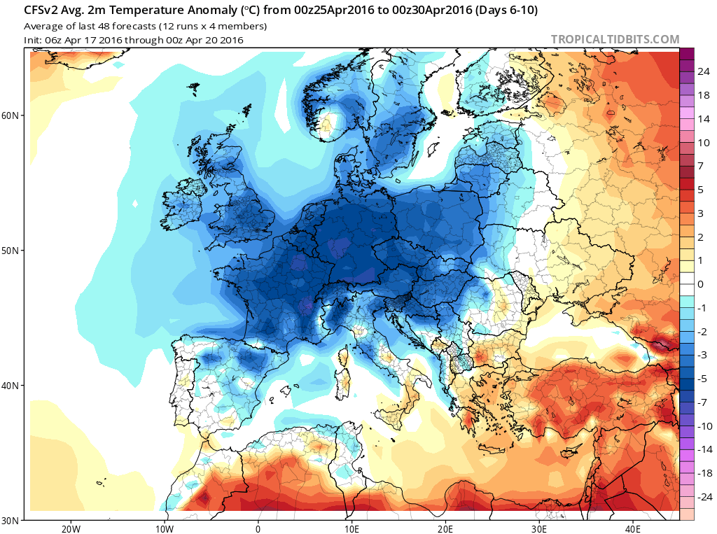
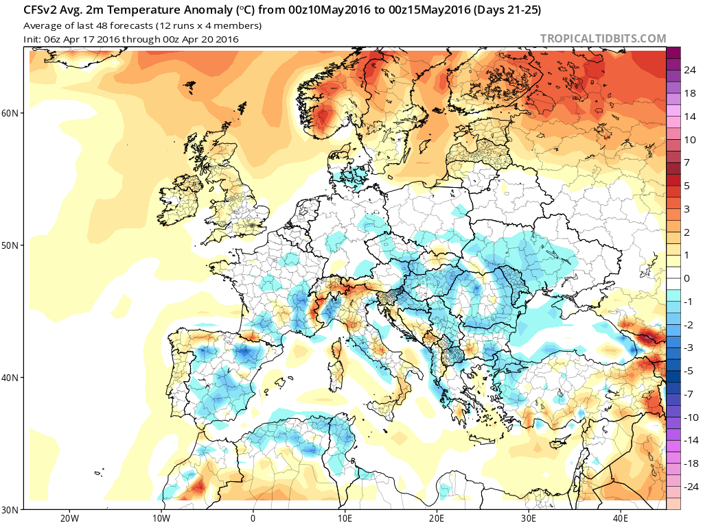
Is there any sign (even in the models) of warmer times ahead? In the CFSv2 weeklies yes but it’s in the day 21-25 period.

Credit: Tropical Tidbits
Credit: Tropical Tidbits

Credit: Tropical Tidbits

Credit: Tropical Tidbits
See this morning’s video.
[/s2If][s2If current_user_cannot(access_s2member_level1)][magicactionbox id=”18716″][/s2If]


")


Recent Comments