
You know that what happens within one area of our atmosphere, there’s often a ripple effect downstream. As high pressure continues to build in over the UK, so southwest winds have picked up ahead of an Alpine low and that means a surge of summer into Greece, Turkey, Bulgaria, Romania into Ukraine.

Credit: Tropical Tidbits
Check out these highs over southeast Europe from yesterday. Note 35C in western Turkey, near 30C up into southern Ukraine.
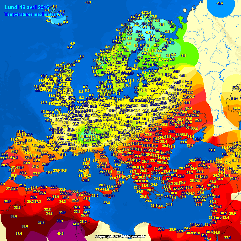
Credit: Meteoceil
More southeast summer warmth ahead today.

Credit: Tropical Tidbits
[s2If current_user_can(access_s2member_level1)]
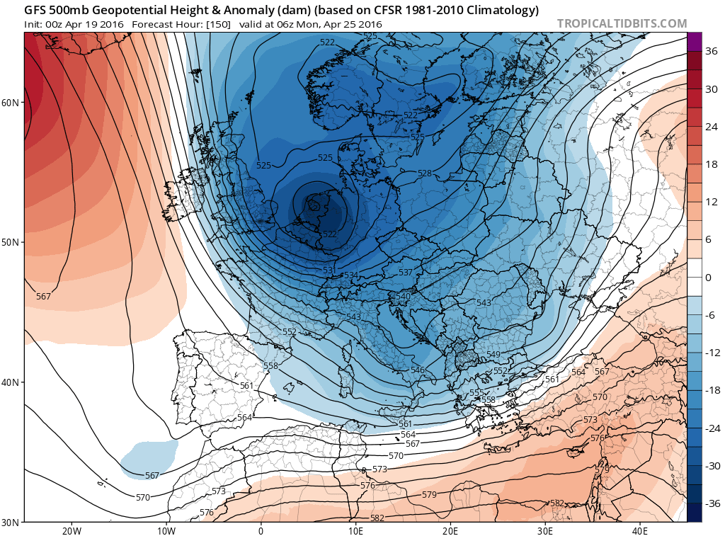
As the high continues to build in over the UK, the system currently over the Alps progresses east, weakening the SE ridge and therefore the heat gets slashed by mid week as a trough drives significantly cooler air in.

Credit: Tropical Tidbits

Credit: Tropical Tidbits

Credit: Tropical Tidbits
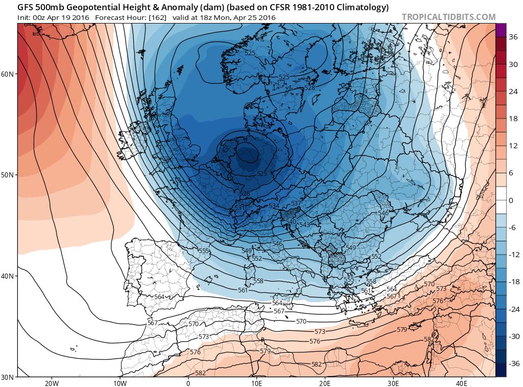
Then down comes the next shot of arctic air into the UK, Low Countries, France this weekend, this will drive significant late season chill including snow while the ridge and summer warmth resurges over southeast Europe. Looks like the chill holds firm through next week.

Credit: Tropical Tidbits

Credit: Tropical Tidbits

Credit: Tropical Tidbits
Credit: Tropical Tidbits
Credit: Tropical Tidbits

Credit: Tropical Tidbits

Credit: Tropical Tidbits

Credit: Tropical Tidbits
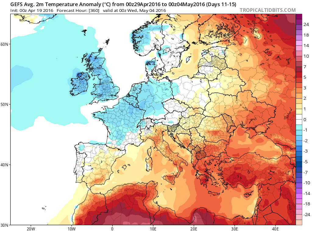
An impressive cold to end April…
GFS ensemble 5-day mean 2m temp anomalies.

Credit: Tropical Tidbits

Credit: Tropical Tidbits
Credit: Tropical Tidbits
See this morning’s video.
[/s2If][s2If current_user_cannot(access_s2member_level1)][magicactionbox id=”18716″][/s2If]


")


Recent Comments