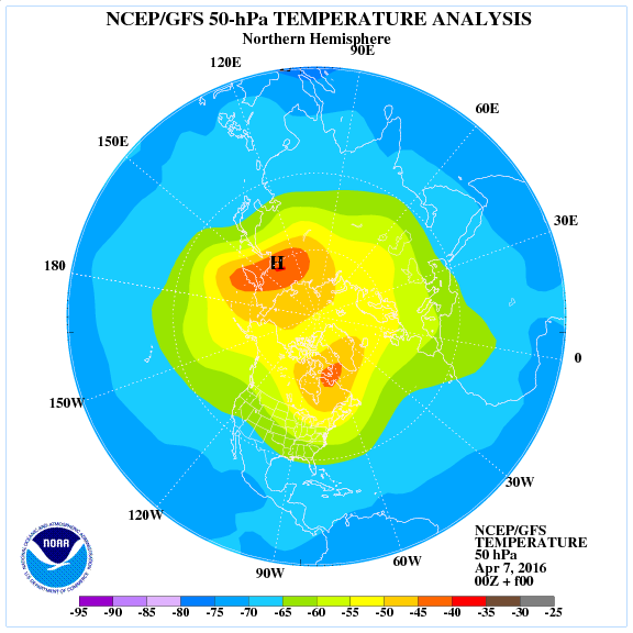
Given the build-up of pressure specifically from Atlantic up over Greenland into the arctic at this time of year in response to tremendous strat warming event through late March, expect cooler than normal to rule through the rest of April over the UK and especially south into Iberia.
[s2If current_user_can(access_s2member_level1)]
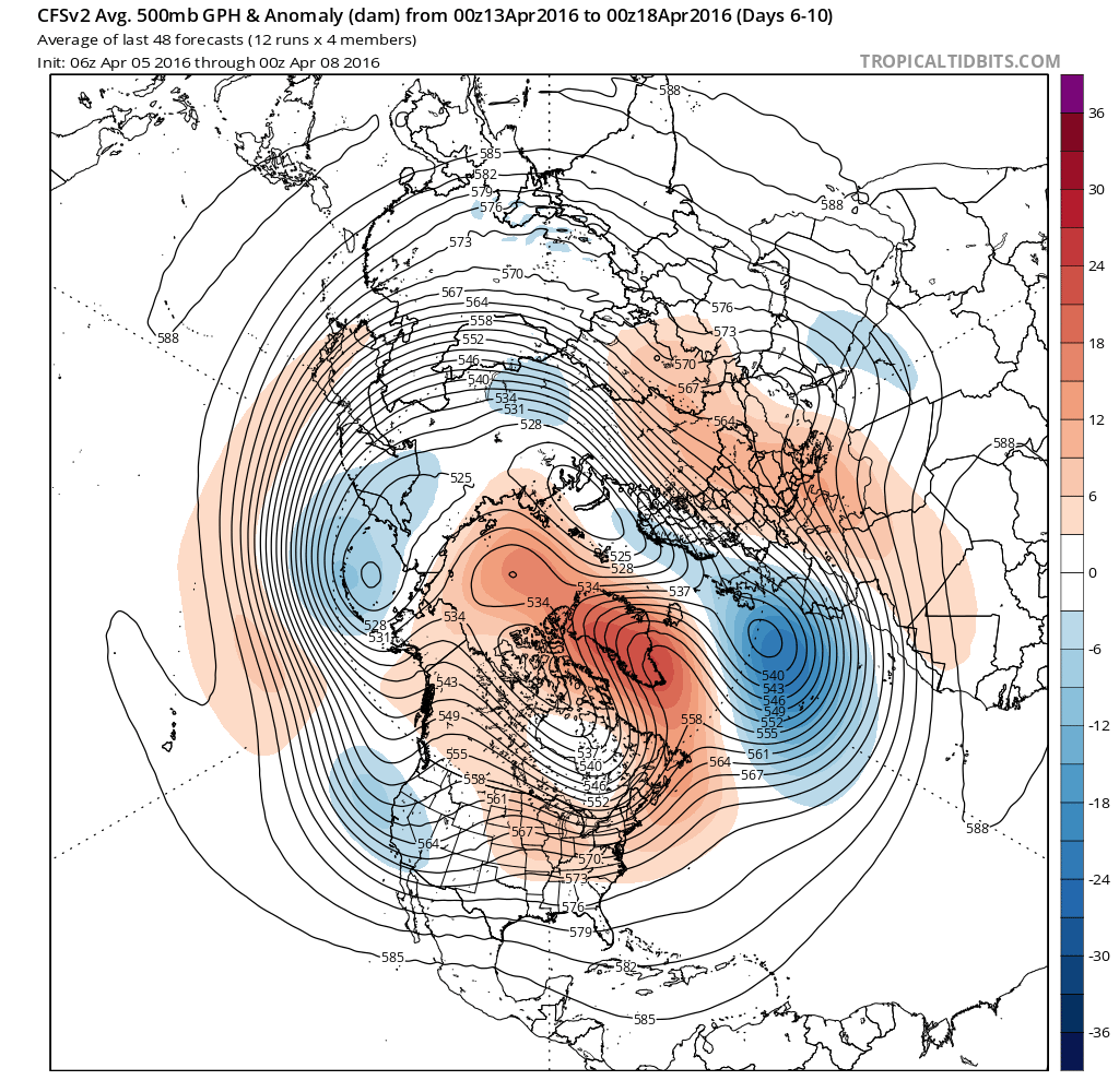
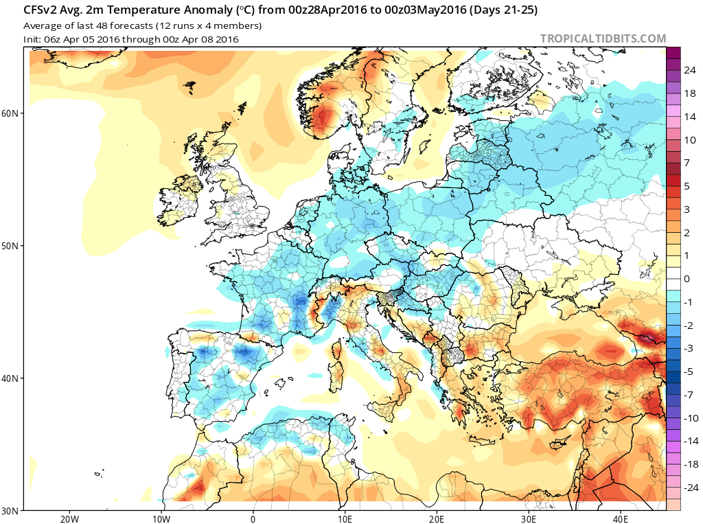
This is a blocking pattern that will be hard to shift quick and therefore I suspect a trough will hold and linger through the rest of April to the SW of Ireland while a ridge dominates central and eastern Europe. This is likely to keep things coolest and unsettled from southern UK down through France into Iberia.
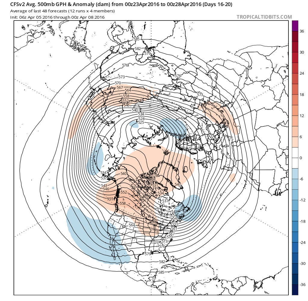
The CFSv2 weeklies show the -NAO signal lingering into May which suggests no sign of summer into the UK this month anyway.

Credit: Tropical Tidbits
Credit: Tropical Tidbits

Credit: Tropical Tidbits
Credit: Tropical Tidbits

Credit: Tropical Tidbits
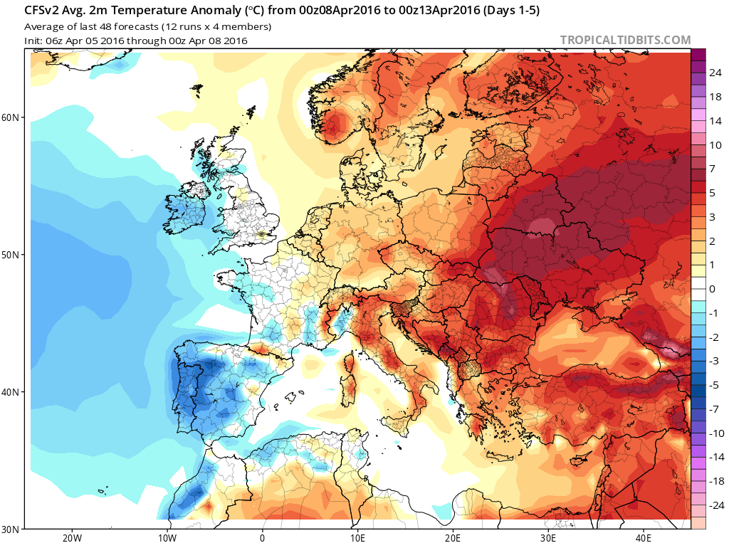
The CFSv2 2m temp anomalies do suggests some warmth lifting north but if anything it’s modest and likely down to strong sunshine by day beneath cool high pressure influencing the UK from north and not south. To me, this supports plenty of sunshine, showers, mild by day but cold still by night.
Notice Europe is warm through first 10 days or so then it turns cool.
Credit: Tropical Tidbits

Credit: Tropical Tidbits

Credit: Tropical Tidbits

Credit: Tropical Tidbits
Credit: Tropical Tidbits
It’s now inevitable that we’re heading from El Nino to La Nina and this will indeed have significant implication on our long term pattern.
Stay tuned tomorrow as I share my first thoughts on summer 2016.
See video.
[/s2If][s2If current_user_cannot(access_s2member_level1)][magicactionbox id=”18716″][/s2If]


")


Recent Comments