
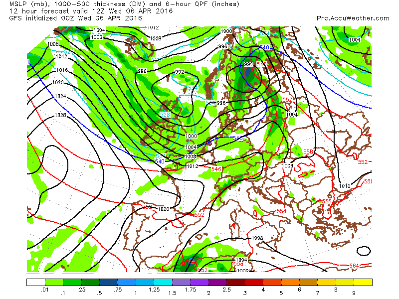
We have late season arctic air draped across Ireland and the UK today, feeling distinctly cool, particularly if exposed to that stiff westerly breeze. This air mass can be traced all the way back to the Canadian Arctic where originally it supported temps of -10 to -30C, thankfully crossing 3,000 miles of Atlantic Ocean and SST’s at 6-10C SE of Greenland, it’s warmed significantly.

Credit: Tropical Tidbits
However, when adding ocean warmth to a cold airmass at this time of year, you get a lot of turbulent, convective shower activity and that will be the story throughout today and the next couple of days.
Credit: AccuWeather Pro

Credit: AccuWeather Pro
Really you can expect sun and showers across many areas not just today where they’ll contain hail, thunder, lightning, sleet as well as snow, all dependant upon elevation. Winds will be particularly gusty beneath these showers and can turn colder by several degrees then rise after it passes.
[s2If current_user_can(access_s2member_level1)]
The next 24 hours will see winds over UK veer northerly.

Credit: AccuWeather Pro
Credit: AccuWeather Pro
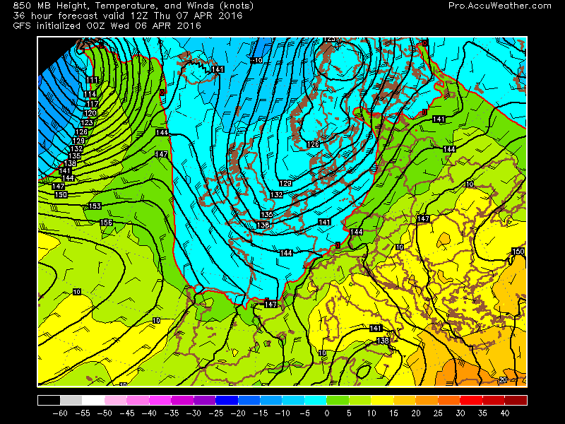
There’s a void (high pressure) in our weather late Thursday into Friday which may support frost if skies are clear ahead of another approaching CF.

Credit: AccuWeather Pro
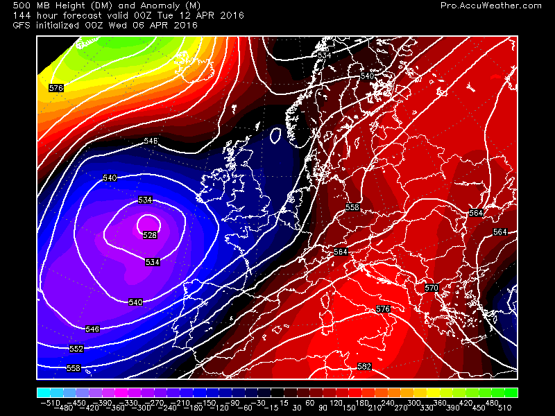
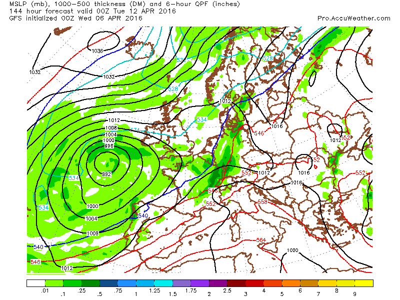
It gets somewhat more interesting through the weekend (meteorologically speaking) as we get an enormous height rise from central Atlantic up into Greenland while a large and cold trough spins lowsover Ireland and the UK. This will keep us unsettled and cool.

Credit: AccuWeather Pro
According to the GFS, that monster high leans eastward across Iceland, forcing the mean low SW’ward early next week.
Credit: AccuWeather Pro
This essentially pushes the disturbed weather to our SW and we get into a chilly NE air flow dragging some pretty cold air in off Norway.
Credit: AccuWeather Pro

Credit: AccuWeather Pro
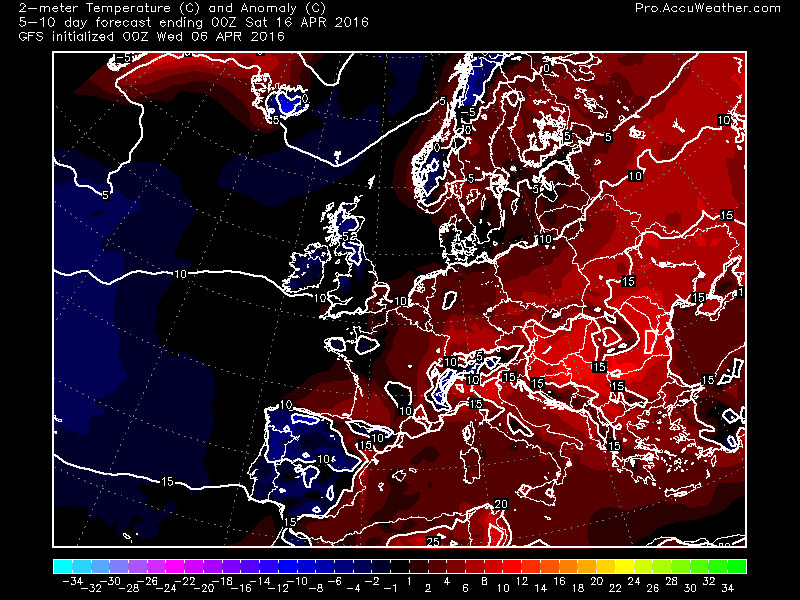
This looks to be a very cool April from UK to Spain.
GFS 5-day mean 2m temp anomalies.

Credit: Meteoceil
Credit: Meteoceil

Credit: Meteoceil
Check out the GFS ensemble day 6-10, wow!

Credit: Meteoceil

Credit: AccuWeather Pro

Credit: AccuWeather Pro
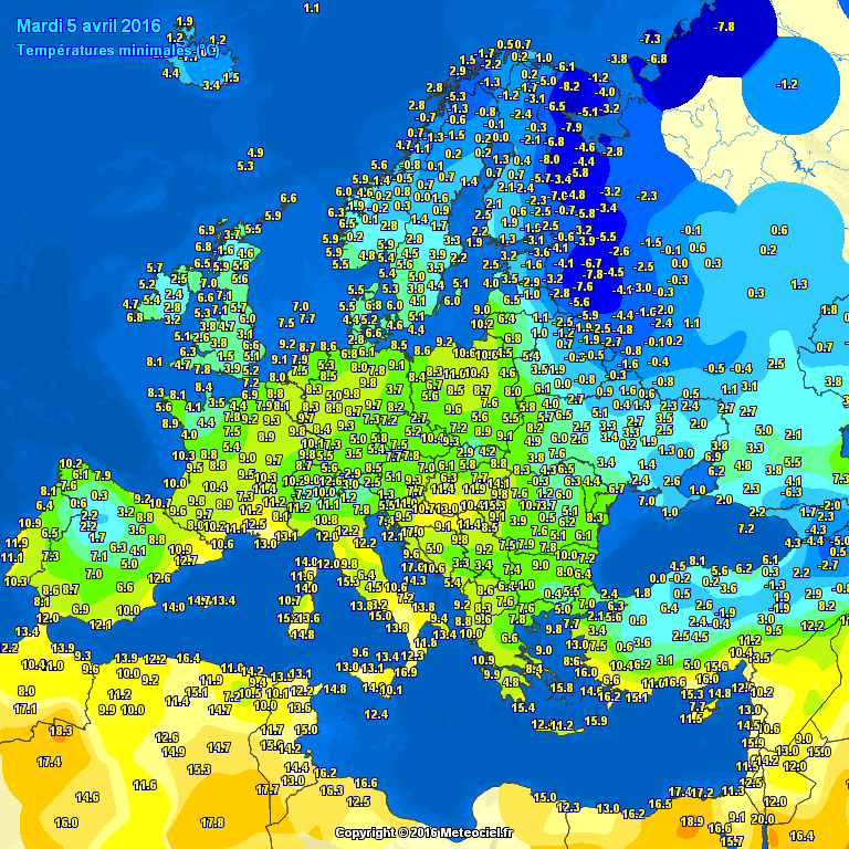
High and lows across Europe yesterday.

Credit: Meteoceil
Credit: Meteoceil
[/s2If][s2If current_user_cannot(access_s2member_level1)][magicactionbox id=”18716″][/s2If]


")


Recent Comments