
Strong, well stacked high pressure from surface to upper atmosphere at this time of year means near perfect visibility and highly contrasting temperature fluctuation and variability.
Check out these great images from space yesterday.
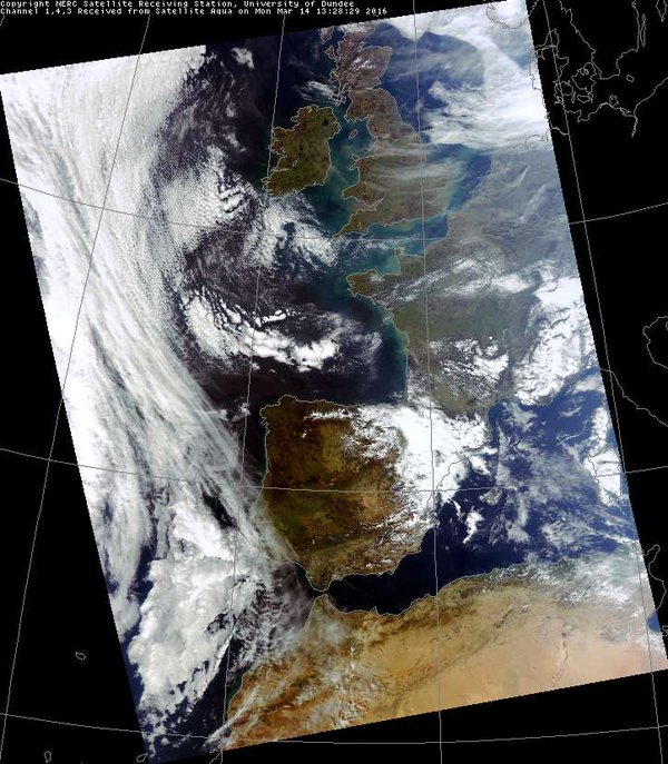
Credit: NASA

Credit: NASA
These clear skies made for great view of the Highlands yesterday. I captured this shot yesterday evening in Fort William. Aonach Mor on left, Ben Nevis on right as the sun went down.

Credit: Mark Vogan
[s2If current_user_can(access_s2member_level1)]
With high pressure stacked and directly overhead, there’s strong sinking and little or no wind. Dry air and no wind means temperatures rise quickly beneath a strengthening March sun but they also cool fast after sunset often making for a large swing between day and night, especially in sheltered Highland Glens were there’s a sun trap by day and where cold air sinks and collects in river valleys at night.
Strong high pressure system centred over the Norwegian Sea at 500mb this morning. -4C was recorded at Braemar.

Credit: AccuWeather Pro
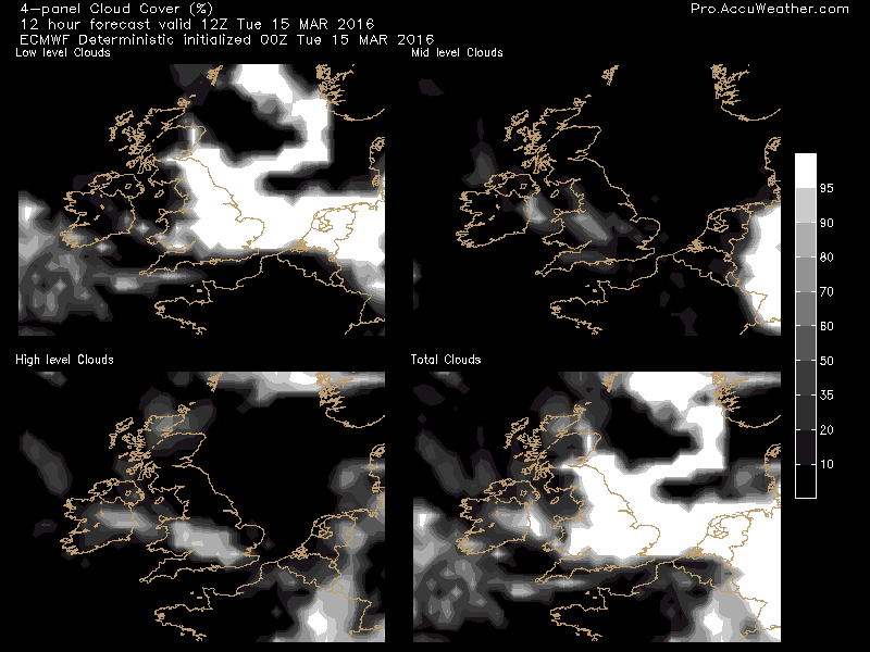
Strong high pressure all the way down to sea level.

Credit: AccuWeather Pro
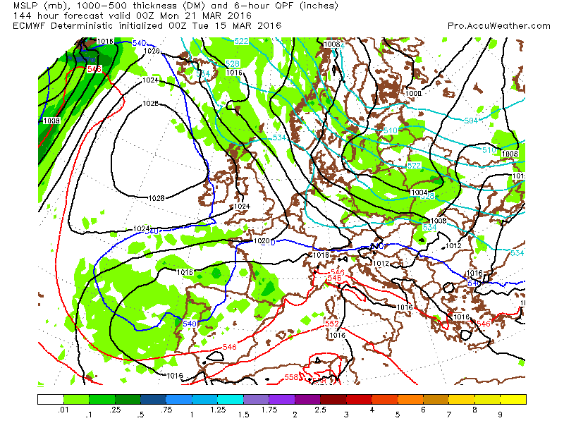
With the core centred over the Faroes, there’s a light to moderate ENE air flow around this high, effecting eastern parts of the UK.
Wind direction is important with this setup.

Credit: AccuWeather Pro
The North Sea is at it’s coldest of the year and that means winds blowing onshore off the water are rather cold feeling. Low cloud and sea fog (haar) is common but inland away from the coast and you get the sunny benefits of this high.
Wind, cloud and fog significantly influences temperature.
Credit: AccuWeather Pro
West is best for sun and mild temps. Dry air is one thing as it heats fast under strong March sunshine by day and cools fast after dark but where there’s wind crossing mountains, you get the warming, foehn effect.
West winds make areas to the east of mountains warmest, sunniest but easterly winds means West is best.

Credit: BBC Weather
Current UK temps.

Credit: Meteoceil
Only 5C beneath laden skies and in exposure to a chilly breeze blowing in off a cold North Sea but head west and get into the sunshine and it’s quite different.

Credit: BBC Weather
Though reasonably mild over Western Europe, it’s rather cold even by mid March standards across the bulk of central and eastern Europe at this hour.

Credit: Meteoceil
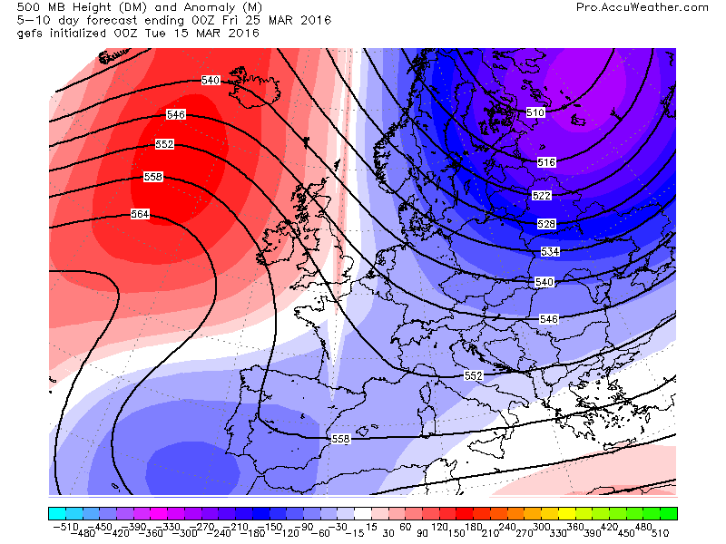
As we progress through this week, the upper ridge looks to retrograde west into the Atlantic and this will allow unseasonably cold, arctic air to drill into Scandinavia and eastern Europe. Depending upon how far west this high gets, the UK may see things turn more wintry once again.

Credit: AccuWeather Pro
Credit: AccuWeather Pro

Credit: AccuWeather Pro
GFS ensemble shows the westward retrograding of the upper high between 0-5 and 5-10 day.

Credit: AccuWeather Pro
Credit: AccuWeather Pro
See this morning’s video.
[/s2If][s2If current_user_cannot(access_s2member_level1)][magicactionbox id=”18716″][/s2If]


")


Recent Comments