
Well the pattern thankfully took a turn in January following an unprecedented, highly El Nino induced warm and wet November-December. The large-scale flip came at the close of December as a storm injected warm air into the arctic which distorted the strong cold circulation and flipped both Arctic and North Atlantic Oscillations negative. In fact it’s said that we had the deepest AO/NAO negative during January since perhaps 2010. This delivered the first true cold spell into Europe including the UK.
You can see right at the turn of 2016 the sudden positives blossoming over the polar region, dislodging the cold south.

As a consequence, January is in fact colder than normal, particularly across Northern Europe.

Credit: M Ventrice

Credit: WxBell
Dramatic contrast to December 2015.

M Ventrice
With the regroup of the polar circulation (AKA polar vortex), we have seen the return of a positive AO/NAO and has led to the return of mild, wet and windy weather for the Western fringes.


With this return to warmer conditions thanks to stronger west-east trans Atlantic jet stream, we may wind up average to slightly above average temperature wise over the UK. Ireland is looking warmer than normal for January.
Plenty of cold over Europe still but it’s well to the east. Positively balmy in the West.

Via D Brockway

Via D Brockway
The same system which delivered epic 20-40 inch snowstorm to the Eastern US Fri-Sat will bring wind and rain to the UK Tuesday.
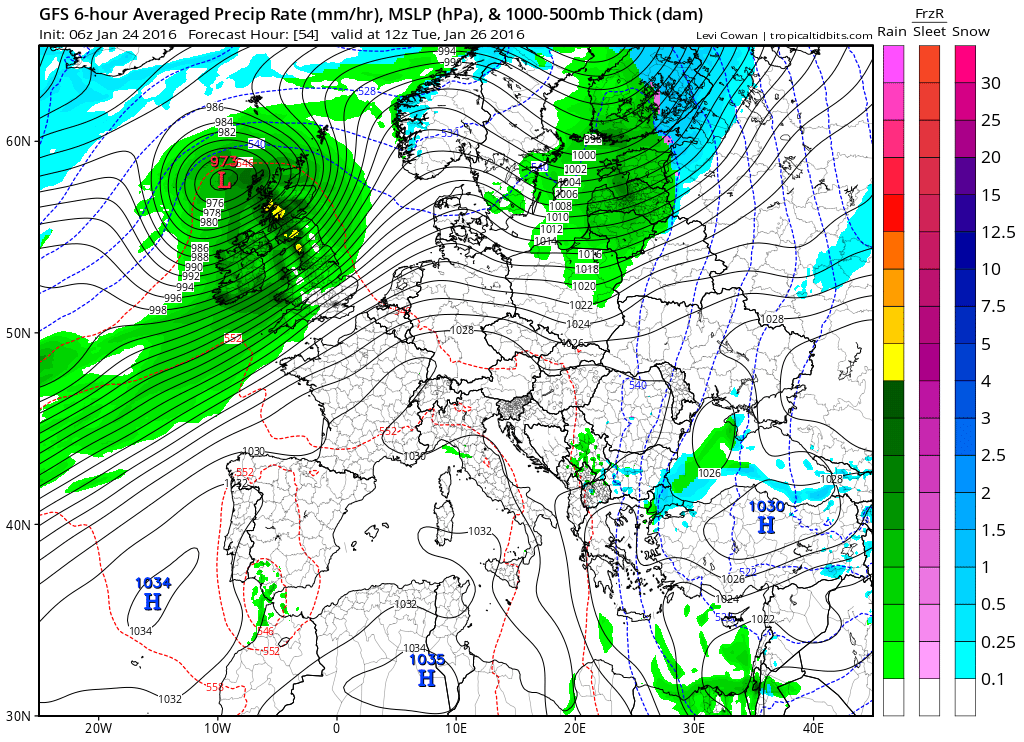
Credit: Tropical Tidbits
Look at what the GFS has just to our northwest next weekend. This would be a major windstorm if correct.
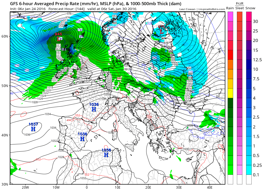
Credit: Tropical Tidbits
As we head into winter 2015-16’s final month, it appears the atmosphere is doing all it can to bring us a sudden stratospheric warming event (SSWE) which would inevitably flip at least the AO back negative, possibly the NAO. I am confident that the AO will flip again and there’s increasing confidence that the NAO follows. This should ‘in theory’ bring the return of colder conditions to Europe including the UK.
Note in the below 50mb temperature charts now through day 10 over the northern hemisphere how the vortex is completely knocked off it’s axis into Eurasia.
Initial

Day 7

Day 10

Up till now, the warming within the polar atmosphere has been in the low to mid levels.

Forecast calls for strong warming up within the stratosphere late January following the cooling and hence the AO/NAO flip we have now…

Credit: AER/J Cohen
The trouble is, even if we see a proper split, dislodge or best case, an SSWE, there’s no guarantee that the Western half of Europe turns very cold. Our chances are increased but it’s not a given.
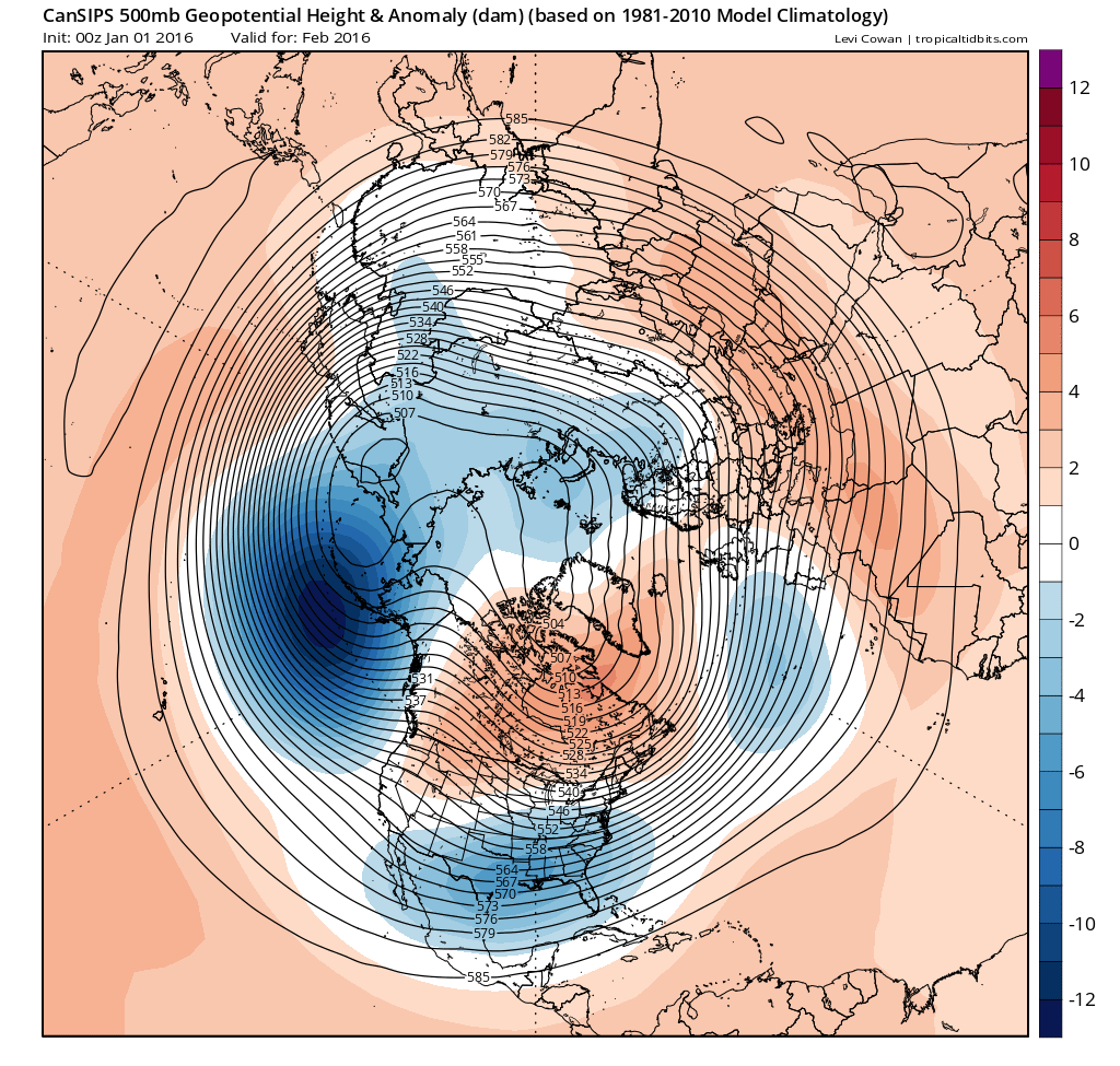
With the El Nino coming off it’s peak, much warmer than normal water stacked up over the far North Atlantic and the fact our wintertime atmosphere is more mature, there’s a pretty good chance we have the coldest weather of winter on the way February which is likely to extend into March.
As pointed out all along, my winter forecast was for cold spells but plenty of mild too. January did at least deliver a ‘cold spell’ which brought some decent snowfall to parts of the UK and western continent, major cold for Scandinavia into Russia and this by the end of December even surprised me given that I was pulling back on much cold during January.
February should be our best month for winter weather.
Keeping a close eye on mid February onwards based on projected top down stratospheric warming which could led to a complete collapse of the polar circulation and the 6-10 day lag in warming above and cooling below.
One thing I wish to point out, models often don’t see what’s going on up within the polar stratosphere and the CFSv2 clearly sees the continuation of a +AO/NAO throughout February.
CFSv2 weekly

Credit: Tropical Tidbits

Credit: Tropical Tidbits

Credit: Tropical Tidbits

Credit: Tropical Tidbits
CFSv2 monthly

Credit: Tropical Tidbits
Canadian sees a little more blocking in February.
Credit: Tropical Tidbits
For daily in-depth written and video forecasts for both Europe and the USA, sign-up today for as little as 69p.


")


Recent Comments