
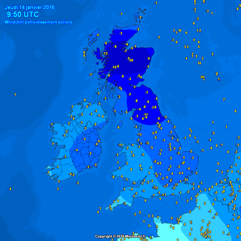
Plenty of folks, mainly above 100m are waking to their first covering of snow this morning along with below freezing wind chills. Many of you who have stepped out this morning will have felt the difference, a drier, more biting cold representative of arctic air.

Credit: Mark Vogan
Thanks to sunny skies, here’s a view of the Northern UK snow cover today.

Via Simon Cardy
In fact the majority of Europe and all of the UK except along the S, SW coast of England are experiencing sub freezing wind chills this morning.

Credit: Meteoceil
Credit: Meteoceil
TOP IMAGE CREDIT: Stuart Clydesdale
[s2If current_user_can(access_s2member_level1)]
I think you’ll agree that my snow forecast from early yesterday played out not too bad, cover mainly settled at or above 100m.

Credit: Met Office
If you haven’t seen any yet, you may well over the next 36 hours with chances of lying snow increasing as air and ground turn colder.
Next 36 hrs off GFS

Credit: AccuWeather Pro
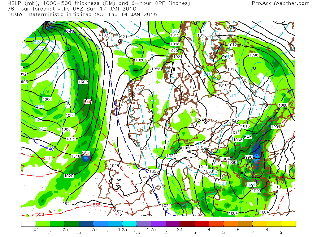
Next 72 hrs off ECMWF

Credit: AccuWeather Pro
Yellow warnings issued for ice, snow today and tomorrow.

Credit: Met Office
The UK isn’t alone with snow, ice and colder weather, Iberia, France and the Low Countries are under the same air mass with snowfall reported in many ‘near continent’ areas and further snowfall is likely.

Credit: AccuWeather Pro
With the building of surface heights combined with fresh snow cover, the stage is set and conditions coming together nicely (as forecasted right here for over a week now) for providing the coldest night in the UK in at least 3 years this weekend. I’ve pegged this weekend as the coldest air potentially since December 2010 or March 2012 for up to 7 days now and finally the BBC are catching on to just how cold this weekend is looking with -10 to -15C expected now by the BBC.

Credit: BBC Weather

Credit: Met Office
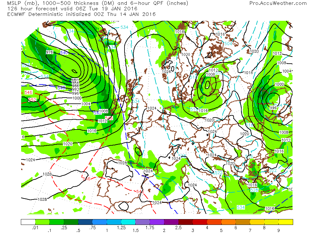
As you can see, the ECMWF still has a strong surface high building in.

Credit: AccuWeather Pro
Credit: AccuWeather Pro
Clear sky, light winds, strong sinking over snow cover means -10C or colder is likely anywhere where the snow lies but prone sheltered areas could conceivably see -15 to -20C.
Timing of mild remains very open to question and modelling can have a tough time figuring out how quickly cold air is removed and replaced by mild.
Core of cold focuses on UK this weekend but looks to focus over northern France and Low Countries as we begin next week. Still cold over UK!

Credit: AccuWeather Pro
According to the ECMWF (I know this is one model and one run) a front tries to push over Ireland into Western parts of the UK Tuesday, this may herald the beginning to a milder pattern but with heavy snow followed by milder air eventually from behind.
Credit: AccuWeather Pro
By early Wednesday, SW winds are blowing once again.

Credit: AccuWeather Pro
See video for the discussion.
[/s2If][s2If current_user_cannot(access_s2member_level1)][magicactionbox id=”18716″][/s2If]


")


Recent Comments