
We’ve two areas of concern through the next 5+ days, the first is the system gathering force off the Carolinas bringing flooding rain, gusty winds and beach erosion to the Mid-Atlantic. This will move into the Northeast through the weekend on into early next week.

AccuWeather
Big rains yesterday for the Carolinas.

The other area of concern is a disturbance gather near the Yucatan. As previously stated, at this time of year when heights soar into Canada, heights tend to fall away into the subtropics and tropics and we’re seeing that. Warm water, favourable upper winds etc mean the Gulf Coast is open to attack next week.
[s2If current_user_can(access_s2member_level1)]
Overall, this is a very wet pattern for Southeast and East.
QPF 10 day rain totals.

Credit: AccuWeather Pro
ECMWF shows rain and wind battering the Mid-Atlantic while disturbed weather brings similar conditions to the Upper Texas coast early Sunday.
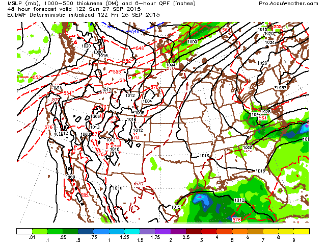
Credit: AccuWeather Pro
As we enter early next week, the East Coast system looks to but note what’s coming up out of the Gulf while a cold front drops out of Canada.

Credit: AccuWeather Pro
Towards mid week, the ECM takes the Gulf system onshore, exactly as what remains to be seen while the cold front dropping out of Canada significantly weakens as the large scale height field is too much.

Credit: AccuWeather Pro
Interestingly the model appears to see more ‘development’ of the Gulf system as it meets the southbound CF which redirects it up the Carolina coast. This could be a big rainstorm up the East Coast late next week.

Credit: AccuWeather Pro
Course you only need look at the above QPF and East Coast rain totals next 10 days to see a lot of rain is coming.
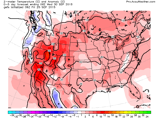
The ridge looks to remain dominant across much of the US through the first half of October but this setup always leaves the Gulf and Atlantic exposed to anything out in the tropics.

Credit: AccuWeather Pro

Credit: AccuWeather Pro

Credit: AccuWeather Pro
This makes for a largely warmer than normal pattern.
Credit: AccuWeather Pro

Credit: AccuWeather Pro

Credit: AccuWeather Pro
Meanwhile, up in Alaska, this is the scene from Fairbanks today!

See today’s video for the discussion.
Next update will be Sunday!
[/s2If][s2If current_user_cannot(access_s2member_level1)][magicactionbox id=”18716″][/s2If]


")


Recent Comments