Despite being on holiday, my intensions have been to continue writing posts. However, there has been ongoing server issues which has prevented me from providing content. This is why there was no posts yesterday but it appears to be back up again today. It seems every time I go abroad, the website plays up. Is it me?
Well low pressure is firmly back in charge of UK and Ireland air space with a wet and windy Monday particularly for England and Wales.

AccuWeather
Scotland and Northern Ireland has been let off lightly but is that likely to change into mid week as the remnants of Henri comes a calling with strong winds and heavy, possibly flooding rains?
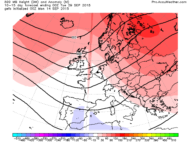
Here’s the 500mb height anomaly pattern for the next 5 days. That’s a decent trough and lows will cycle around this as heights are strong all around.

Credit: AccuWeather Pro
2m temp anomaly next 5 days.

Credit: AccuWeather Pro
Here on the SW tip of Menorca, the weather’s been largely sunny and very warm and humid but we’ve be close to a trough and associated frontal system which brought heavy, flooding storms to S France in recent days. We sit just east really of the warm, humid vs cooler, fresher air mass separating western Europe. With the exception of moderate rain a few nights ago it’s been dry and mostly sunny. Temp hasn’t dipped below 21C.
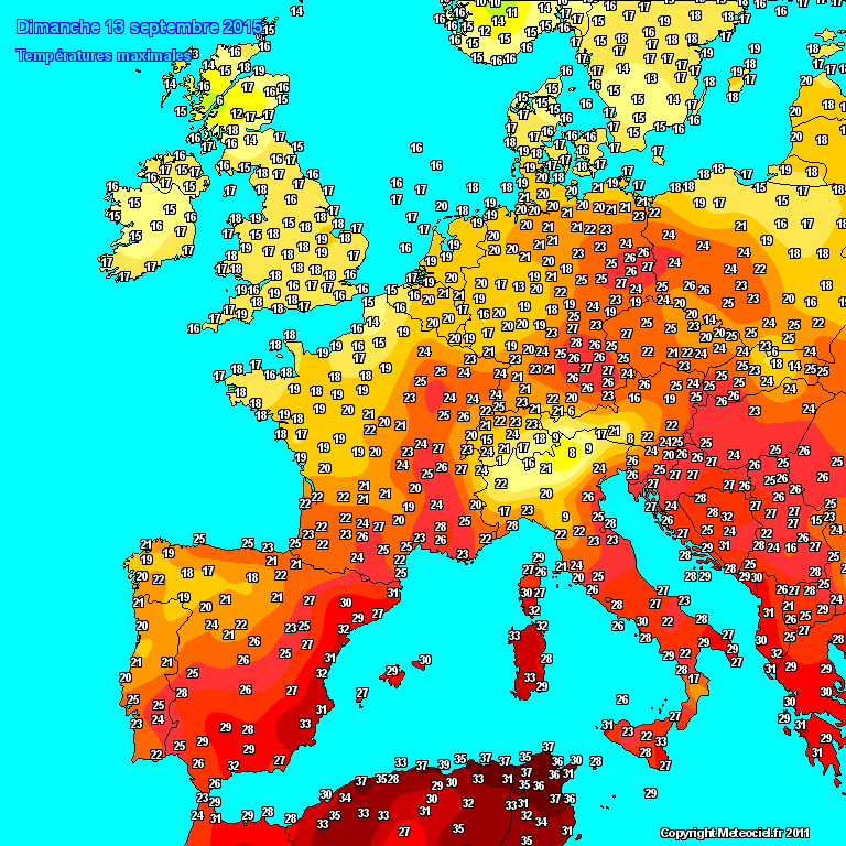
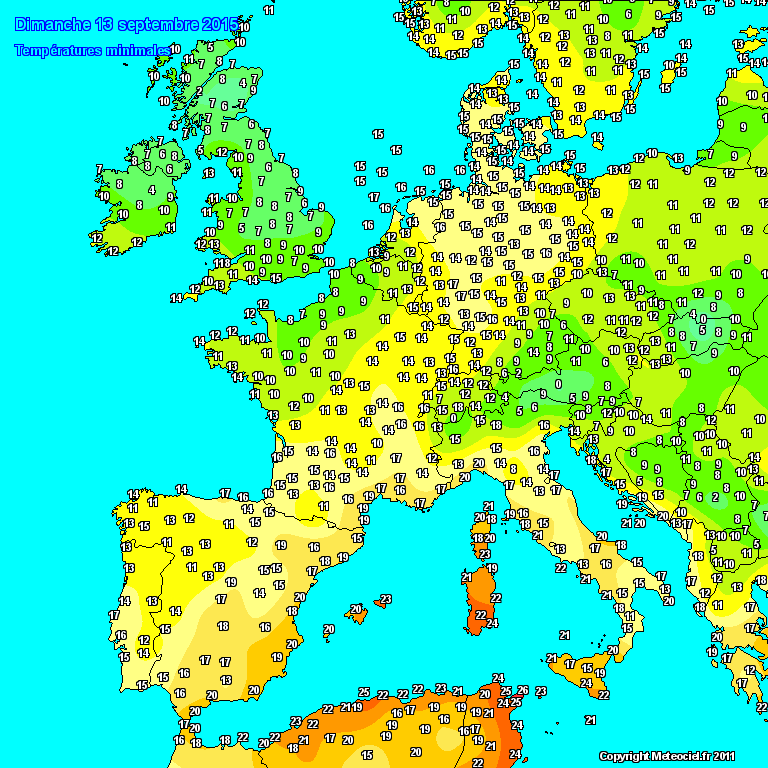
Highs and lows over Europe yesterday.
This is a similar setup to late August when a deep trough with lows circling, just continued to sweep in from the SSW but this time I looks like the tracks have more SW to NE orientation which means Northern Ireland and Scotland is likely to miss the greatest impacts from the Wed-Thu system.
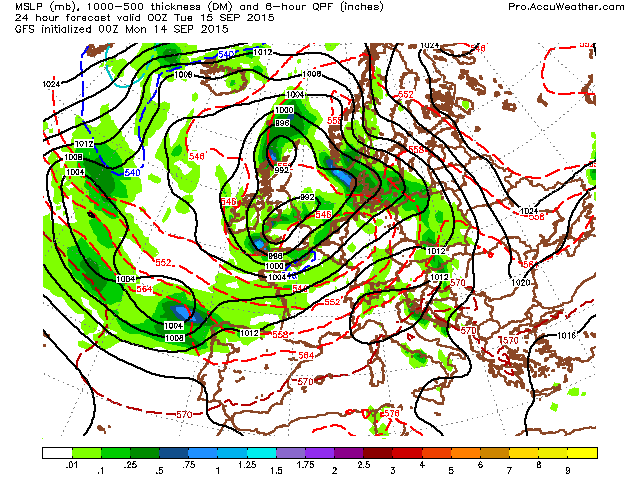
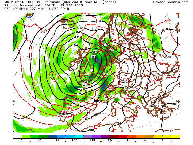
Latest GFS surface.
Credit: AccuWeather Pro

Credit: AccuWeather Pro

Credit: AccuWeather Pro
Credit: AccuWeather Pro
Forecasted 10m wind gusts in the coming days, 50-75 mph wind along coastal France, England, Wales, Belgium, Netherlands, Denmark and Norway.

Credit: AccuWeather Pro

Credit: AccuWeather Pro

Credit: AccuWeather Pro
So what’s next? I suspect this unsettled theme continues through the remainder of this work week but models seem to be in agreement about rebuilding a northerly blocking high next week and beyond which may suggests more unsettled weather across S Europe while it becomes more settled from Ireland to Scandinavia once again.
GFS ensemble

Credit: AccuWeather Pro

More tomorrow (all going well!)


")


Recent Comments