
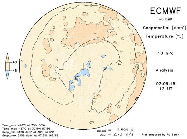
We’re into September and approaching the height of the arctic sea ice melt season. This usually coincides with regeneration of cold over the pole and the sun angle continues to lower from it’s peak back on June 21. There’s a lag of about a month between longest day and warmest time of year but by late August, early September nights are noticeably shorter, especially the further north you are and with less sunlight reaching the polar region, cold builds and so too does sea ice.
Sure enough, the polar vortex does show signs of strengthening over the next 10 day period.
0 hours
240 hours.

Influence of this building cold usually comes late September into October for the mid-latitudes with the southward migration and intensification of the jet. Storms are soon to grow stronger as the temperature gradient increases.
Autumn can be a turbulent time as summer heat tries to hold on but cold air continues to swell across the north and at times dives south.
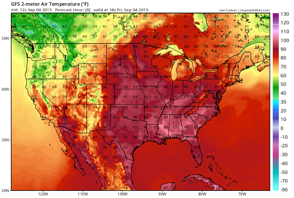
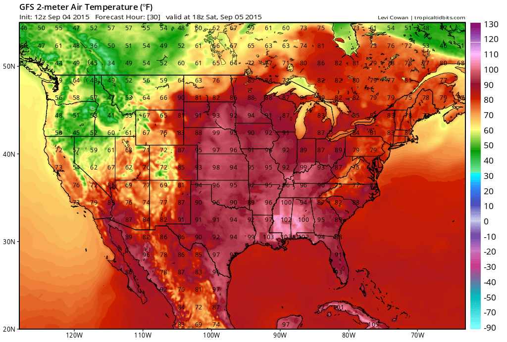
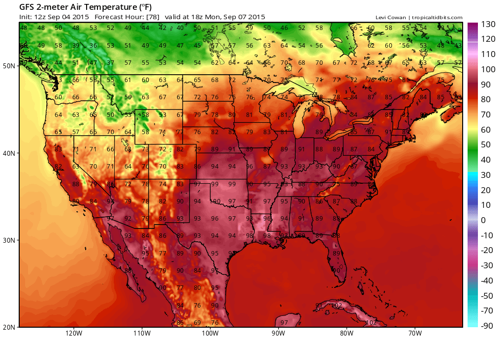
Labor Day is known as the unofficial start to fall but it’s going to feel more like July 4th weekend across much of the Midwest and East.
[s2If current_user_can(access_s2member_level1)]
For the Midwest, it’s a persistent hot, humid pattern next 5 days but for the Northeast it’s highly back and fourth.
Credit: Tropical Tidbits
Credit: Tropical Tidbits

Credit: Tropical Tidbits
Credit: Tropical Tidbits
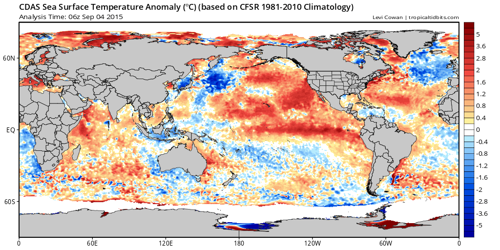
What’s going to be most interesting this fall and indeed winter is the reaction of the strong El Nino verses the warm pool or ‘blob’ in the Gulf of Alaska which has ultimately driven the back to back cold central and eastern US winters and warmth/drought up the West Coast.
Strong El Nino’s are known to hold warmth longer into fall and even during winter as the warmest waters in-close to South America promotes ridging over most of the Lower 48. This is no typical ‘strong El Nino’.
There is literally no other example that I can find where the El Nino has been as strong along with a very warm PDO. In other words the north Pacific is far warmer than it should be given the strength of the El Nino below and so this really throws and wrench in the works with regards to the winter forecast.
Current SSTA’s.
Credit: Tropical Tidbits
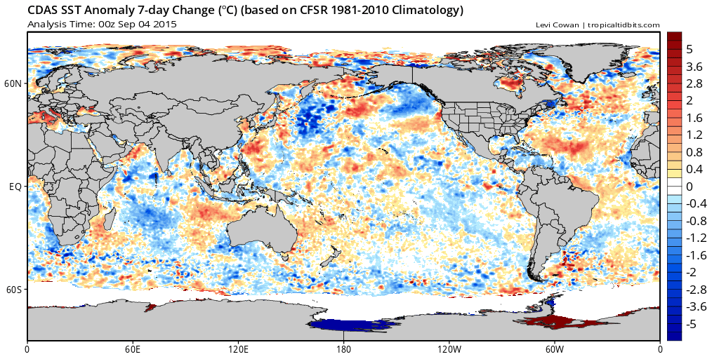
Note the cooling over the Gulf of Alaska in just the last 7 days while the Atlantic shows signs of warming.
Credit: Tropical Tidbits
This is something I will keep reverting back to in the coming weeks as this shift may be a blip or a trend.
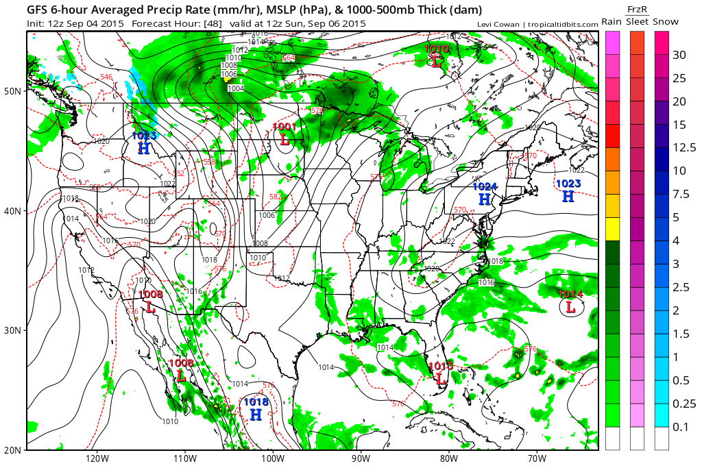
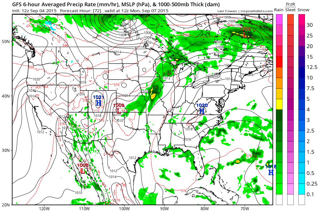
As for the upcoming Labor Day weekend on into next week….
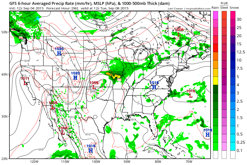
GFS surface looks like this through mid next week.

Credit: Tropical Tidbits
Credit: Tropical Tidbits
Credit: Tropical Tidbits
Credit: Tropical Tidbits

Credit: Tropical Tidbits
See today’s video for the discussion.
[/s2If][s2If current_user_cannot(access_s2member_level1)][magicactionbox id=”18716″][/s2If]


")


Recent Comments