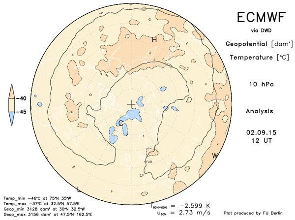
Well we’re now into September and as the summer sea ice melt season peaks, that’s usually around the time cold begins to regenerate over the high latitudes.
Sure enough the next 10 days sees the strengthening of the polar vortex at 10pha over the pole.
o hours
240 hours

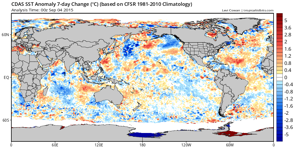
There appears to be changes happening in sea surface temperature anomaly over the North Atlantic which is catching my eye and something worth watching carefully.
[s2If current_user_can(access_s2member_level1)]
Over the years, I’ve come to realise that we should assume nothing. While the AMO has been cold for the majority of the past 24 months, particularly the past 12, there’s hints at least that we may be seeing a flip. Notice in the below SSTA’s that there’s warming over the west-north Atlantic while it remains cold towards Ireland.

Credit: Tropical Tidbits
Now here’s the change in the last 7 days and this will be closely monitored over the next 8-10 weeks as this is highly important, water temperatures ultimately drive the atmosphere above. Strong cold anomaly like we’ve seen the last 2 winters over the N Atlantic has supported a mean N Atlantic trough or westerly flow pattern.
In 2009 with warmer than normal waters, we had high pressure dominate the N Atlantic which promoted frequent shots of cold into the UK from the east. Note in the below chart the cooling North Pacific and warming North Atlantic.
Credit: Tropical Tidbits
Nothing is written in stone as of yet regarding the 2015-16 winter. We’ve had back to back warm winters across the majority of Europe, will it be a third?
Back in 09-10, the AMO was highly positive, a warm AMO peak is known to coincide with solar minimums, hence the cold winter we had. At this point, we’re half way between , maximum and minimum. The peak occurred in early spring 2013 and the minimum is expected around 2020. The winters in between tend to be mixed here, both with warm and cold spells. Some of our worst winter weather outbreaks have occurred in between maximums and minimums, so we must use caution with the upcoming season.
The AMO could well be warming now as we head towards the minimum and that means an increased chance of -NAO/AO winters, triggered by sudden stratospheric warming events once again.
The CFSv2 is less and less reliable in my opinion as it has flipped from wet to dry for October but notice it’s still got a wetter November.

Credit: Tropical Tidbits

Credit: Tropical Tidbits
This may be right back I am of the thinking that we turn wetter in October and much wetter in November.
As for the next 10-15 days, well we’ve a highly amplified, wavy upper air pattern across the hemisphere and thank fully for us, a strong ridge is building in this weekend settling wind and shower activity and with plenty of sun by day, it’s not going to feel too bad at all.
How long does this settle spell last though? Good question. My hunch is we hold onto a high pressure dominated pattern through mid month at least.
EPS control brings the return of the trough day 10-15 whereas the GFS ENS holds it longer. See the video.
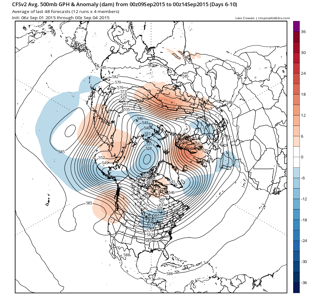
Here’s the CFSv2 weeklies from the N Hemisphere view, gives a better overall perspective. Notice how amplified this pattern is and also note the ridge sliding over the UK.

Credit: Tropical Tidbits
Credit: Tropical Tidbits
The CFSv2 holds the ridge through day 6-10 but in the 11-15 the trough is back which I see happening.

Credit: Tropical Tidbits
Is that it once the trough returns for us? No I agree with the CFSv2 bringing back the ridge at the end of September beginning of October.

Credit: Tropical Tidbits
Interesting times for sure. Stay right here for the latest.
See today’s video for more.
[/s2If][s2If current_user_cannot(access_s2member_level1)][magicactionbox id=”18716″][/s2If]


")


Recent Comments