
Meteorological summer 2015 ended yesterday and Autumn begins today! In the coming days I will be writing up a review of the summer and compare it to the forecast issued back on April 1. I think it’s safe to say that the summer forecast this year has been pretty spoyt on and probably the best since commencing seasonal forecast back in 2009. Doesn’t quite match the my bullish forecast for a very cold, snowy 2009-10 winter which first grabbed media attention but it’s probably second best seasonally. All ‘monthly’ outlooks have turned out well too which means the streak of ‘good seasonal forecasts’ continue from last winter and this summer following the busts in both summer 2012 and winter 2013-14.
Here are the latest thoughts on the summer from the Met Office. http://blog.metoffice.gov.uk/2015/08/28/so-what-happened-to-our-summer/
This month will also have much more talk about the upcoming winter and it won’t be too long till the official winter 2015/16 forecast is released.
For central and eastern Europe, summer isn’t over but for us here in the UK, Ireland down into France, it’s feeling more like autumn.
Credit: Met Office

Credit: Met Office
[s2If current_user_can(access_s2member_level1)]
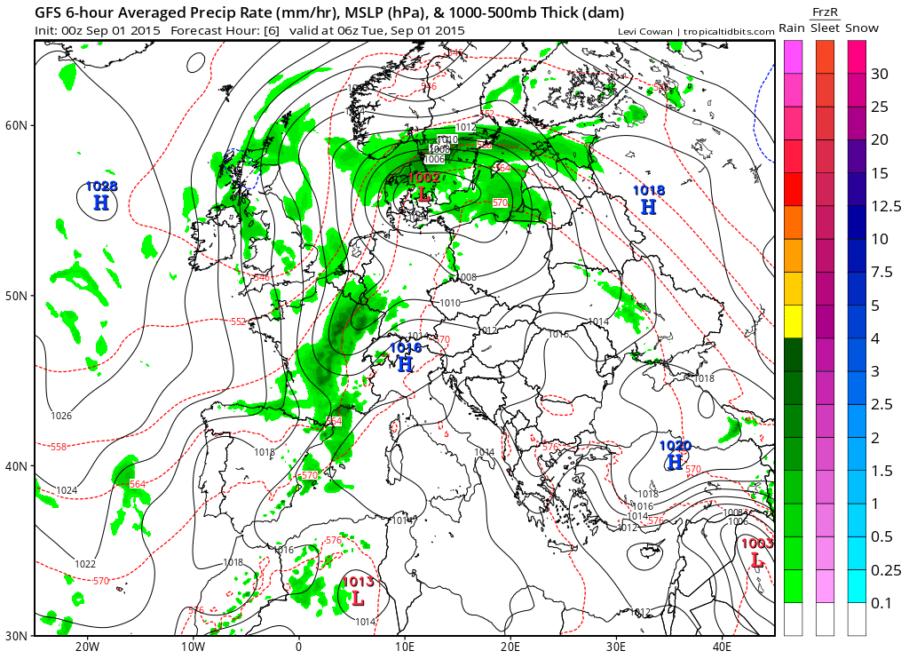
As for the current Europe pattern, well what goes up must come down… The low approaching the Danish shores is acting as a wheel, drawing Africa origin air up through central and eastern Europe and even had Paris and Amsterdam in the 30s during the past weekend. However, as the associated front moves through, the air flow shifts from SW to NNW and many areas France and the Low Countries have seen heavy rain, storms and a drop of 10C off last weekend’s values.
For much of mainland Europe which has been baking not just recently but throughout this summer, well cooling relief is coming gradually into Central areas where highs are in the 32-38, locally 40C range, that’s a good 5-10, even 15C above normal for late August/early September.

Credit: AccuWeather
The GFS chart shows the low moving across Denmark with a front triggering flooding rainfall and thunderstorms as it moves into hot, humid air. Behind the front it’s much fresher even cool in the brisk northerly flow over the UK. Here temps are running below normal!

Credit: Tropical Tidbits

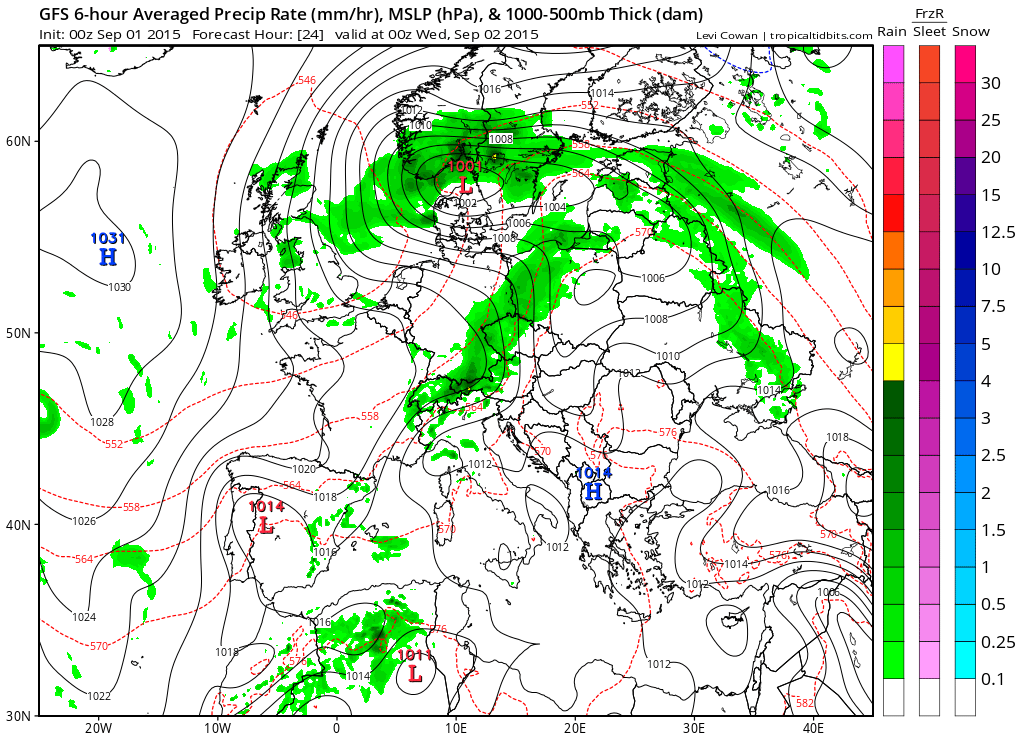
Credit: Tropical Tidbits
Credit: Tropical Tidbits
Credit: Tropical Tidbits
See how the extreme heat gets forced into southeast Europe as this working week progresses.
GFS forecast temps at 12z each day this week.

Credit: Tropical Tidbits
Check out the anomaly for today across the continent.

Credit: Tropical Tidbits

Credit: Tropical Tidbits

Credit: Tropical Tidbits

For the UK and Ireland specifically, it’s sunshine, showers and a strengthening northerly wind that’s the story through the rest of this week but that building high out over the Atlantic does begin to trim both wind and shower activity late week into the weekend as the low moves further away and the high moves in.
Daytime highs are solidly below normal, especially mid week as you can see from the above temperature charts. A few northern areas may struggle to reach 10C if cloud, outbreaks of rain linger through the day in the stiff northerly. Gales are expected over the mountains and for a time down the North Sea coast.
By night under clear sky and less wind, the cool, dry air mass is likely to support pockets of rural frost late week.
Check out the projected early AM temps this Sat AM.

Credit: Tropical Tidbits
Yes, even France, Low Countries into Germany could turn quite cold for the time of year and in stark contrast to lately.
Next week
No change, high pressure still looks to build OVER the UK and this means a sustained period of dry settled weather which I expect to take us into mid September as forecasted back on August 24.

Credit: Tropical Tidbits

[/s2If][s2If current_user_cannot(access_s2member_level1)][magicactionbox id=”18716″][/s2If]


")


Recent Comments