
Following record cold days and sustained below normal temperatures following the initial hot surge, July will wind up cooler-than-normal across at least 90% of the UK. The only place which may be average or slightly above in the SE corner of England.
Just look at how cold the last 7 day mean has been.

Credit: WSI Energy
No surprise this is how July looks. This was forecasted even BEFORE the early hot spell based on large-scale drivers and influences.

Credit: WSI Energy
[s2If current_user_can(access_s2member_level1)]
The good news is there is light at the end of the tunnel. In fact, we go from one extreme to the other as we enter August’s first week.
As we draw July’s final week to a close, low pressure is positioned up nearer Iceland rather than the Azores and therefore our source of air is subtropical rather than arctic. The first of two lows pushes in during Friday bringing the return of wind and rain to Northern Ireland, Scotland and northern England but further south, SW winds are sunshine will finally bring temperatures back to the seasonal average of 21-24C. However, the next low drifts Ireland-bound late this weekend, tightening into a system more accustomed to November, not early August. It’s position though, means a heat pump from Algeria to the UK is put in place and temperatures look set to rise back into the upper 20s potentially as far north as Yorkshire during Monday while winds increase to possibly gale-force over Northern Ireland and Scotland.
The below GFS surface shows system 1 and 2 bringing back summer to at least the southern and central UK but even Scotland looks set to enjoy low to possibly mid 20s, especially early next week.
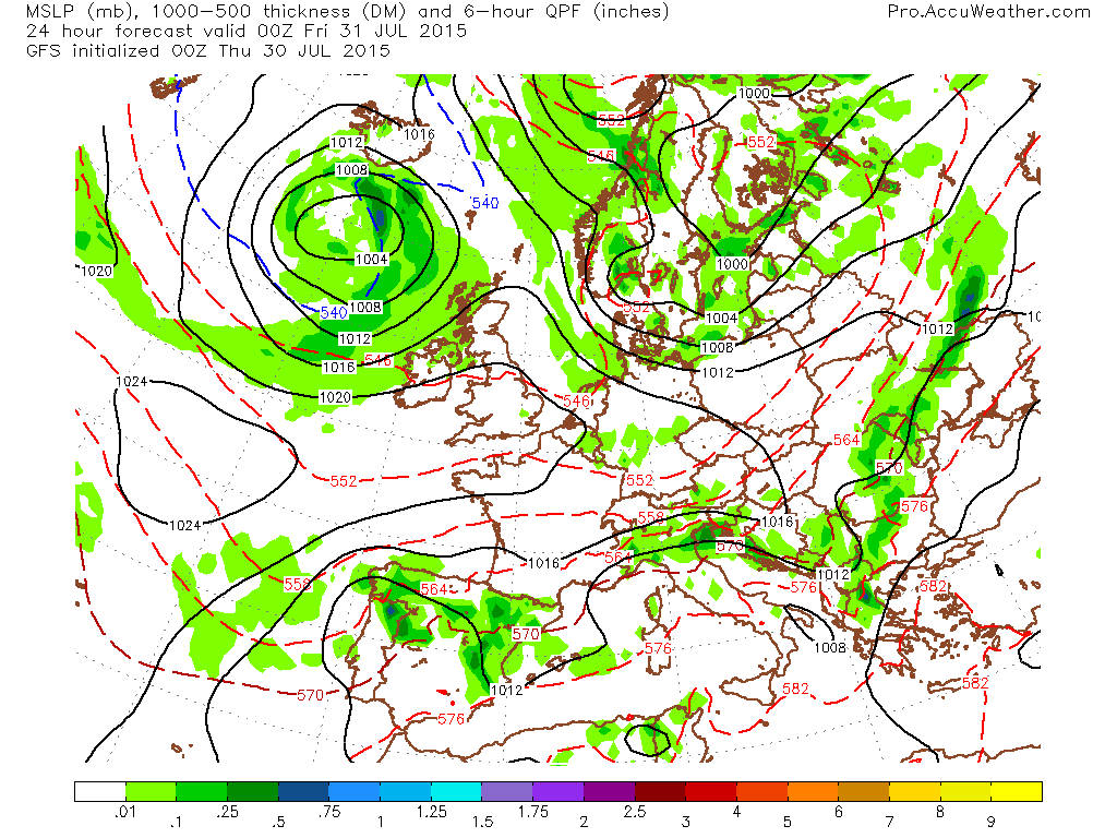
Credit: AccuWeather Pro

Credit: AccuWeather Pro

Credit: AccuWeather Pro
The 105 hour 5,000ft temp chart shows a nice plume of Africa/Mediterranean source air lifting north.

Credit: AccuWeather Pro
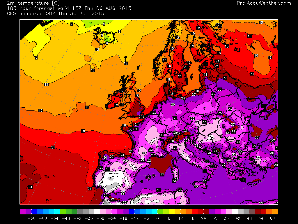
Just look at these temperatures for Monday PM.

Credit: AccuWeather Pro

Credit: AccuWeather Pro
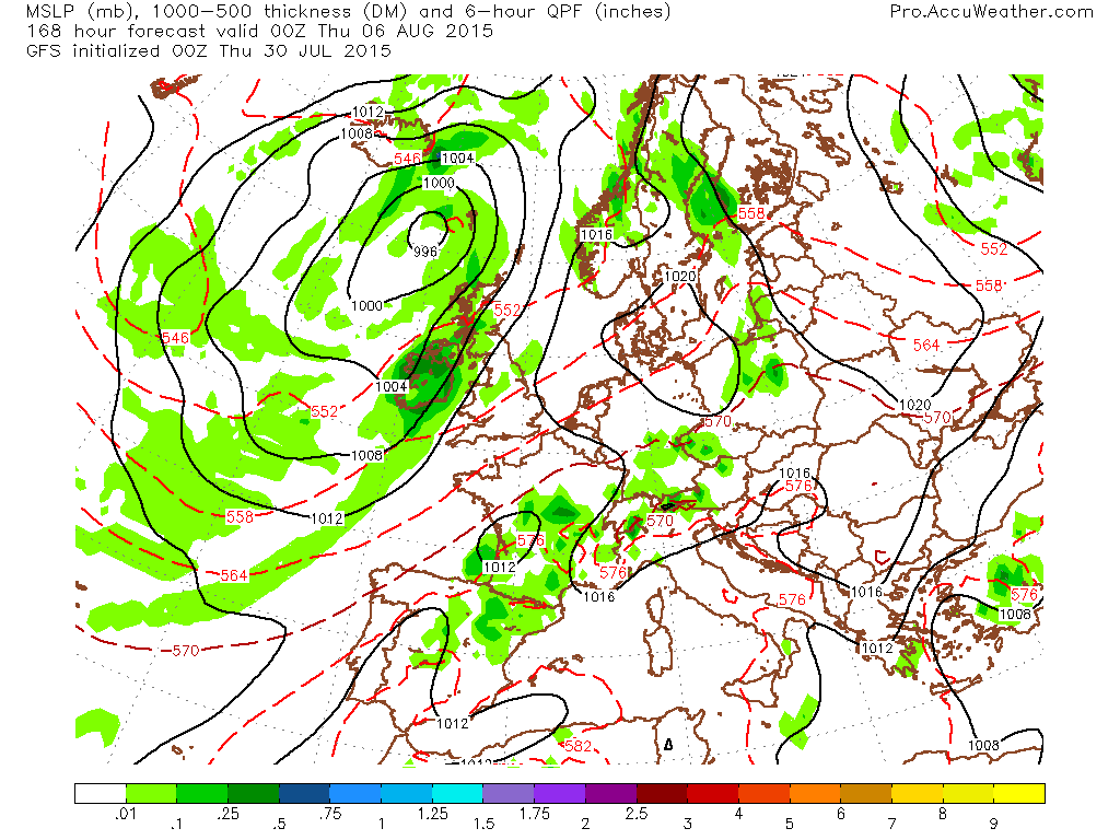
The GFS pushes this low in bringing cooler and more unsettled weather but thankfully it appears to be in a weakening phase so hopefully no widespread gales!

Credit: AccuWeather Pro

Credit: AccuWeather Pro
Credit: AccuWeather Pro
As you can see in the final chart above, waves of low pressure appear to run the boundary attached to the mother low up nearer Iceland. This suggests heavy rain for Ireland, NI and western Scotland but with continues SSW flow and more sun further south and east, it’s all about the warmth once again.
Credit: AccuWeather Pro
Just look at how much Spain, France and the central continent heats back up. Looks like Denmark and Scandinavia get in on some of this welcome summer warmth.
See this morning’s video for the discussion.
[/s2If][s2If current_user_cannot(access_s2member_level1)][magicactionbox id=”18716″][/s2If]


")


Recent Comments