
In today’s video I show the 1972 example of similar (not exact by any means) SSTA’s with the horseshoe of cold in the Atlantic vs modestly warm Pacific with an El Nino coming on. Out of the last 30+ years, it appears 1972 is closest but the Pacific is very warm and the El Nino is far stronger.
[s2If current_user_can(access_s2member_level1)]
It’s interesting because the anomalies show that June was abnormally cool, July and August where also cool over the UK and West Europe but also drier than normal. A cold Atlantic typically supports drier than normal conditions over West Europe while a warm Atlantic as seen in recent years, tends to make for wetter summers. Be sure to watch today’s video for the details and similarity between model projection for this summer vs 1972.
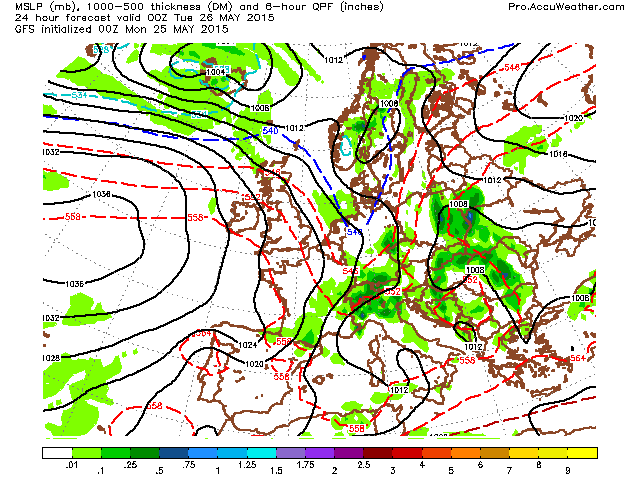
As for the here and now. It’s a decent start to this week with high pressure dominating. However, because the UK and Ireland is on the eastern flank of a near 1035 high out over the Atlantic, our flow is coming in from the NW. While sunny, daytime maximums are restricted at near or slightly below average.
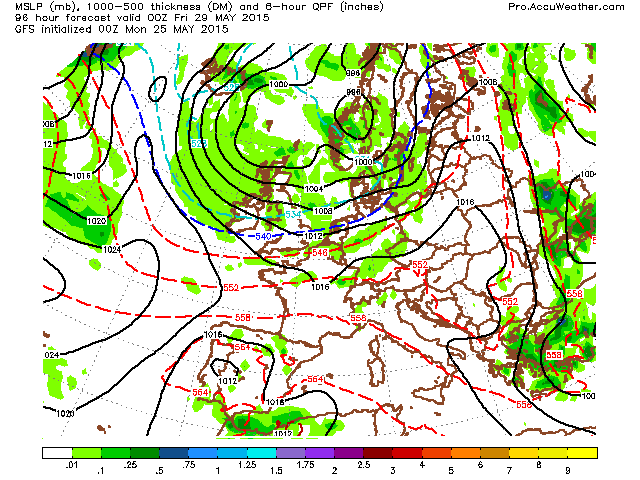
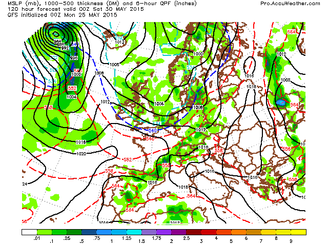
There’s strong agreement with both GFS and ECMWF on a midweek pattern shift with low pressure regaining control. This upcoming weekend looks rather wet, windy and cool for the close of May/open of June.
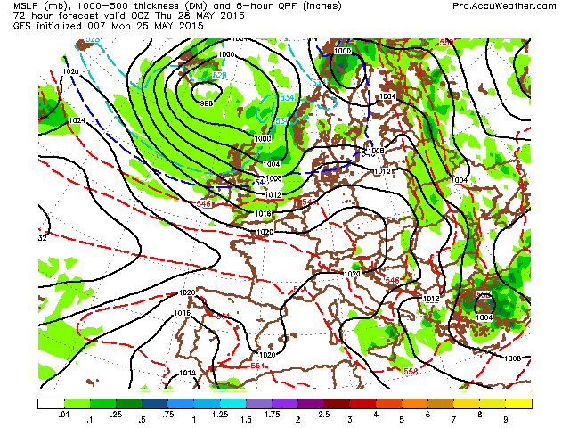
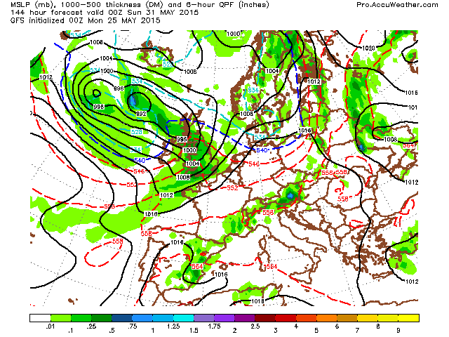
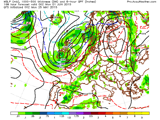
The GFS shows a front pushing SE Thursday with the return of hefty, blustery showers and cool temps, then by the weekend, low pressure slides in from Iceland bringing a proper unsettled second half to next weekend.
GFS
Credit: AccuWeather Pro

Credit: AccuWeather Pro
Credit: AccuWeather Pro
Credit: AccuWeather Pro
Credit: AccuWeather Pro
Credit: AccuWeather Pro
Credit: AccuWeather Pro
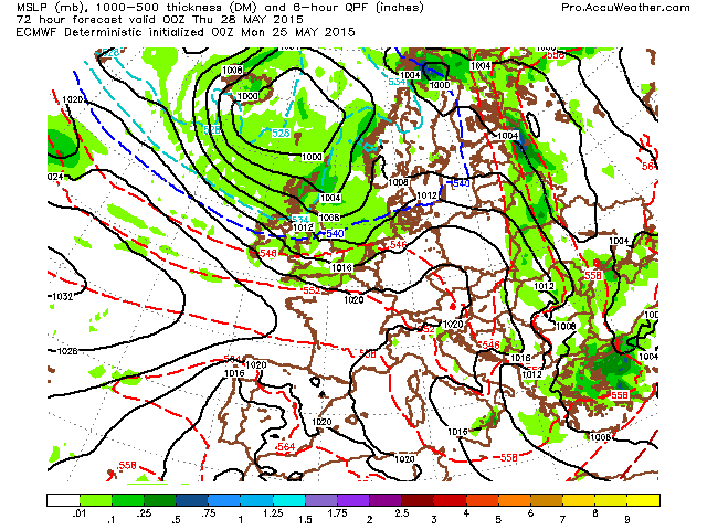
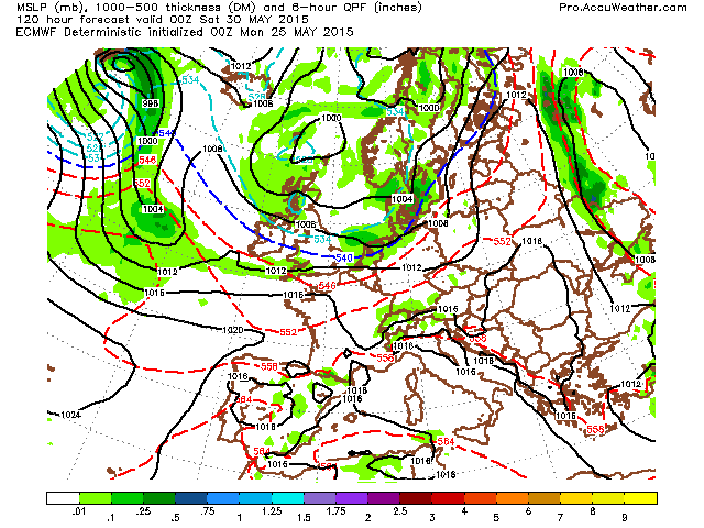
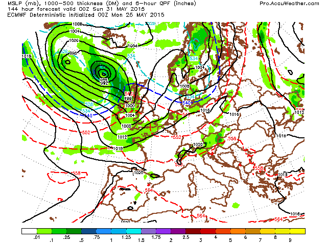
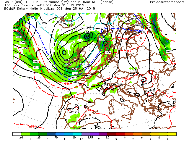
ECMWF has a front pushing south over the UK late Wednesday onwards, introducing much cooler air and the return of hefty showers but towards the weekend, a fairly deep low by end of May/early June standards comes in from the NW bringing a dose of wind and rain.
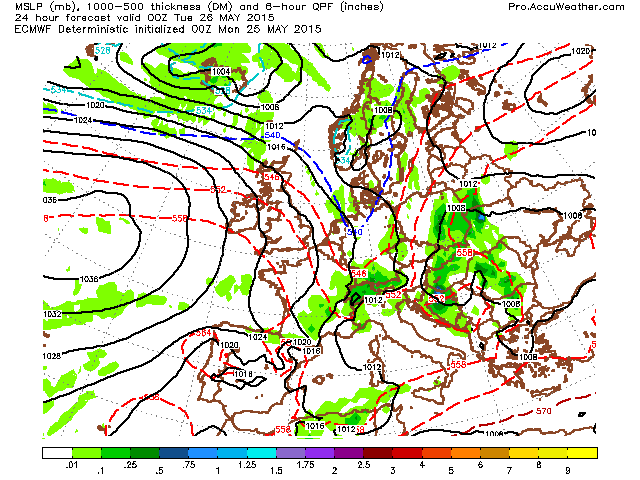
Credit: AccuWeather Pro

Credit: AccuWeather Pro
Credit: AccuWeather Pro

Credit: AccuWeather Pro
Credit: AccuWeather Pro
Credit: AccuWeather Pro
Credit: AccuWeather Pro
The GFS ensemble 5-day mean 2m temps and anomalies show it firmly below normal through the next 10 days but is hinting at a potential warming trend day 10-15. This very much remains to be seen.


See this morning’s video for more on the summer of 72.
[/s2If][s2If current_user_cannot(access_s2member_level1)][magicactionbox id=”18716″][/s2If]


")


Recent Comments