
I stand by the idea that April’s final week and May’s opening week is cool with a major storm threat on the East Coast. That very system could be responsible for recasting the upper atmospheric pattern and allowing the first real surge of ‘summer warmth’ into the Northeast and Mid-Atlantic.
New York has managed to creep up to 71 and while surround areas have touched 70, Boston still waits. That wait may end come week 2 of May.
Winter’s hangover has for the 2nd year in a row has spoiled early spring with unusually cold, dreary days. Only spring warmth (at best) has managed to reach the East Coast whereas most places have seen their first mid to upper 70s, even 80s by now.
TOP IMAGE CREDIT: WeatherBug
[s2If current_user_can(access_s2member_level1)]
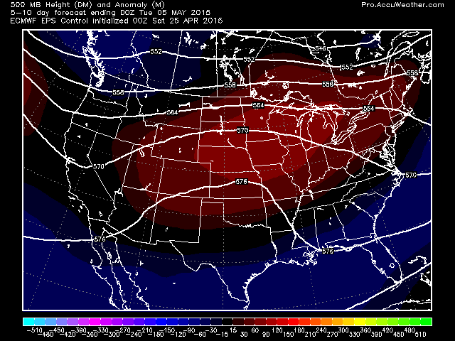
If this coastal storm truly winds up, feeding off the abnormally warm waters off the Southeast coast and deepens the trough, so heights rapidly rise back west over the Plains.

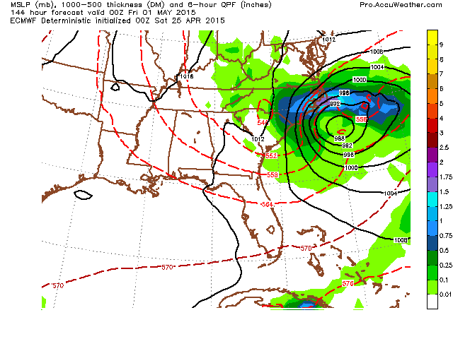
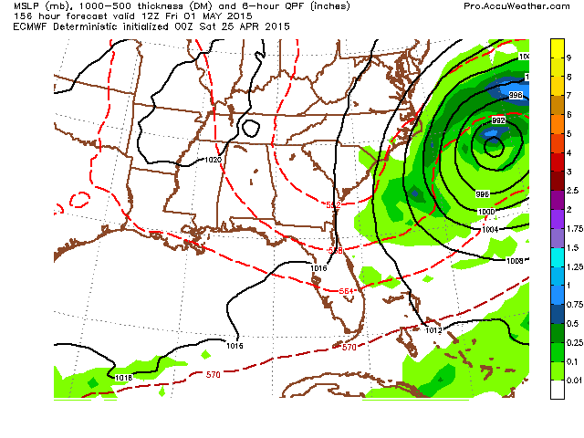
As shown in this morning’s video, the updated version of the ECMWF deepens the storm off the SE coast but takes it out rather than riding up the coast.

Credit: AccuWeather Pro
Credit: AccuWeather Pro
Credit: AccuWeather Pro
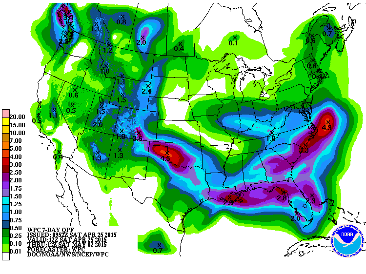
System will be a decent rain producer, especially with the injection of both Gulf and Atlantic moisture wrapping in.
With energy then piling into the West Coast with more rain chances for California, so that Plains ‘hot dome’ gets forced east towards the day 10-15 period. The first 80s of the year are possible for the East Coast with this kind of set up.
Here’s the latest GFS operational.

Credit: AccuWeather Pro

Credit: AccuWeather Pro

Credit: AccuWeather Pro
EPS control

Credit: AccuWeather Pro
Credit: AccuWeather Pro

Credit: AccuWeather Pro
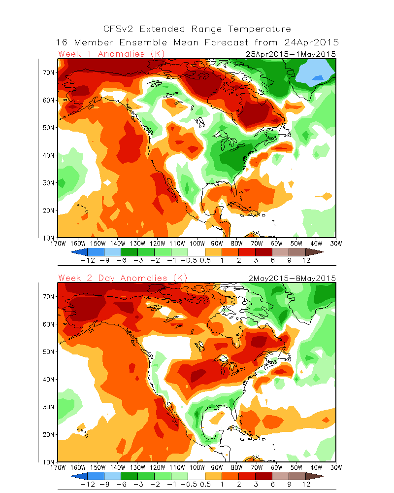
The latest CFSv2 weeklies show the cold week 1 followed by warming week 2 from Plains into Northeast, focus of warmth week 3 over the Northeast then return to cooler week 4 which I can see as I don’t think we’re going into a longer term ridge pattern. When you’ve still strong blocking in the north, it’s easier to get the trough back into the east than the ridge.

Be sure to watch today’s video for the discussion.
[/s2If][s2If current_user_cannot(access_s2member_level1)][magicactionbox id=”18716″][/s2If]


")


Recent Comments