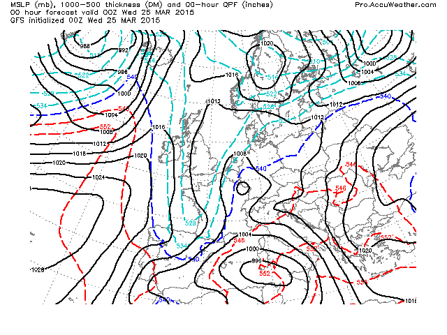
As forecasted back on Sunday, it was a cold start to Wednesday thanks to high pressure overhead!
Credit: AccuWeather Pro

Credit: BBC
Frost never lasts long once the sun rises within those clear blue skies. Dry air cools quickly after sunset but also heats fast at sunrise this time of year.

Hope you got a chance to read yesterday’s April Outlook and watch the video with thoughts on summer as well as the rest of spring. Later on, I will be sharing some thoughts on winter 2015-16.
[s2If current_user_can(access_s2member_level1)]
Make the most of today’s pleasant sunshine and light winds because the next system arrives overnight tonight.

Credit: AccuWeather Pro

Credit: AccuWeather Pro
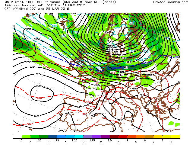
It’s not too late to mention the ‘S’ word… Yes, this next system will drag in enough cold air that snow returns to the hills of the North.

Credit: AccuWeather Pro
Later Thursday into Friday, westerly winds increase as the pressure fields tightens and forces a faster arrival of not one but two lows (Fri-Sat).

Credit: AccuWeather Pro

Credit: AccuWeather Pro
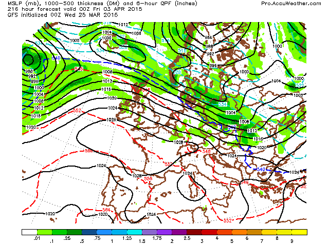
Looking like a mucky weekend with strong west winds (possibly widespread gales) on the backside of the Saturday low.

Credit: AccuWeather Pro

Credit: AccuWeather Pro
Strong winds carry into early next week.

Credit: AccuWeather Pro
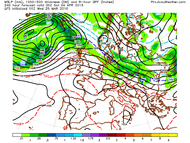
Still a little far out but as we head towards mid next week, looks like winds turn NW’erly, driving some polar-maritime air into the UK and Ireland. Snow?
Credit: AccuWeather Pro

Credit: AccuWeather Pro
Looks like the model rebuilds the Azores high NNE into the UK late next week into the weekend. This would not just bring the return of sunny and settled but potentially edges us closer to the first 20C.

See video for the discussion.
[/s2If][s2If current_user_cannot(access_s2member_level1)][magicactionbox id=”18716″][/s2If]


")


Recent Comments