
With little or no change in SST’s (abnormally warm up West Coast), colder than normal Great Lakes etc, I see no reason to believe that the Alaska ridge/Eastern trough doesn’t persist through at least the first 15 days of April and therefore, like we’ve seen throughout the 2nd half of winter… warm West, cold or cool East.
Current SST anomalies.
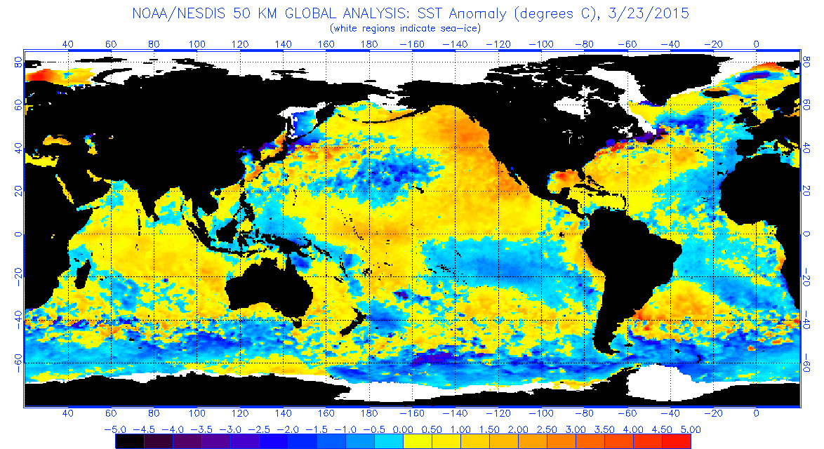
The MJO is pushing through phases 1,2 and 3. Those are cold phases and combined with continued feedback of warm NE Pacific/Alaska ridge, the chill will keep on coming.

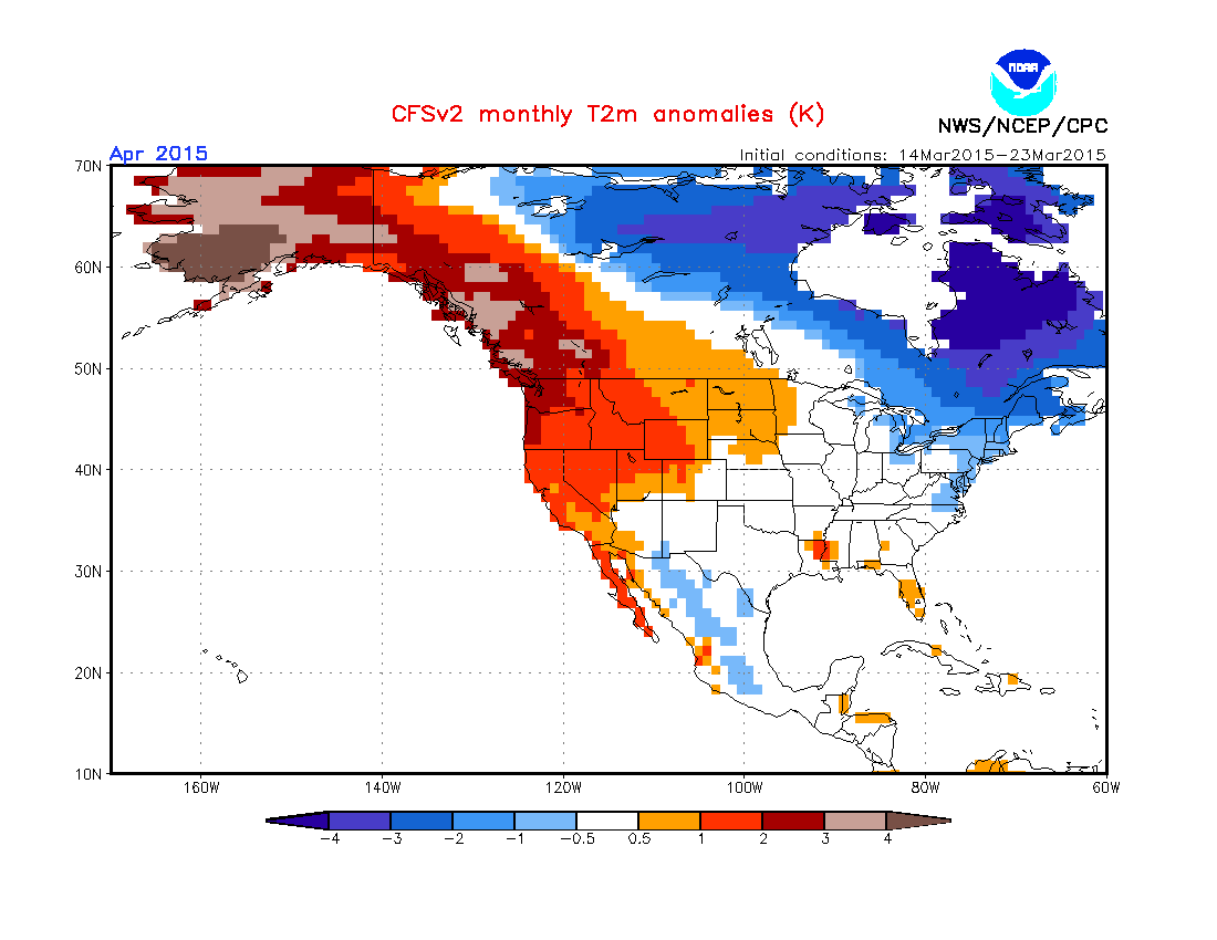
CFSv2 sees this upper pattern in it’s 700mb anomaly for the month.

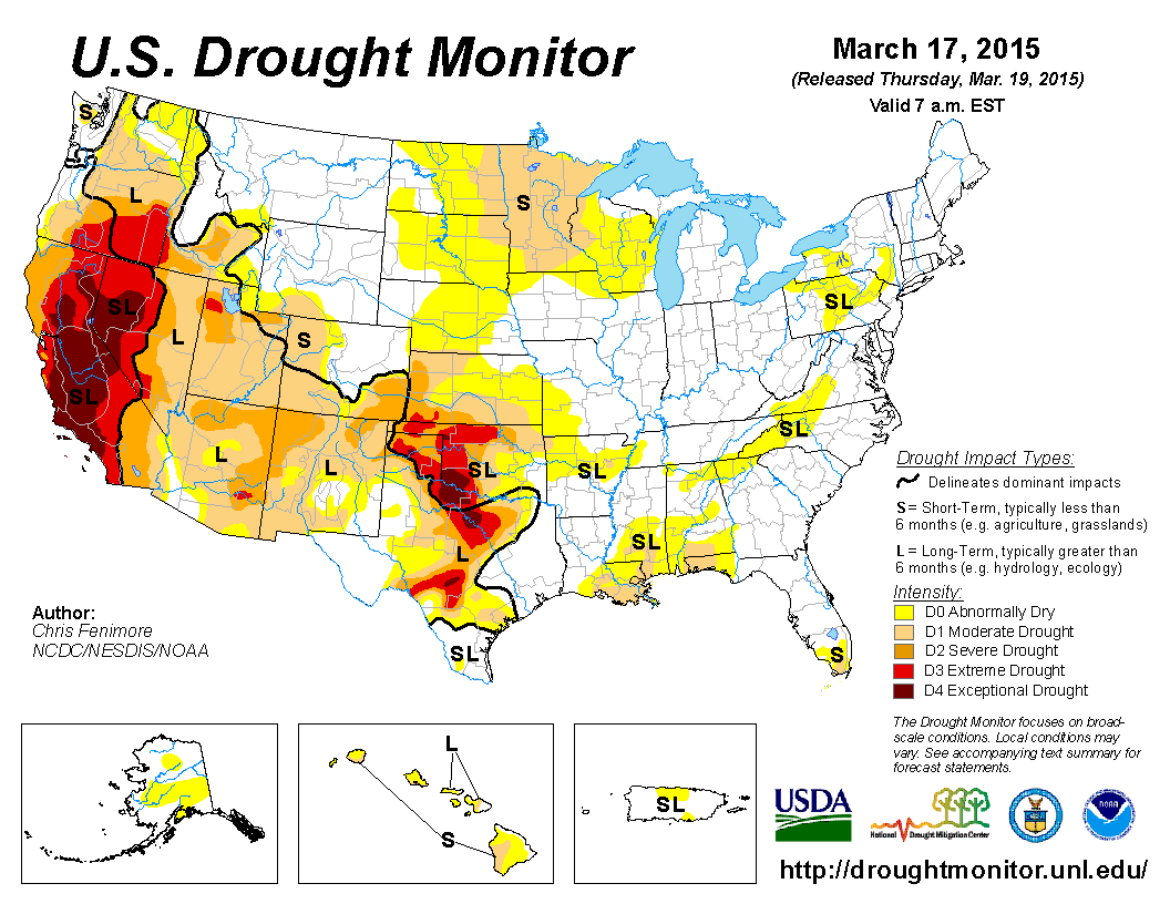
I do suspect however that a potentially warm, dry April is on the cards for the Northern Plains since drought conditions are starting to set in.
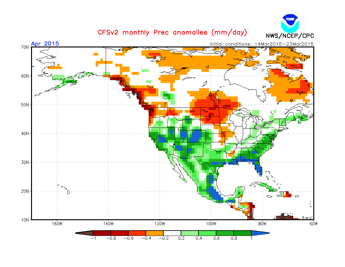
It’s looking like a wet pattern for a large swathe of the US as cold air continues to push into the Midwest and East while heat and humidity naturally tries to push north out of the Gulf and it’s this that may spark a sharp ramp up in severe weather that we’ve not seen up till now.

The continued dry Out West is sure to build heights and surface heat and this is expected to progress east through mid to late month.
The CFSv2 is seeing below normal precipitation over that increasingly dry Northern zone, indicative of a strengthening El Nino. This may lead to warmer than normal conditions and may be bad news as we head towards the warm season.
CFSv2 April precipitation
Temperature
Will have a video discussion and more tomorrow.
[s2If current_user_can(access_s2member_level1)]
[/s2If][s2If current_user_cannot(access_s2member_level1)][magicactionbox id=”18716″][/s2If]


")


Recent Comments