
While today we remain under the influence of the Scandinavian blocking high, feeding a modest chill in from a predominantly mild continent, we see this large system weaken and drift east through this week. An Azores high builds in to replace and this should herald some lighter winds and brighter skies also. Daytime temps will rise from the 4-8C values of the past weekend to something more typical of mid March, 10-15C.
Brighter skies by day will make for cool and frosty nights.
[s2If current_user_can(access_s2member_level1)]
As we progress through the week, this high strengthens overhead and then weakens through the second half of the week allowing fronts will start bringing somewhat wetter and breezier conditions. That southward sinking or retreating Azores high then opens the door to Atlantic lows once again with colder spells on their rear.
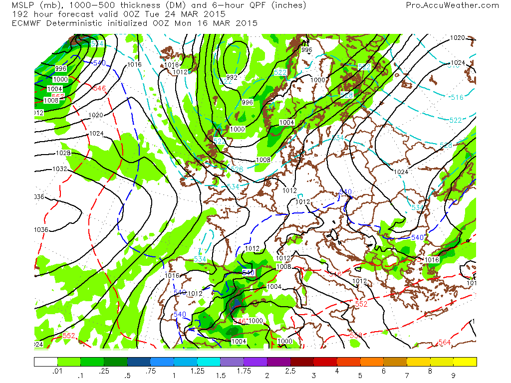
Here’s how the ECMWF surface is looking through the next 10 days. This is a fairly unsettled, up and down pattern but notice how the model builds high pressure north of the UK and with the help of a low spinning just SE of the UK, we pick up a chilly northeast flow off Norway. Then a low swings in from Iceland and this has some colder air behind it for early NEXT week. Another low follows and another blast of colder polar-maritime air follows.

Credit: AccuWeather Pro

Credit: AccuWeather Pro

Credit: AccuWeather Pro

Credit: AccuWeather Pro

Credit: AccuWeather Pro
Credit: AccuWeather Pro

Credit: AccuWeather Pro

Credit: AccuWeather Pro
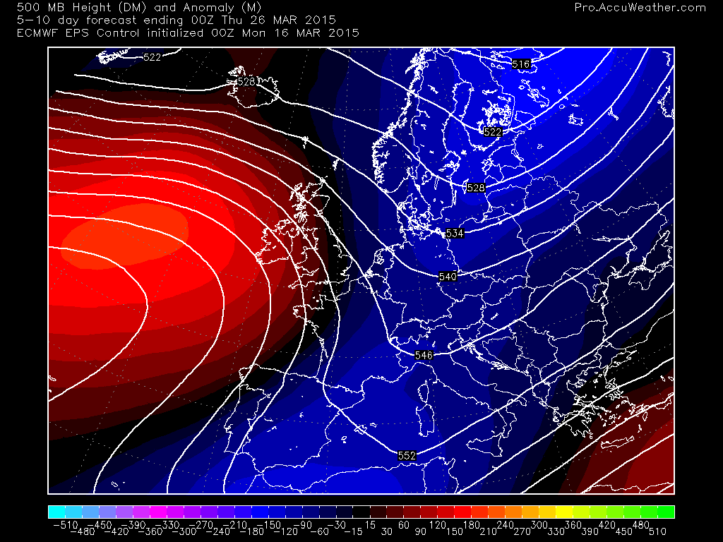
You can see what’s happening, the atmosphere is trying to builds blocks like we saw last week and to commence this week but ocean feedback keeps supressing that as the colder Atlantic continues to lower heights over Iceland while it’s trying to build them nearer the tropics into the sub-tropics (Azores-Bermuda) where waters are warmer. I think this setup should continue throughout the spring unless we get less rain than expected through the April-May period.
EPS Control day 0-5

Credit: AccuWeather Pro
5-10
Credit: AccuWeather Pro
10-15

Credit: AccuWeather Pro
Cold water over North Atlantic continues to force lower height field above. Notice how anytime a ridge tries to develop, it always gets beaten back. As long as soils remain wet, this upper air pattern should sustain itself into the upcoming summer.
See video for today’s discussion.
[/s2If][s2If current_user_cannot(access_s2member_level1)][magicactionbox id=”18716″][/s2If]


")


Recent Comments