
Making the most of the above view captured this morning as snow may be about to disappear around here for good. Well for the rest of this season anyway!
As you saw first hand on here yesterday, March has the ability to produce big snows but also has the ability to take away just as quick.
Check out this 24 hour snap shot of my street yesterday morning and this morning. Rapid melt thanks to a much stronger sun despite a biting cold wind.

Credit: Mark Vogan
[s2If current_user_can(access_s2member_level1)]
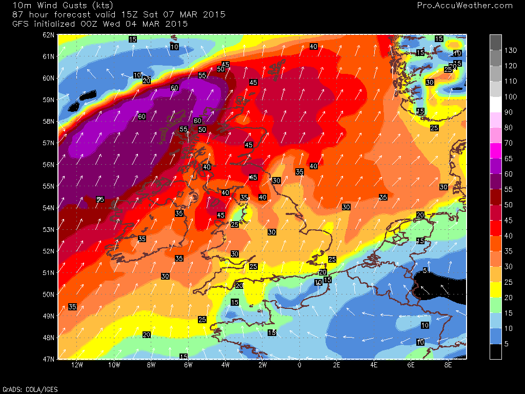
While there was heavy snow to commence this week. March’s opening week may end with significant spring warmth. Surely 17C on the Moray coast this Saturday isn’t possible? We’ve seen countless examples of when we’ve seen heavy snow followed by 16-19C or vice versa. The transition from winter to spring can be a wild and bumpy ride and this year appears to be no exception.
Ridging builds but as a front pushes into Scotland, so a strong SW wind develops. Lack of snow cover over the eastern side of Scotland means a conducive setup for downslope compressional warming on the leeside of the Grampians.

Credit: AccuWeather Pro
Credit: AccuWeather Pro

Credit: AccuWeather Pro
As for next week. There appears to be a battle between high pressure to the east and low pressure to the west… More on next week in tomorrow’s posts!
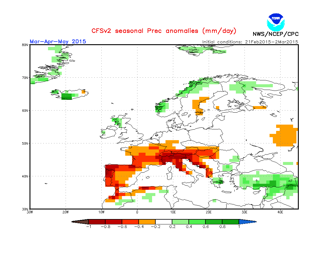
CFSv2 for the March-May and June-August period.
Precip

Temp


This overall spring/summer thinking extends into the west mainland of Europe including Low Countries and Denmark as well as Norway and the rest of Scandinavia.
I am leaning towards this CFSv2 idea. More in today’s video discussion.
[/s2If][s2If current_user_cannot(access_s2member_level1)][magicactionbox id=”18716″][/s2If]


")


Recent Comments